tMoA

Would you like to react to this message? Create an account in a few clicks or log in to continue.
tMoA

~ The only Home on the Web You'll ever need ~

5 posters

    The Earthquake/Seismic Activity Log

    Carol
    Carol
    Admin
    Admin


    Posts : 31775
    Join date : 2010-04-07
    Location : Hawaii

    The Earthquake/Seismic Activity Log - Page 2 Empty Re: The Earthquake/Seismic Activity Log

    Post  Carol Mon Jun 24, 2013 11:08 pm

    Scientists monitor Carson City earthquake swarm – potential to result in major quake
    Posted on June 24, 2013by The Extinction Protocol
    The Earthquake/Seismic Activity Log - Page 2 Ca-nv-3
    June 24, 2013  NEVADA – Nevada seismologists and emergency managers say they’re monitoring an earthquake swarm in Carson City that has the potential to result in a major temblor. But officials from the Nevada Seismological Laboratory at the University of Nevada, Reno, stress they can’t predict how the sequence of over 120 minor quakes that began June 1 will play out or if it will result in larger events. The largest quakes of the swarm have been one of magnitude-2.9 on June 5 and two of magnitude-2.8 on Thursday and June 16. While each has been followed by many smaller quakes, no injuries or major damage have been reported. UNR seismologists say based on past seismic activity in the region, the probability of larger quakes increases as sequences progress. They say the swarm is of concern because it may be associated with the Genoa Fault Zone, which is capable of producing major quakes of magnitude-7 or more. Nevada is the third most seismically active state in the nation behind California and Alaska. –LVS


    _________________
    What is life?
    It is the flash of a firefly in the night, the breath of a buffalo in the wintertime. It is the little shadow which runs across the grass and loses itself in the sunset.

    With deepest respect ~ Aloha & Mahalo, Carol
    Carol
    Carol
    Admin
    Admin


    Posts : 31775
    Join date : 2010-04-07
    Location : Hawaii

    The Earthquake/Seismic Activity Log - Page 2 Empty Re: The Earthquake/Seismic Activity Log

    Post  Carol Thu Jul 04, 2013 9:39 am


    DATE and TIME (UTC) LAT LON MAG DEPTH km REGION
    04-JUL-2013 12:24:45 -3.58 139.96 4.7 35 IRIAN JAYA, INDONESIA
    04-JUL-2013 11:15:40 -17.88 -178.55 4.9 595 FIJI ISLANDS REGION
    04-JUL-2013 11:08:29 46.84 141.79 4.7 10 SAKHALIN ISLAND
    04-JUL-2013 04:17:46 -23.80 179.99 4.7 541 SOUTH OF FIJI ISLANDS
    04-JUL-2013 02:59:23 -6.44 -80.77 4.7 27 NEAR COAST OF NORTHERN PERU
    03-JUL-2013 22:22:18 1.55 30.80 5.4 10 UGANDA
    03-JUL-2013 21:13:27 46.39 152.96 4.7 34 KURIL ISLANDS
    03-JUL-2013 20:16:39 -58.40 -26.37 5.3 141 SOUTH SANDWICH ISLANDS REGION
    03-JUL-2013 20:13:34 -32.30 -179.99 5.2 226 SOUTH OF KERMADEC ISLANDS
    03-JUL-2013 19:41:05 -44.51 167.87 4.9 2 SOUTH ISLAND, NEW ZEALAND
    03-JUL-2013 19:21:46 1.56 30.85 5.7 10 UGANDA
    03-JUL-2013 15:59:45 2.29 127.19 4.7 104 NORTHERN MOLUCCA SEA
    03-JUL-2013 15:09:04 -30.60 -178.11 5.3 70 KERMADEC ISLANDS, NEW ZEALAND
    03-JUL-2013 15:06:10 37.35 141.48 5.0 12 NEAR EAST COAST OF HONSHU, JAPAN
    03-JUL-2013 14:09:16 38.23 143.91 4.7 40 OFF EAST COAST OF HONSHU, JAPAN
    03-JUL-2013 13:28:23 40.20 21.83 5.2 7 GREECE
    03-JUL-2013 13:09:12 40.07 21.98 4.0 14 GREECE
    03-JUL-2013 12:05:47 27.38 54.85 4.4 10 SOUTHERN IRAN
    03-JUL-2013 11:31:58 36.56 70.36 4.4 217 HINDU KUSH REGION, AFGHANISTAN
    03-JUL-2013 11:13:40 -17.77 -177.75 4.6 479 FIJI ISLANDS REGION
    03-JUL-2013 10:40:36 -19.37 -70.72 4.8 19 NEAR COAST OF NORTHERN CHILE
    03-JUL-2013 07:04:17 36.50 70.43 5.2 204 HINDU KUSH REGION, AFGHANISTAN
    03-JUL-2013 06:29:40 51.57 -167.05 4.8 10 FOX ISLANDS, ALEUTIAN ISLANDS
    03-JUL-2013 03:40:27 51.52 -166.94 5.7 5 SOUTH OF ALEUTIAN ISLANDS
    02-JUL-2013 20:04:55 -23.81 -66.40 5.7 193 JUJUY PROVINCE, ARGENTINA
    02-JUL-2013 18:39:43 -35.91 -102.92 5.2 10 SOUTHEAST OF EASTER ISLAND
    02-JUL-2013 15:36:47 4.67 96.76 5.2 38 NORTHERN SUMATERA, INDONESIA
    02-JUL-2013 14:08:51 27.29 54.90 4.5 10 SOUTHERN IRAN
    02-JUL-2013 13:55:41 4.69 96.72 5.3 38 NORTHERN SUMATERA, INDONESIA
    02-JUL-2013 13:33:17 1.60 30.91 5.2 10 UGANDA
    02-JUL-2013 12:05:14 -4.84 152.27 4.9 39 NEW BRITAIN REGION, P.N.G.
    02-JUL-2013 11:18:32 27.31 54.97 5.0 10 SOUTHERN IRAN
    02-JUL-2013 11:01:51 14.32 145.77 4.7 86 MARIANA ISLANDS
    02-JUL-2013 10:45:22 40.14 21.87 4.9 10 GREECE
    02-JUL-2013 09:38:41 -15.80 -173.80 5.6 43 TONGA ISLANDS
    02-JUL-2013 07:37:02 4.70 96.69 6.1 10 NORTHERN SUMATERA, INDONESIA
    02-JUL-2013 00:28:41 33.04 92.76 4.6 35 QINGHAI, CHINA
    01-JUL-2013 15:25:07 18.74 145.73 4.7 196 MARIANA ISLANDS
    01-JUL-2013 12:10:05 -17.29 -70.75 4.5 121 NEAR COAST OF PERU
    01-JUL-2013 08:47:14 -55.56 -28.47 5.1 10 SOUTH SANDWICH ISLANDS REGION
    01-JUL-2013 08:40:56 41.40 141.98 4.5 63 HOKKAIDO, JAPAN REGION


    _________________
    What is life?
    It is the flash of a firefly in the night, the breath of a buffalo in the wintertime. It is the little shadow which runs across the grass and loses itself in the sunset.

    With deepest respect ~ Aloha & Mahalo, Carol
    Carol
    Carol
    Admin
    Admin


    Posts : 31775
    Join date : 2010-04-07
    Location : Hawaii

    The Earthquake/Seismic Activity Log - Page 2 Empty Re: The Earthquake/Seismic Activity Log

    Post  Carol Thu Jul 04, 2013 9:41 am

    3.6 magnitude earthquake strikes under Lake Erie: residents report loud explosion, homes rattled
    The Earthquake/Seismic Activity Log - Page 2 Erie-earthquake
    July 2, 2013 – MICHIGAN - An earthquake of preliminary magnitude 3.6 struck early yesterday, beneath Lake Erie, just outside of Cleveland, according to the U.S. Geological Survey (USGS). The temblor’s epicenter was 4 miles (6 km) northwest of Fairport Harbor, Ohio. It originated 3.7 miles (6 km) deep and struck at 3:48 a.m. local time (07:48 UTC), the USGS reports. Some light shaking was felt in coastal towns just northeast of Cleveland, but no damages were reported, according to The Columbus Dispatch. Damaging earthquakes are rare in the region. The largest temblor on record in the Northeast Ohio seismic zone struck in 1986 with a magnitude of 4.8, according to the USGS. That quake, which caused minor property damage and a few injuries, was felt over a wide area from Illinois to New York. In Ohio, Lake County officials received multiple calls. “I heard a gigantic explosion, and it rumbled entire house,” one caller said. “I’m sorry; I’m like shaking so bad right now,” she went on. The quake was felt in places like Perry, and Fairport Harbor. Even Eileen Steele of Mentor heard the pictures on her walls shake. “It was pretty significant, like an explosion had gone off far away and you kind of feel the rumble from it,” said Steele. “This was different. The bed shook,” she said. All of her animals were alert and scared too, especially her dog. According to the United States Geological Survey, this was a 3+ magnitude earthquake. Even At the Cleveland Museum of Natural History, this seismograph machine picked up the activity at 3:49 a.m. The machine is part of the museum’s Earthquake Zone display, which is full of information about the natural disasters. But the kind of shaking and rumbling some Lake County residents felt, is something they don’t want to experience again. “It was scary,” Steele said. – Live Science , Fox8


    The Earthquake/Seismic Activity Log - Page 2 Indonesia-july-2-2013
    Strong 6.1 magnitude earthquake strikes Indonesia: 29 dead, scores injured
    July 2, 2013 – INDONESIA – Soldiers, police and volunteers fanned out across an earthquake-damaged region of western Indonesia on Wednesday, scouring the debris of fallen homes and landslides for possible victims of a temblor that killed at least 29 people and injured hundreds. The magnitude- 6.1 quake struck Tuesday afternoon at a depth of just 10 kilometers (6 miles) and was centered on the far western tip of Sumatra island in Aceh province. Twelve people were killed and 70 others were injured by a landslide or collapsing buildings in Bener Meriah district, said Sutopo Purwo Nugroho of the National Disaster Mitigation Agency. Fauzi, head of the local mitigation agency, said about 600 houses and building were damaged in the district, where many residents were still staying in tents outside their homes. “What we need right now are tents, since many people prefer to stay outside,” said Fauzi, who like many Indonesians uses a single name. “They all are afraid of aftershocks.” In neighboring Central Aceh district, 17 people were killed and about 350 were injured, said Subhan Sahara, head of the local mitigation agency. Nugroho said about 1,500 houses and buildings were damaged by the quake, which also triggered landslides and caused hundreds of people to be evacuated to 10 temporary shelters. Rescuers and other assistance teams arrived in Bener Meriah, while the air force dispatched aircraft to the region, Nugroho said. “We are now concentrating on searching for people who may be trapped under the rubble,” said Rusli M. Saleh, the deputy district chief of Bener Meriah. He said at least 25 of the injured in his district were hospitalized in intensive care. Indonesia is prone to seismic upheaval due to its location on the Pacific Ring of Fire, an arc of volcanoes and fault lines encircling the Pacific Ocean. In 2004, a magnitude-9.1 earthquake off Aceh triggered a tsunami that killed 230,000 people in 14 countries. -ABC


    _________________
    What is life?
    It is the flash of a firefly in the night, the breath of a buffalo in the wintertime. It is the little shadow which runs across the grass and loses itself in the sunset.

    With deepest respect ~ Aloha & Mahalo, Carol
    Carol
    Carol
    Admin
    Admin


    Posts : 31775
    Join date : 2010-04-07
    Location : Hawaii

    The Earthquake/Seismic Activity Log - Page 2 Empty Re: The Earthquake/Seismic Activity Log

    Post  Carol Wed Jul 17, 2013 3:19 pm


    DATE and TIME (UTC) LAT LON MAG DEPTH
    km REGION
    17-JUL-2013 19:46:12 -6.35 130.01 5.0 170 BANDA SEA
    17-JUL-2013 16:10:51 2.97 128.55 4.6 35 HALMAHERA, INDONESIA
    17-JUL-2013 15:48:51 2.92 128.46 4.6 31 HALMAHERA, INDONESIA
    17-JUL-2013 15:27:03 2.93 128.58 4.8 34 HALMAHERA, INDONESIA
    17-JUL-2013 15:08:43 12.28 142.73 4.6 70 SOUTH OF MARIANA ISLANDS
    17-JUL-2013 14:32:19 51.44 -174.71 4.1 43 ANDREANOF ISLANDS, ALEUTIAN IS.
    17-JUL-2013 13:56:24 35.63 140.18 4.6 65 NEAR EAST COAST OF HONSHU, JAPAN
    17-JUL-2013 12:59:23 -6.35 -76.70 4.6 59 NORTHERN PERU
    17-JUL-2013 11:55:29 26.53 57.81 4.3 25 SOUTHERN IRAN
    17-JUL-2013 11:32:03 35.23 137.00 4.2 47 WESTERN HONSHU, JAPAN
    17-JUL-2013 06:36:18 69.14 -144.48 4.3 1 NORTHERN ALASKA
    17-JUL-2013 03:29:32 -2.69 138.61 4.5 47 IRIAN JAYA, INDONESIA
    17-JUL-2013 03:00:56 36.54 3.03 4.9 10 NORTHERN ALGERIA
    17-JUL-2013 02:37:42 -15.66 -71.72 5.9 6 SOUTHERN PERU
    17-JUL-2013 01:40:34 40.62 41.99 4.2 7 TURKEY
    16-JUL-2013 23:41:14 5.39 98.02 5.3 29 NORTHERN SUMATERA, INDONESIA
    16-JUL-2013 23:05:11 -59.63 -25.51 5.1 30 SOUTH SANDWICH ISLANDS REGION
    16-JUL-2013 19:41:56 -63.30 -62.48 5.7 20 SOUTH SHETLAND ISLANDS
    16-JUL-2013 18:57:16 34.48 25.01 4.5 49 CRETE
    16-JUL-2013 17:46:35 -4.75 134.17 4.9 28 IRIAN JAYA REGION, INDONESIA
    16-JUL-2013 14:09:26 43.04 145.47 5.3 36 HOKKAIDO, JAPAN REGION
    16-JUL-2013 13:31:41 -29.45 -69.44 4.4 97 CHILE-ARGENTINA BORDER REGION
    16-JUL-2013 11:14:33 51.37 179.75 4.8 61 RAT ISLANDS, ALEUTIAN ISLANDS
    16-JUL-2013 10:11:36 24.27 121.52 5.2 10 TAIWAN
    16-JUL-2013 09:35:59 -6.31 154.75 5.9 86 SOLOMON ISLANDS
    16-JUL-2013 09:27:43 -15.87 -71.96 4.8 60 SOUTHERN PERU
    16-JUL-2013 08:36:30 -30.85 -178.40 4.5 40 KERMADEC ISLANDS, NEW ZEALAND
    16-JUL-2013 07:37:55 -26.86 -65.10 4.1 56 TUCUMAN PROVINCE, ARGENTINA
    15-JUL-2013 22:45:59 39.60 142.19 5.3 72 NEAR EAST COAST OF HONSHU, JAPAN
    15-JUL-2013 22:39:59 -6.49 154.53 4.6 112 SOLOMON ISLANDS
    15-JUL-2013 22:35:47 -9.90 -74.54 5.4 145 CENTRAL PERU
    15-JUL-2013 21:59:35 52.02 -171.79 4.9 53 FOX ISLANDS, ALEUTIAN ISLANDS
    15-JUL-2013 21:59:32 13.24 -89.22 4.4 71 EL SALVADOR
    15-JUL-2013 21:36:07 -14.97 -172.60 4.6 10 SAMOA ISLANDS
    15-JUL-2013 19:09:54 61.52 -140.67 4.1 14 SOUTHERN YUKON TERRITORY, CANADA
    15-JUL-2013 16:59:50 61.51 -140.66 4.2 14 SOUTHERN YUKON TERRITORY, CANADA
    15-JUL-2013 16:22:06 6.00 125.88 4.4 147 MINDANAO, PHILIPPINE ISLANDS
    15-JUL-2013 15:00:22 -8.99 111.88 4.5 74 JAWA, INDONESIA
    15-JUL-2013 14:43:04 51.91 157.31 5.3 114 NEAR EAST COAST OF KAMCHATKA
    15-JUL-2013 14:39:59 69.90 -15.76 4.8 16 JAN MAYEN ISLAND REGION
    15-JUL-2013 14:03:42 -60.84 -25.21 6.5 27 SOUTH SANDWICH ISLANDS REGION
    15-JUL-2013 14:02:32 19.27 -70.14 4.9 37 DOMINICAN REPUBLIC REGION
    15-JUL-2013 13:59:06 -15.43 -173.05 5.4 28 TONGA ISLANDS
    15-JUL-2013 13:41:39 23.78 122.91 5.3 39 TAIWAN REGION


    _________________
    What is life?
    It is the flash of a firefly in the night, the breath of a buffalo in the wintertime. It is the little shadow which runs across the grass and loses itself in the sunset.

    With deepest respect ~ Aloha & Mahalo, Carol
    Carol
    Carol
    Admin
    Admin


    Posts : 31775
    Join date : 2010-04-07
    Location : Hawaii

    The Earthquake/Seismic Activity Log - Page 2 Empty Re: The Earthquake/Seismic Activity Log

    Post  Carol Sat Jul 20, 2013 11:39 am

    The Earthquake/Seismic Activity Log - Page 2 City
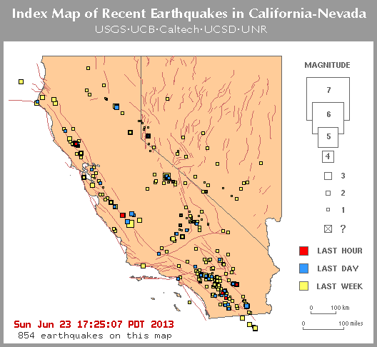
    Residents alarmed: New Zealand shaken by dozens of earthquakes in 24 hour period
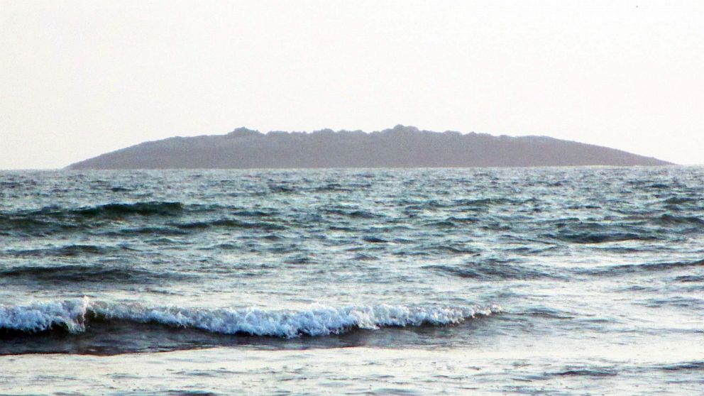
    July 19, 2013 – WELLINGTON, NZ – A 4.3 quake hit the east coast of New Zealand tonight, following a 4.5 magnitude quake in central New Zealand this afternoon, and a 5.7 earthquake that rattled people in Wellington and Blenheim this morning. Geonet reported tonight’s quake was 20 km east of Te Araroa, a settlement on the east coast of the north island, near the southern edge of the Bay of Plenty. The quake was 62 km deep and hit at 11.42pm. GeoNet reported this afternoon’s was of a “strong” intensity, 35 km east of Seddon, at a depth of 15 km. The quake hit at 3.21pm. The first quake struck at 9.06 am and was centered 30km east of Seddon, south of Blenheim, at a depth of 8 km. Rated as severe, it turned Wellington office workers white-knuckled as it swayed high-rises in the capital, with buildings also being rocked in Blenheim. The shallow tremor was felt as far away as Christchurch and New Plymouth. In Wellington it was felt as one jolt, gradually picking up in intensity, while those in Blenheim felt two shakes. GeoNet said it received more than 6000 reports after the jolt. It said the fact it struck off the South Island spared the region from its full force, though there were a few reports that it had a damaging intensity. Though it had knocked goods off shelves in Blenheim it was much too small to cause a tsunami, GeoNet said. An offshore earthquake needed to be at least magnitude 7.5 for a tsunami to be considered possible. The quake was preceded by a magnitude-2.9 “foreshock” in the same location 6 minutes before the main shock. An Earthqake Commission spokeswoman said 14 claims had been received following the first quake, but she expected more once people got home from work. By 11am there had been 17 aftershocks in the region, the largest a magnitude 3.7, 30km east of Seddon. Aftershocks were likely to continue for the next 24 hours. Early analysis had the fault movement as “reverse faulting,” meaning each side of the fault was being compressed. In Marlborough, Lake Grassmere farmer Peter Davison said he had never seen his house buck and shake so much. “It was like being on a bloody rollercoaster,” he said. He was looking out the window of his Marfells Beach Rd home when it hit. It was worse than the Boxing Day quake in 2010, which he had been in Christchurch for, he said. “I’ve never felt anything like it,” he said. His fishing rods had fallen and lay scattered around his library and pictures were askew on the walls. “It’s a wooden house and I’ve never seen the walls move like this,” he said. –Stuff NZ


    DEPTH
    km  REGION
    20-JUL-2013 12:01:20 -2.24 138.51 5.2 35 IRIAN JAYA, INDONESIA
    20-JUL-2013 09:14:15 21.95 94.40 4.7 102 MYANMAR
    20-JUL-2013 06:10:55 -17.04 168.39 4.5 54 VANUATU ISLANDS
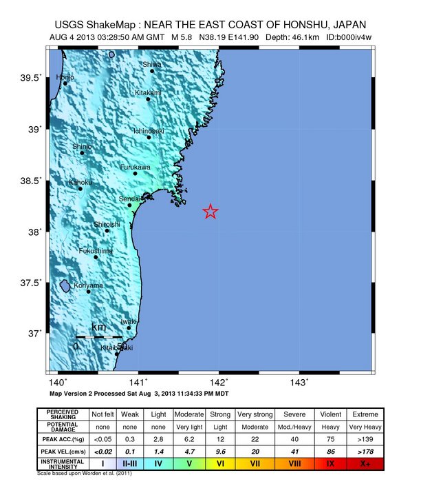
    20-JUL-2013 06:06:23 36.25 141.79 5.5 22 NEAR EAST COAST OF HONSHU, JAPAN
    20-JUL-2013 05:08:57 -1.65 136.51 4.9 29 IRIAN JAYA REGION, INDONESIA
    20-JUL-2013 04:18:58 -3.73 151.38 4.6 3 NEW IRELAND REGION, P.N.G.
    20-JUL-2013 01:49:04 -21.07 -178.58 4.4 517 FIJI ISLANDS REGION
    19-JUL-2013 19:39:13 -48.90 164.82 4.4 43 OFF W. COAST OF S. ISLAND, N.Z.
    19-JUL-2013 19:11:18 51.94 178.30 4.5 130 RAT ISLANDS, ALEUTIAN ISLANDS
    19-JUL-2013 16:39:19 37.52 141.39 5.2 39 NEAR EAST COAST OF HONSHU, JAPAN
    19-JUL-2013 15:33:25 -6.67 129.78 4.8 152 BANDA SEA
    19-JUL-2013 14:54:14 -17.36 167.74 4.8 17 VANUATU ISLANDS
    19-JUL-2013 14:05:35 -8.77 157.73 5.1 29 SOLOMON ISLANDS
    19-JUL-2013 11:40:41 -30.39 -176.24 5.7 16 KERMADEC ISLANDS REGION
    19-JUL-2013 10:58:08 47.47 88.97 4.7 10 NORTHERN XINJIANG, CHINA
    19-JUL-2013 09:05:09 38.68 142.03 4.5 63 NEAR EAST COAST OF HONSHU, JAPAN
    19-JUL-2013 07:28:51 -3.51 139.37 4.8 56 IRIAN JAYA, INDONESIA
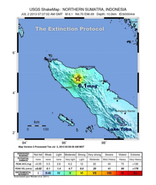
    19-JUL-2013 06:36:22 2.36 98.86 4.3 149 NORTHERN SUMATERA, INDONESIA
    19-JUL-2013 05:20:10 -10.82 165.82 5.1 10 SANTA CRUZ ISLANDS
    19-JUL-2013 05:05:49 -21.00 -113.25 4.6 9 SOUTHERN EAST PACIFIC RISE
    19-JUL-2013 03:21:13 -41.55 174.32 4.5 15 COOK STRAIT, NEW ZEALAND
    19-JUL-2013 02:58:57 -13.66 167.92 4.4 25 VANUATU ISLANDS
    19-JUL-2013 02:20:41 -16.77 167.66 5.4 25 VANUATU ISLANDS
    18-JUL-2013 23:56:21 25.69 98.92 4.5 35 MYANMAR-CHINA BORDER REGION
    18-JUL-2013 23:44:13 39.04 142.07 5.0 48 NEAR EAST COAST OF HONSHU, JAPAN
    18-JUL-2013 23:30:08 -17.19 -113.96 4.6 10 SOUTHERN EAST PACIFIC RISE
    18-JUL-2013 21:06:39 -41.56 174.36 5.5 17 COOK STRAIT, NEW ZEALAND
    18-JUL-2013 19:48:15 13.92 -91.27 4.8 63 NEAR COAST OF GUATEMALA
    18-JUL-2013 17:05:06 38.55 141.53 4.7 54 NEAR EAST COAST OF HONSHU, JAPAN
    18-JUL-2013 15:43:11 -8.31 117.16 5.0 34 SUMBAWA REGION, INDONESIA
    18-JUL-2013 14:41:07 69.15 -145.03 4.1 6 NORTHERN ALASKA
    18-JUL-2013 09:59:33 -17.46 167.82 5.1 19 VANUATU ISLANDS

    The Earthquake/Seismic Activity Log - Page 2 Nz-july-21
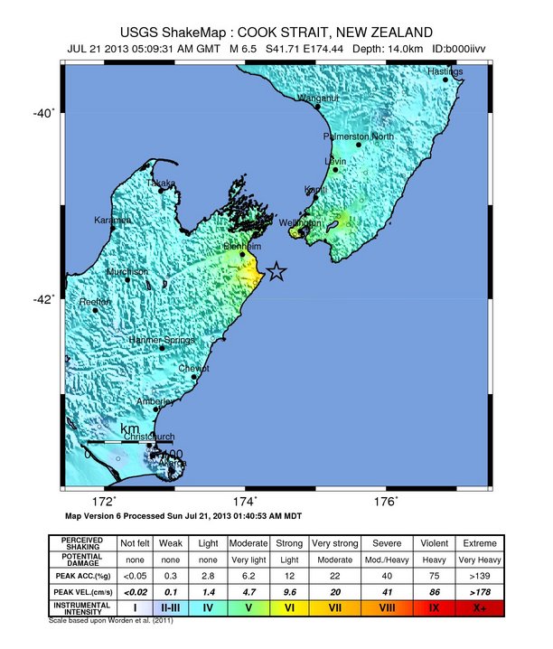
    Powerful 6.5 magnitude earthquake strikes Cook Strait, New Zealand
    July 21, 2013 – WELLINGTON, NZ - A 6.9-magnitude earthquake has struck New Zealand, rattling the capital Wellington and some other cities. The quake was later downgraded to a 6.5 by the USGS. The quake on Sunday hit 57km southwest of Wellington at a depth of 10.1km, the US Geological Survey said. There were no immediate reports of major damage and injuries after the earthquake but some water mains were broken, windows smashed and power lines downed. Wellington police inspector Marty Parker said there had been minor structural damage that had left parts of the city without power. No tsunami alert was issued. New Zealand’s GeoNet earthquake monitoring service described the 6.9 tremor which was felt widely as severe. “There was a rocking and rattling which lasted about 30 seconds,” a resident in the resort town of Nelson told the AFP news agency. It tremor was followed minutes later by another quake with a magnitude of 5.5 and came about 10 hours after a 5.8 tremor in the same region, which has been hit by multiple quakes in recent days. Recent quakes have been centered about 200km north of New Zealand’s second largest city Christchurch, where a 6.3-magnitude quake in February 2011 toppled buildings onto lunchtime crowds, leaving 185 people dead. The country sits on the so-called “Ring of Fire,” the boundary of the Australian and Pacific tectonic plates, and experiences up to 15,000 tremors a year. – Al Jazeera


    Last edited by Carol on Sun Jul 28, 2013 10:27 pm; edited 2 times in total


    _________________
    What is life?
    It is the flash of a firefly in the night, the breath of a buffalo in the wintertime. It is the little shadow which runs across the grass and loses itself in the sunset.

    With deepest respect ~ Aloha & Mahalo, Carol
    Carol
    Carol
    Admin
    Admin


    Posts : 31775
    Join date : 2010-04-07
    Location : Hawaii

    The Earthquake/Seismic Activity Log - Page 2 Empty Re: The Earthquake/Seismic Activity Log

    Post  Carol Sat Jul 27, 2013 2:10 am


    DATE and TIME (UTC) LAT LON MAG DEPTH
    km REGION
    27-JUL-2013 06:10:47 19.36 -64.64 4.1 21 VIRGIN ISLANDS
    27-JUL-2013 04:38:34 40.17 21.95 4.1 10 GREECE
    27-JUL-2013 04:24:39 13.13 145.46 5.4 46 MARIANA ISLANDS
    27-JUL-2013 01:27:11 27.60 139.89 4.2 470 BONIN ISLANDS REGION
    27-JUL-2013 01:14:46 32.88 141.74 4.6 29 SOUTH OF HONSHU, JAPAN
    27-JUL-2013 01:09:02 32.98 141.65 5.6 31 SOUTH OF HONSHU, JAPAN
    27-JUL-2013 01:01:29 -9.96 107.60 4.5 10 SOUTH OF JAWA, INDONESIA
    26-JUL-2013 21:32:59 -57.79 -23.96 6.2 10 SOUTH SANDWICH ISLANDS REGION
    26-JUL-2013 20:37:19 58.14 -151.89 4.5 24 KODIAK ISLAND REGION
    26-JUL-2013 19:08:29 -23.10 179.18 5.1 547 SOUTH OF FIJI ISLANDS
    26-JUL-2013 16:25:08 32.93 104.86 4.6 31 SICHUAN, CHINA
    26-JUL-2013 16:14:02 36.28 69.96 4.4 148 HINDU KUSH REGION, AFGHANISTAN
    26-JUL-2013 15:56:51 51.75 -176.75 4.5 61 ANDREANOF ISLANDS, ALEUTIAN IS.
    26-JUL-2013 14:36:20 -0.43 99.19 4.9 59 SOUTHERN SUMATERA, INDONESIA
    26-JUL-2013 13:28:37 25.40 125.04 4.6 111 SOUTHWESTERN RYUKYU ISLANDS
    26-JUL-2013 12:57:25 50.40 -129.99 5.0 10 VANCOUVER ISLAND REGION
    26-JUL-2013 08:37:05 2.27 127.23 4.7 36 NORTHERN MOLUCCA SEA
    26-JUL-2013 08:31:36 52.07 160.34 5.1 37 OFF EAST COAST OF KAMCHATKA
    26-JUL-2013 07:47:38 36.51 70.49 4.0 196 HINDU KUSH REGION, AFGHANISTAN
    26-JUL-2013 07:46:04 5.61 124.64 4.9 49 MINDANAO, PHILIPPINE ISLANDS
    26-JUL-2013 07:07:17 -15.36 167.59 6.1 133 VANUATU ISLANDS
    26-JUL-2013 04:39:22 15.81 -96.05 4.3 11 NEAR COAST OF OAXACA, MEXICO
    26-JUL-2013 04:06:21 -19.90 -70.59 4.2 23 NEAR COAST OF NORTHERN CHILE
    26-JUL-2013 02:38:05 -60.40 -26.81 4.6 41 SOUTH SANDWICH ISLANDS REGION
    26-JUL-2013 00:22:55 36.03 35.89 4.2 17 TURKEY
    25-JUL-2013 19:05:07 40.21 142.41 4.9 44 NEAR EAST COAST OF HONSHU, JAPAN
    25-JUL-2013 13:25:35 -28.37 -177.94 4.9 93 KERMADEC ISLANDS REGION
    25-JUL-2013 12:09:25 6.75 -73.09 4.8 149 NORTHERN COLOMBIA
    25-JUL-2013 10:51:28 7.37 125.08 4.8 44 MINDANAO, PHILIPPINE ISLANDS
    25-JUL-2013 10:42:43 -6.41 149.26 4.4 56 NEW BRITAIN REGION, P.N.G.
    25-JUL-2013 04:28:57 -21.53 -179.44 4.3 596 FIJI ISLANDS REGION
    25-JUL-2013 02:07:23 -15.91 -72.17 4.7 23 SOUTHERN PERU
    24-JUL-2013 23:43:47 38.44 73.41 4.4 130 TAJIKISTAN-XINJIANG BORDER REG.
    24-JUL-2013 21:39:22 -3.63 101.48 5.2 60 SOUTHERN SUMATERA, INDONESIA
    24-JUL-2013 20:51:24 38.99 26.11 4.1 12 AEGEAN SEA
    24-JUL-2013 19:51:55 12.93 93.27 4.7 42 ANDAMAN ISLANDS, INDIA
    24-JUL-2013 16:54:17 -18.84 -178.04 4.3 447 FIJI ISLANDS REGION
    24-JUL-2013 16:46:02 35.49 -118.29 4.3 7 CENTRAL CALIFORNIA
    24-JUL-2013 16:22:06 -22.80 -179.44 4.2 551 SOUTH OF FIJI ISLANDS
    24-JUL-2013 15:41:11 23.84 121.62 4.4 8 TAIWAN
    24-JUL-2013 15:32:14 23.88 121.54 4.8 10 TAIWAN
    24-JUL-2013 14:47:26 -11.89 166.62 4.7 201 SANTA CRUZ ISLANDS
    24-JUL-2013 14:47:04 23.87 121.58 5.0 11 TAIWAN
    24-JUL-2013 13:59:24 51.35 -179.04 5.3 55 ANDREANOF ISLANDS, ALEUTIAN IS.
    24-JUL-2013 13:29:54 -20.20 -70.70 4.8 27 NEAR COAST OF NORTHERN CHILE
    24-JUL-2013 11:03:14 -41.69 174.28 4.0 18 COOK STRAIT, NEW ZEALAND
    24-JUL-2013 10:00:56 18.24 -103.20 4.2 35 NEAR COAST OF MICHOACAN, MEXICO
    24-JUL-2013 03:32:35 -23.06 -177.16 5.9 167 SOUTH OF FIJI ISLANDS
    24-JUL-2013 01:47:29 28.15 129.84 4.7 28 RYUKYU ISLANDS
    24-JUL-2013 00:30:41 -17.38 167.54 4.9 35 VANUATU ISLANDS


    _________________
    What is life?
    It is the flash of a firefly in the night, the breath of a buffalo in the wintertime. It is the little shadow which runs across the grass and loses itself in the sunset.

    With deepest respect ~ Aloha & Mahalo, Carol
    Carol
    Carol
    Admin
    Admin


    Posts : 31775
    Join date : 2010-04-07
    Location : Hawaii

    The Earthquake/Seismic Activity Log - Page 2 Empty Re: The Earthquake/Seismic Activity Log

    Post  Carol Sun Jul 28, 2013 10:10 pm

    The Earthquake/Seismic Activity Log - Page 2 8952307
    Officials tell public, it’s time to prepare for an Alpine Fault earthquake
    July 24, 2013 – NEW ZEALAND – The fault-line behind the swarm of quakes in central New Zealand may be much longer than previously realized and therefore capable of larger quakes. The National Institute of Water and Atmospheric Research is heading into Cook Strait tomorrow to map the area around the swarm of earthquakes that has been rattling Wellington and Marlborough since Friday. It is hoped the work will identify the fault-line from which the quakes have been generated. GNS Science seismologist John Ristau said that, because the quakes appeared to be happening between the known Vernon and Needles fault-lines, it seemed increasingly likely that the London Hill fault was to blame. In 2003 a Marlborough District Council geotech report described London Hill as a one of “several relatively small faults near the east coast between Seddon and the Waima River.” Dr. Ristau said it now appeared the fault-line might be much longer than originally thought, which meant it could be capable of creating much larger earthquakes. “That means it’s actually considerably longer than initially thought … the larger a fault-line is, the larger the earthquake.” It was important scientists were able to determine exactly which fault the earthquake had occurred on, as it would allow them to establish whether other nearby faults could now produce large earthquakes as a result. It appeared the level of stress had not greatly affected the other Wellington faults, but there were a few lines in the Marlborough region that were capable of creating quakes of magnitude 7 or greater. “If they increase stress, it could trigger a similar-sized earthquake or even a much larger earthquake … hopefully by the end of the week we’ll be able to be a lot more definitive.”

    Yesterday, GNS Science seismologist Stephen Bannister said scientists could not rule out the possibility that the quakes could stir up other faults and “kick off” the Alpine Fault. He said the biggest misconception the public had when it came to earthquakes was that small ones minimized or took “the edge off” the possibility of a large one occurring. However, GNS Science spokesman John Callan said the recent swarm of quakes east of Seddon was “not increasing or decreasing the risk of a quake on the Alpine Fault.” He said the quakes were too far away to affect the Alpine Fault, which stretches 600 kilometers from Milford Sound along the western Southern Alps to Marlborough and is the on-land boundary between the Pacific and Australian tectonic plates. Recent research led by GNS Science found it last ruptured 296 years ago, and it predicted a 30 per cent chance of a big quake along it in the next 50 years. The average interval between large quakes on the fault was 330 years. In the past 8000 years it had ruptured 24 times and caused magnitude-8 quakes, including four in the past millennium. The longest gap between major quakes was 510 years and the shortest 140 years. “An earthquake on the Alpine Fault in the near future would not be a big surprise. Equally, it could be many decades away, based on its past behavior,” Callan said. “There is no better time than the present to prepare for the next quake on the Alpine Fault. The more thoroughly we prepare, the lower the eventual impact will be.” He said work was under way to prepare to drill a deep borehole into the fault early next year to study processes taking place at depth inside a major plate boundary fault. GNS Science is jointly leading the Deep Fault Drilling Project with Otago and Victoria universities, and it involved 22 organizations from eight countries. –Stuff


    _________________
    What is life?
    It is the flash of a firefly in the night, the breath of a buffalo in the wintertime. It is the little shadow which runs across the grass and loses itself in the sunset.

    With deepest respect ~ Aloha & Mahalo, Carol
    Carol
    Carol
    Admin
    Admin


    Posts : 31775
    Join date : 2010-04-07
    Location : Hawaii

    The Earthquake/Seismic Activity Log - Page 2 Empty Re: The Earthquake/Seismic Activity Log

    Post  Carol Sun Jul 28, 2013 10:20 pm

    The Earthquake/Seismic Activity Log - Page 2 _68878120_china_gansu_464
    China’s Gansu province struck by two powerful earthquakes- at least 94 reported dead
    July 22, 2013 – CHINA – Two powerful earthquakes have struck China’s north-west Gansu province, killing at least 94 people and leaving more than 400 others injured. The first earthquake near Dingxi city had a magnitude of 5.9 and was shallow, with a depth of just 9.8 km (6 miles), the US Geological Survey said. Just over an hour later, a magnitude 5.6 quake hit the same area, it added. In 2008, an earthquake in Sichuan province left up to 90,000 people dead and millions homeless. A factory worker in Minxian county told AFP that he felt “violent shaking” and “ran to the yard of the [factory] plant immediately. Our factory is only one floor. When I came to the yard, I saw an 18-storey building, the tallest in our county, shaking ferociously, especially the 18th floor,” he said. The area has been hit by 371 aftershocks, according to the Earthquake Administration of Gansu province. Tremors were felt in the provincial capital, Lanzhou, and as far away as Xian, 400km (250 miles) to the east.

    At least 5,600 houses in the province’s Zhangxian County are seriously damaged and 380 have collapsed, while some areas suffered from power cuts or mobile communications being disrupted, the earthquake administration added. “Many have been injured by collapsed houses,” a doctor based in Minxian County was quoted by Reuters news agency as saying. “Many villagers have gone to local hospitals along the roads.” The earthquake has caused a direct economic loss of 198 million Yuan ($32m; £21m), the Dingxi government said on its micro-blog. The closer to the surface an earthquake strikes, the more damage it can cause, our correspondent adds. The earthquake reportedly triggered a series of mudslides and landslides, making it difficult for rescuers to access some areas hit by the quake. The Gansu military police have deployed 500 soldiers, including 120 specialist rescuers, while 500 emergency tents and 2,000 quilts are also being transported to affected areas, Xinhua added. Officials from the civil affairs, transportation and earthquake departments were also visiting local towns to assess the damage, a statement on the Dingxi party website said. –BBC


    _________________
    What is life?
    It is the flash of a firefly in the night, the breath of a buffalo in the wintertime. It is the little shadow which runs across the grass and loses itself in the sunset.

    With deepest respect ~ Aloha & Mahalo, Carol
    Carol
    Carol
    Admin
    Admin


    Posts : 31775
    Join date : 2010-04-07
    Location : Hawaii

    The Earthquake/Seismic Activity Log - Page 2 Empty Re: The Earthquake/Seismic Activity Log

    Post  Carol Tue Aug 06, 2013 9:11 pm

    The Earthquake/Seismic Activity Log - Page 2 A-japan-8-4
    5.8 magnitude earthquake strikes off northeast coast of Japan
    August 5, 2013 – TOKYO — A strong 5.8 magnitude earthquake shook northeastern Japan on Sunday in the same region devastated by a giant tsunami and temblor 2-1/2 years ago, but there were no immediate reports of damage or injuries. The quake had a preliminary magnitude of 6.0 struck shortly after midday, and was centered off the coast of Miyagi Prefecture, and 50 kilometers (30 miles) below the seabed. The earthquake was later downgraded to a 5.8 event by the USGS. The quake shook a wide region, including Fukushima and Iwate prefectures, and there was no risk of a tsunami, the Japan Meteorological Agency said. Tokyo Electric Power Co., the utility that runs Fukushima Dai-ichi, said no problems were reported there or at another one of its nuclear plants in Fukushima, and that there were no power outages and radiation monitors did not show any change. Fukushima Dai-ichi plant went into multiple meltdowns after the March 2011 tsunami, and tons of water are being used daily to keep its reactors under control. Decommissioning is expected to take decades. Tohoku Electric Power Co. also said no problems were detected at its Onagawa nuclear plant in Miyagi Prefecture. Some roads were blocked off and some trains stopped running temporarily for safety checks, broadcaster NHK TV said. -TWC


    _________________
    What is life?
    It is the flash of a firefly in the night, the breath of a buffalo in the wintertime. It is the little shadow which runs across the grass and loses itself in the sunset.

    With deepest respect ~ Aloha & Mahalo, Carol
    Carol
    Carol
    Admin
    Admin


    Posts : 31775
    Join date : 2010-04-07
    Location : Hawaii

    The Earthquake/Seismic Activity Log - Page 2 Empty Re: The Earthquake/Seismic Activity Log

    Post  Carol Tue Aug 13, 2013 8:53 am

    The Earthquake/Seismic Activity Log - Page 2 Ptwc
    4.8 earthquake strikes beneath Kilauea Volcano; several aftershocks follow
    August 12, 2013 – HAWAII – The U.S. Geological Survey’s Hawaiian Volcano Observatory (HVO) recorded a 4.8 magnitude earthquake beneath the Big Island early Sunday morning. It was recorded at 5:54 a.m. about 5 miles south of the summit of Kilauea Volcano and at a depth of about 20 miles. Several aftershocks followed, the largest of which was a 3.4 magnitude earthquake at 6:06 a.m. According to Wes Thelen, HVO’s Seismic Network Manager, “these earthquakes were most likely structural adjustment of the Earth’s crust due to the weight of the island on the underlying mantle.” Many Big Island residents reported feeling the shaking and the HVO says people as far away as Oahu and Maui reported feeling the earthquake. Almost 400 reports received within the first hour of the earthquake. No injuries were reported. –Khon2


    _________________
    What is life?
    It is the flash of a firefly in the night, the breath of a buffalo in the wintertime. It is the little shadow which runs across the grass and loses itself in the sunset.

    With deepest respect ~ Aloha & Mahalo, Carol
    Carol
    Carol
    Admin
    Admin


    Posts : 31775
    Join date : 2010-04-07
    Location : Hawaii

    The Earthquake/Seismic Activity Log - Page 2 Empty Re: The Earthquake/Seismic Activity Log

    Post  Carol Wed Aug 14, 2013 9:57 pm

    The Earthquake/Seismic Activity Log - Page 2 Colombia-aug-13-a
    Strong 6.7 magnitude earthquake strikes off the coast of Colombia
    August 13, 2013 – COLOMBIA – The U.S. Geological Survey said a strong earthquake of 6.7 magnitude occurred in the Pacific Ocean about 59 miles (95 km) west southwest of Mutis, Colombia. The quake hit at 10:43 a.m. local time (11:43 a.m. EDT/1543 GMT) at a shallow depth of 2.7 miles (4.4 km), USGS said. There were no immediate reports of damage, and the Alaska Tsunami Warning Center, which covers this region of the Pacific, said no tsunami warning was issued. –Reuters


    _________________
    What is life?
    It is the flash of a firefly in the night, the breath of a buffalo in the wintertime. It is the little shadow which runs across the grass and loses itself in the sunset.

    With deepest respect ~ Aloha & Mahalo, Carol
    Carol
    Carol
    Admin
    Admin


    Posts : 31775
    Join date : 2010-04-07
    Location : Hawaii

    The Earthquake/Seismic Activity Log - Page 2 Empty Re: The Earthquake/Seismic Activity Log

    Post  Carol Sun Sep 01, 2013 6:50 pm

    Alaska earthquake hits Aleutians: 7.0 magnitude shock
    Alaska earthquake hits some 67 miles west of Aleutian Islands, rattling homes and residents. But so far, there are no reports of injuries or damage from the Alaska earthquake.
    By Rachel D'Oro, Associated Press / August 30, 2013
    The town of Adak, Alaska, (seen here in 2010) was shaken Friday, Aug. 30, 2013, by a magnitude 7.0 earthquake. There were no immediate reports of damage or injuries from the Alaska earthquake.

    ANCHORAGE, Alaska

    A magnitude 7.0 earthquake rocked Alaska's Aleutian Islands with a jet-like rumble Friday that shook homes and sent residents scrambling for cover.

    "I heard it coming," said Kathleen Nevzoroff, who was sitting at her computer in the tiny Aleutians village of Adak when the major temblor struck at 8:25 a.m. local time, getting stronger and stronger. "I ran to my doors and opened them and my chimes were all ringing."...


    DATE and TIME (UTC) LAT LON MAG DEPTH
    km REGION
    24-AUG-2013 05:10:05 -24.54 -179.98 4.4 526 SOUTH OF FIJI ISLANDS
    17-AUG-2013 13:04:26 -25.32 -179.94 4.8 464 SOUTH OF FIJI ISLANDS
    12-AUG-2013 04:16:48 -30.62 -179.72 6.1 343 KERMADEC ISLANDS REGION
    24-AUG-2013 15:47:08 -31.76 -179.21 5.1 10 KERMADEC ISLANDS REGION
    29-AUG-2013 13:52:26 -19.32 -179.15 5.7 649 FIJI ISLANDS REGION
    28-AUG-2013 03:40:35 -21.29 -179.12 4.7 576 FIJI ISLANDS REGION
    09-AUG-2013 21:46:48 49.96 -179.02 5.0 11 SOUTH OF ALEUTIAN ISLANDS
    23-AUG-2013 12:06:22 -31.84 -178.85 5.0 69 KERMADEC ISLANDS REGION
    17-AUG-2013 06:53:15 -30.71 -178.82 4.1 47 KERMADEC ISLANDS, NEW ZEALAND
    18-AUG-2013 14:49:44 -20.72 -178.73 4.4 585 FIJI ISLANDS REGION
    18-AUG-2013 15:58:54 -17.77 -178.70 4.2 538 FIJI ISLANDS REGION
    08-AUG-2013 09:11:00 -15.41 -178.68 4.1 406 FIJI ISLANDS REGION
    03-AUG-2013 18:24:59 -23.98 -178.53 4.5 511 SOUTH OF FIJI ISLANDS
    10-AUG-2013 21:17:31 -19.77 -178.50 4.4 495 FIJI ISLANDS REGION
    11-AUG-2013 10:33:56 -29.18 -178.44 5.0 196 KERMADEC ISLANDS, NEW ZEALAND
    22-AUG-2013 01:18:13 51.55 -178.35 4.1 1 ANDREANOF ISLANDS, ALEUTIAN IS.
    16-AUG-2013 20:25:45 51.74 -178.32 4.7 39 ANDREANOF ISLANDS, ALEUTIAN IS.
    07-AUG-2013 08:59:49 -18.06 -178.27 4.3 568 FIJI ISLANDS REGION
    24-AUG-2013 03:45:54 -17.93 -178.09 4.1 592 FIJI ISLANDS REGION


    _________________
    What is life?
    It is the flash of a firefly in the night, the breath of a buffalo in the wintertime. It is the little shadow which runs across the grass and loses itself in the sunset.

    With deepest respect ~ Aloha & Mahalo, Carol
    Carol
    Carol
    Admin
    Admin


    Posts : 31775
    Join date : 2010-04-07
    Location : Hawaii

    The Earthquake/Seismic Activity Log - Page 2 Empty Re: The Earthquake/Seismic Activity Log

    Post  Carol Sun Sep 01, 2013 6:57 pm

    The Earthquake/Seismic Activity Log - Page 2 Ind-sept-1
    6.5 magnitude earthquake strikes off eastern Indonesia
    eptember 1, 2013 – INDONESIA – A powerful 6.5-magnitude earthquake struck off eastern Indonesia on Sunday, the United States Geological Survey said, but no tsunami warning was issued. The quake struck in waters near the Barat Daya islands in Maluku province, 411 kilometres (254 miles) east of Atambua and 425 kilometres south of Ambon, the USGS said. It was at a depth of 132 kilometers. It is understood the quake hit at a depth of 114km in the Banda Sea just before 10pm AEST. –Times of India


    _________________
    What is life?
    It is the flash of a firefly in the night, the breath of a buffalo in the wintertime. It is the little shadow which runs across the grass and loses itself in the sunset.

    With deepest respect ~ Aloha & Mahalo, Carol
    Carol
    Carol
    Admin
    Admin


    Posts : 31775
    Join date : 2010-04-07
    Location : Hawaii

    The Earthquake/Seismic Activity Log - Page 2 Empty Re: The Earthquake/Seismic Activity Log

    Post  Carol Sun Sep 01, 2013 7:03 pm

    The Earthquake/Seismic Activity Log - Page 2 Alaska-aug-30
    7.0 magnitude earthquake strikes Alaska’s Aleutian Islands
    August 30, 2013 – ANCHORAGE, Alaska — Officials say a magnitude 7.0 earthquake has rocked Alaska’s Aleutian Islands with a jet-like rumble that shook homes and sent residents scrambling for cover. There are no immediate reports of damage or injuries from the major temblor at 8:25 a.m. Friday, local time. It was followed by multiple aftershocks, including one measuring magnitude 4.5. The Alaska Earthquake Information Center says the primary earthquake was centered 67 miles southwest of Adak, Alaska, and shaking lasted up to one minute. The village is about 1,200 miles southwest of Anchorage. The earthquake didn’t trigger a tsunami warning, but Michael Burgy with the West Coast and Alaska Tsunami Warning Center in Palmer, Alaska, says the center is monitoring for potential tsunamis caused by landslides, either on land or under water. –SF Gate

    Activity increases at Alaskan Volcano: JUNEAU, AK — Scientists reported increased activity at one of Alaska’s largest volcanoes on Friday, but geologist Chris Waythomas said it was unrelated to the earthquake that shook the Aleutian Islands that morning. Waythomas said the increased seismicity at the Veniaminof Volcano, on the Alaska Peninsula, started before the magnitude 7.0 earthquake struck, and the two are too far apart. The Alaska Volcano Observatory reported increased activity, including lava fountaining and ash emissions up to 20,000 feet, from the volcano on Friday morning. Waythomas, a geologist with the U.S. Geological Survey at the observatory, said scientists have been monitoring increased activity at the site since early June. He said the volcano has had some significant past eruptions but nothing that scientists are seeing now suggests anything major is in the works this time. Rather, he suspects there will be a protracted period of the same kind of activity that scientists have been watching. Veniaminof is about 480 miles southwest of Anchorage; Perryville is the nearest community to the volcano, about 20 miles away, and it received trace amounts of ash fall Friday, Waythomas said — like a dusting on the windshields of vehicles. Depending on how the wind blows, the Chignik area also could see some ash but amounts should be minimal, and there could be some impact on local air travel, he said. According to the observatory, the volcano, which has an ice-filled summit caldera, is one of the most active volcanic centers in the Aleutian Arc. It has erupted at least 13 times in the past 200 years, with what were characterized as minor ash-producing explosions in 2002, 2004, 2005, 2006 and 2008. Waythomas said steam has been observed coming off the lava flow as it hits the ice. But he said the lava has not been melting a lot of ice, so there is not a perceived flood hazard. –Anchorage Daily News


    _________________
    What is life?
    It is the flash of a firefly in the night, the breath of a buffalo in the wintertime. It is the little shadow which runs across the grass and loses itself in the sunset.

    With deepest respect ~ Aloha & Mahalo, Carol
    Carol
    Carol
    Admin
    Admin


    Posts : 31775
    Join date : 2010-04-07
    Location : Hawaii

    The Earthquake/Seismic Activity Log - Page 2 Empty Re: The Earthquake/Seismic Activity Log

    Post  Carol Thu Sep 05, 2013 11:54 pm


    DATE and TIME (UTC) LAT LON MAG DEPTH
    km REGION
    06-SEP-2013 02:57:46 34.54 24.92 4.4 10 CRETE
    06-SEP-2013 02:28:10 -47.06 33.54 5.3 10 PRINCE EDWARD ISLANDS REGION
    06-SEP-2013 01:27:48 51.37 -174.29 4.5 25 ANDREANOF ISLANDS, ALEUTIAN IS.
    06-SEP-2013 00:08:57 -24.34 -66.50 4.4 51 SALTA PROVINCE, ARGENTINA
    06-SEP-2013 00:00:10 52.50 -168.05 4.2 28 FOX ISLANDS, ALEUTIAN ISLANDS
    05-SEP-2013 23:54:26 10.57 -86.12 4.8 35 OFF COAST OF COSTA RICA
    05-SEP-2013 22:34:15 10.40 -86.14 4.6 35 OFF COAST OF COSTA RICA
    05-SEP-2013 21:21:48 24.79 124.76 4.9 26 SOUTHWESTERN RYUKYU ISLANDS
    05-SEP-2013 20:11:59 69.19 -144.41 4.2 5 NORTHERN ALASKA
    05-SEP-2013 16:33:53 17.54 145.78 4.7 206 MARIANA ISLANDS
    05-SEP-2013 16:30:00 -7.30 144.09 4.4 33 NEAR S COAST OF NEW GUINEA, PNG.
    05-SEP-2013 15:35:08 -7.24 144.19 4.9 35 NEAR S COAST OF NEW GUINEA, PNG.
    05-SEP-2013 15:27:06 -7.23 144.04 5.6 32 NEAR S COAST OF NEW GUINEA, PNG.
    05-SEP-2013 14:16:39 10.40 -86.20 4.5 44 OFF COAST OF COSTA RICA
    05-SEP-2013 12:29:18 10.58 -86.05 6.0 42 OFF COAST OF COSTA RICA
    05-SEP-2013 11:22:59 51.75 -174.72 4.8 24 ANDREANOF ISLANDS, ALEUTIAN IS.
    05-SEP-2013 10:57:17 51.69 -174.96 4.8 32 ANDREANOF ISLANDS, ALEUTIAN IS.
    05-SEP-2013 10:09:27 51.39 -174.68 5.1 34 ANDREANOF ISLANDS, ALEUTIAN IS.
    05-SEP-2013 09:49:21 51.55 -174.68 4.7 30 ANDREANOF ISLANDS, ALEUTIAN IS.
    05-SEP-2013 09:34:23 51.41 -174.53 5.0 29 ANDREANOF ISLANDS, ALEUTIAN IS.
    05-SEP-2013 07:44:06 51.45 -174.69 4.9 27 ANDREANOF ISLANDS, ALEUTIAN IS.
    05-SEP-2013 07:13:43 2.07 96.72 4.7 42 NORTHERN SUMATERA, INDONESIA
    05-SEP-2013 06:38:57 51.67 -174.97 4.5 20 ANDREANOF ISLANDS, ALEUTIAN IS.
    05-SEP-2013 05:52:40 -24.11 -70.49 4.2 50 NEAR COAST OF NORTHERN CHILE
    05-SEP-2013 05:43:40 51.46 -174.55 5.6 24 ANDREANOF ISLANDS, ALEUTIAN IS.
    05-SEP-2013 04:01:35 15.21 -45.17 6.0 10 NORTHERN MID-ATLANTIC RIDGE
    04-SEP-2013 23:54:02 51.43 -174.59 4.8 27 ANDREANOF ISLANDS, ALEUTIAN IS.
    04-SEP-2013 23:32:41 2.50 96.01 4.8 37 NORTHERN SUMATERA, INDONESIA
    04-SEP-2013 16:57:27 55.97 162.18 4.6 28 NEAR EAST COAST OF KAMCHATKA
    04-SEP-2013 16:13:07 36.06 68.92 4.0 77 HINDU KUSH REGION, AFGHANISTAN
    04-SEP-2013 15:26:32 51.05 -130.56 4.3 10 QUEEN CHARLOTTE ISLANDS REGION
    04-SEP-2013 12:04:10 -41.52 174.42 4.8 20 COOK STRAIT, NEW ZEALAND
    04-SEP-2013 11:14:18 53.64 -164.95 4.2 36 UNIMAK ISLAND REGION
    04-SEP-2013 10:41:40 53.63 -164.85 4.9 10 UNIMAK ISLAND REGION
    04-SEP-2013 10:04:06 53.19 -166.79 5.0 11 FOX ISLANDS, ALEUTIAN ISLANDS
    04-SEP-2013 09:16:28 51.41 -174.85 5.1 24 ANDREANOF ISLANDS, ALEUTIAN IS.
    04-SEP-2013 09:11:57 2.79 98.99 4.8 164 NORTHERN SUMATERA, INDONESIA
    04-SEP-2013 08:16:53 51.52 -174.90 4.7 29 ANDREANOF ISLANDS, ALEUTIAN IS.
    04-SEP-2013 07:42:26 51.71 -174.73 4.3 51 ANDREANOF ISLANDS, ALEUTIAN IS.
    04-SEP-2013 06:54:16 51.51 -174.58 5.2 42 ANDREANOF ISLANDS, ALEUTIAN IS.
    04-SEP-2013 06:27:05 51.57 -174.99 6.2 33 ANDREANOF ISLANDS, ALEUTIAN IS.
    04-SEP-2013 06:16:50 51.50 -174.80 5.9 25 ANDREANOF ISLANDS, ALEUTIAN IS.
    04-SEP-2013 05:47:10 -20.50 -178.03 4.7 470 FIJI ISLANDS REGION
    04-SEP-2013 05:37:52 12.46 -87.90 4.3 32 NEAR COAST OF NICARAGUA
    04-SEP-2013 05:15:56 51.60 -174.87 5.2 45 ANDREANOF ISLANDS, ALEUTIAN IS.
    04-SEP-2013 04:16:31 51.60 -174.81 5.5 35 ANDREANOF ISLANDS, ALEUTIAN IS.
    04-SEP-2013 04:12:39 -21.46 -69.85 4.3 75 NORTHERN CHILE
    04-SEP-2013 02:32:33 51.59 -174.76 6.4 40 ANDREANOF ISLANDS, ALEUTIAN IS.
    04-SEP-2013 00:43:11 51.18 -178.29 4.5 10 ANDREANOF ISLANDS, ALEUTIAN IS.
    04-SEP-2013 00:23:12 51.20 -129.90 6.0 10 QUEEN CHARLOTTE ISLANDS REGION
    04-SEP-2013 00:18:24 30.01 138.79 6.5 407 SOUTH OF HONSHU, JAPAN


    _________________
    What is life?
    It is the flash of a firefly in the night, the breath of a buffalo in the wintertime. It is the little shadow which runs across the grass and loses itself in the sunset.

    With deepest respect ~ Aloha & Mahalo, Carol
    magamud
    magamud


    Posts : 1280
    Join date : 2012-06-17

    The Earthquake/Seismic Activity Log - Page 2 Empty Re: The Earthquake/Seismic Activity Log

    Post  magamud Fri Sep 06, 2013 12:01 am

    I think this is a good time to use Floyd's logic and act like its all normal...

    Carol
    Carol
    Admin
    Admin


    Posts : 31775
    Join date : 2010-04-07
    Location : Hawaii

    The Earthquake/Seismic Activity Log - Page 2 Empty Re: The Earthquake/Seismic Activity Log

    Post  Carol Fri Sep 06, 2013 12:25 pm

    The Earthquake/Seismic Activity Log - Page 2 Costa-rica-9-4
    6.0 magnitude earthquake strikes off the coast of Costa Rica
    September 5, 2013 – COSTA RICA – The United States Geological Service (USGS) recorded a magnitude 6.0 earthquake 44 km west of Sardinal, in Costa Rica’s Guanacaste province at 6:29 a.m. this morning.  The USGS reports that the quake struck at a depth of 41.7km. ICR has received reports of shaking in the popular tourist destination and beach community of Playas del Coco, described as three strong jolts over the course of about a minute. The Observatorio Vulcanológico y Sismológico de Costa Rica (OVSICORI) has yet to record the event, but reported a magnitude 3.8 temblor 39 km southwest of Manzanillo de Santa Cruz, also in the province of Guanacaste, a few minutes after the event reported by USGS.  OVSICORI reports that quake having struck at a depth of 5 km. There are no reports of injuries or damage at this time. Today marks one year to the day when a magnitude 7.4 earthquake struck the Nicoya Peninsula, also in the province of Guanacaste, on September 5th, 2012. That quake occurred at 8:42 a.m. local time. –Inside Costa Rica


    _________________
    What is life?
    It is the flash of a firefly in the night, the breath of a buffalo in the wintertime. It is the little shadow which runs across the grass and loses itself in the sunset.

    With deepest respect ~ Aloha & Mahalo, Carol
    Carol
    Carol
    Admin
    Admin


    Posts : 31775
    Join date : 2010-04-07
    Location : Hawaii

    The Earthquake/Seismic Activity Log - Page 2 Empty Re: The Earthquake/Seismic Activity Log

    Post  Carol Sun Sep 08, 2013 9:52 pm

    The Earthquake/Seismic Activity Log - Page 2 Quakes-for-september-2013

    The Earthquake/Seismic Activity Log - Page 2 Guatemala-9-6
    6.6 magnitude quake strikes Guatemala: planet reeling from series of powerful earthquakes
    September 7, 2013 – GUATEMALA – A 6.6-magnitude earthquake has hit Guatemala’s Pacific coastline, US seismologists say. The US Geological Survey said the quake struck around three miles (6km) south of Pajapita, at a depth of 42 miles (68km). Guatemala’s fire department issued a statement saying a few poorly-built homes were destroyed in the town of Patzicia, located between the epicenter and the capital. The quake was felt strongly in Guatemala City, the capital, and caused blackouts in some areas, but authorities have not reported any immediate injuries or damage. “People living in Guatemala City’s tall buildings were panicked,” said Eddy Sanchez, director of Guatemala’s National Institute of Seismology. The Central American nation’s natural disaster agency said a major highway was blocked by a landslide. The quake was also reportedly felt in neighboring Mexico and El Salvador, but there were no immediate reports of injuries or damage in both countries. The tremor was one of the strongest in Guatemala since a 7.4-magnitude earthquake last November killed 44 people in the west of the country. It was the strongest in 36 years and left thousands of people homeless and without electricity or water. –KLFM


    The Earthquake/Seismic Activity Log - Page 2 Philippines-9-6
    6.0 magnitude earthquake strikes off coast of northern Philippines
    September 6, 2013 – PHILIPPINES - A strong 6.0 magnitude earthquake struck off the northern Philippines late Friday, but there were no immediate reports of damage or casualties, officials said. The quake was recorded at 7:33 pm local time (1133 GMT) with an epicenter about 42 kilometers (26 miles) south of Uyugan town in the Batan Islands, the Philippine Institute of Volcanology and Seismology said. The United States Geological Survey said the quake had a depth of 178 kilometers. Norma Talosig, the Batan Islands’ civil defense chief, said she contacted a Philippine navy detachment in Basco — the capital of the sparsely populated island group near the sea border with Taiwan — to check on the impact. “I was told it registered as a low-intensity tremor there, with no visible damage,” Talosig told AFP. She said there were no immediate reports of casualties in Uyugan, a town of around one thousand residents, or nearby areas. The Philippines lies in the so-called Pacific ring of fire, a chain of islands that are prone to quakes and volcanic eruptions. –My Republica


    The Earthquake/Seismic Activity Log - Page 2 Costa-rica-9-4
    6.0 magnitude earthquake strikes off the coast of Costa Rica
    eptember 5, 2013 – COSTA RICA – The United States Geological Service (USGS) recorded a magnitude 6.0 earthquake 44 km west of Sardinal, in Costa Rica’s Guanacaste province at 6:29 a.m. this morning. The USGS reports that the quake struck at a depth of 41.7km. ICR has received reports of shaking in the popular tourist destination and beach community of Playas del Coco, described as three strong jolts over the course of about a minute. The Observatorio Vulcanológico y Sismológico de Costa Rica (OVSICORI) has yet to record the event, but reported a magnitude 3.8 temblor 39 km southwest of Manzanillo de Santa Cruz, also in the province of Guanacaste, a few minutes after the event reported by USGS. OVSICORI reports that quake having struck at a depth of 5 km. There are no reports of injuries or damage at this time. Today marks one year to the day when a magnitude 7.4 earthquake struck the Nicoya Peninsula, also in the province of Guanacaste, on September 5th, 2012. That quake occurred at 8:42 a.m. local time. –Inside Costa Rica


    _________________
    What is life?
    It is the flash of a firefly in the night, the breath of a buffalo in the wintertime. It is the little shadow which runs across the grass and loses itself in the sunset.

    With deepest respect ~ Aloha & Mahalo, Carol
    Carol
    Carol
    Admin
    Admin


    Posts : 31775
    Join date : 2010-04-07
    Location : Hawaii

    The Earthquake/Seismic Activity Log - Page 2 Empty Re: The Earthquake/Seismic Activity Log

    Post  Carol Wed Sep 18, 2013 11:36 am

    The Earthquake/Seismic Activity Log - Page 2 Greece-Athens
    4.5 magnitude earthquake rattles buildings in Greek capital
    September 16, 2013 – ATHENS - An earthquake shook buildings in the Greek capital on Monday but there were no immediate reports of casualties or damage. A magnitude 4.5 quake struck central Greece just before 1500 GMT and was followed by a stronger tremor, the Athens Geodynamics Institute said. Fire brigade officials said they had not received any calls for assistance. The EMSC registered the earthquake as a 5.0 magnitude event. Greece is often rattled by earthquakes, most causing no serious damage. A 5.9 magnitude quake in 1999 killed 143 people. –Reuters


    _________________
    What is life?
    It is the flash of a firefly in the night, the breath of a buffalo in the wintertime. It is the little shadow which runs across the grass and loses itself in the sunset.

    With deepest respect ~ Aloha & Mahalo, Carol
    mudra
    mudra


    Posts : 23223
    Join date : 2010-04-09
    Age : 69
    Location : belgium

    The Earthquake/Seismic Activity Log - Page 2 Empty Re: The Earthquake/Seismic Activity Log

    Post  mudra Tue Sep 24, 2013 2:10 pm

    Earthquake in Pakistan Kills At Least 45, Creates New Island

    Read Latest Breaking News from Newsmax.com http://www.newsmax.com/TheWire/earthquake-pakistan-island/2013/09/24/id/527405#ixzz2fq529QTg

    Magnitude 7.7 24/09/2013 11:29 PAKISTAN

    These parameters are preliminary and subject to revisions.
    For updates, please consult: http://www.emsc-csem.org


    A magnitude 7.7 earthquake has occurred PAKISTAN at:
    27.07N  65.56E Depth 20km 24/09/2013 at 11:29:49 (Universal Time)

    Earthquake location with respect to nearby cities:
    285 km NW Karachi (pop 11624219, local time 16:29:49.4 2013-09-24)
    131 km SW Khuzdar (pop 141227, local time 16:29:49.4 2013-09-24)
    119 km NW Bela (pop 20119, local time 16:29:49.4 2013-09-24)

    9/24/2013 -- 7.8M earthquake causes NEW ISLAND to instantly rise off Pakistan shores

    https://www.youtube.com/watch?v=qiKFzDT99jM


    Love Always
    mudra
    Jenetta
    Jenetta


    Posts : 1978
    Join date : 2010-04-16
    Location : British Columbia Canada

    The Earthquake/Seismic Activity Log - Page 2 Empty Re: The Earthquake/Seismic Activity Log

    Post  Jenetta Wed Sep 25, 2013 12:28 am

    Volcanism is culprit behind sudden appearance of island off Pakistan’s coast


    September 25, 2013 – PAKISTAN – Mud houses in the mountains crumbled as a 7.7-magnitude earthquake shook western Pakistan early on Tuesday. Meanwhile, on the coast, residents of Gwadar saw a solitary island rise from the sea. Older residents of the coastal town said the land emergence was déjà vu — an earthquake in 1968 produced an island that stayed for one year and then vanished, Ali Mohammad, 60, and Azeem Baloch, 57, told NBC News. Seismologists suspect the island is a temporary formation resulting from a “mud volcano,” a jet of mud, sand and water that gushed to the surface as the temblor churned and pressurized that slurry under the ocean floor. “Sandy layers underground are shaken, and sand grains jiggle and become more compact,” John Armbruster, a seismologist at the Lamont Doherty Earth Observatory at Columbia University told NBC News. The shifting sand layers are compacted and pressurize the water, which gushed upwards, carrying mud and sand along with it. This “liquefaction” of sand and mud layers take place after any earthquake, but these sudden islands are usually spotted after strong earthquakes, at least 7- or 8-magnitude events. The distance of the island from the epicenter of the quake is a “little bit surprising,” Armbruster said, granted that “the sediments are quite soft and susceptible to this.” Back in the 1940s, a sizable island rose from the sea in the area, but it didn’t last long. After an earthquake near Karachi struck, the British Indian Geological survey recorded a new island “big enough that people could land a boat and walk on it,” Armbruster said. “Within days, weeks” — he wasn’t sure how long — “it washed away.”


    Complete story at: http://theextinctionprotocol.wordpress.com/

    _____________________________________
    As it is above; so it is below
    mudra
    mudra


    Posts : 23223
    Join date : 2010-04-09
    Age : 69
    Location : belgium

    The Earthquake/Seismic Activity Log - Page 2 Empty Re: The Earthquake/Seismic Activity Log

    Post  mudra Wed Sep 25, 2013 2:52 pm

    M7.0 - 46km S of Acari, Peru (BETA)
    2013-09-25 16:42:43 UTC


    Tectonic Summary

    The Peru earthquake of September 25, 2013, occurred as thrust-faulting on or near the thrust-interface at the boundary between the South America plate and the subducting Nazca plate. The Nazca plate subducts beneath the South America plate at the Peru-Chile trench offshore of western South America, and the thrust interface between the two plates dips east-northeast beneath the South American continent. At the latitude of the earthquake, the Nazca plate moves to the east-northeast with respect to the South America plate with a velocity of about 70 mm/y.

    The boundary-region between the Nazca and South American plates experiences a large number of earthquakes. The region within 250 km of the epicenter of the earthquake of September 25 had experienced seventeen previous earthquakes of magnitude 6 and larger since 1973. The largest of these, the magnitude 8.4 earthquake of June 23, 2001, occurred along the plate boundary to the south. It killed at least 74 people and destroyed over 17,000 homes. The magnitude 7.7 earthquake of November 12, 1996, killed at least 14 people and left 12,000 homeless. It occurred along the plate boundary to the north of the September 25 epicenter.

    http://comcat.cr.usgs.gov/earthquakes/eventpage/usb000jzma#summary

    Love Always
    mudra
    Carol
    Carol
    Admin
    Admin


    Posts : 31775
    Join date : 2010-04-07
    Location : Hawaii

    The Earthquake/Seismic Activity Log - Page 2 Empty Re: The Earthquake/Seismic Activity Log

    Post  Carol Thu Sep 26, 2013 2:38 pm

    The Earthquake/Seismic Activity Log - Page 2 Peru-3-sept-25
    7.0 magnitude earthquake strikes along the coast of Peru
    September 25, 2013 – PERU - There is no tsunami threat to Hawaiʻi after a 7.0 magnitude earthquake reported at 6:43 a.m. HST on Wednesday, Sept. 25, 2013 off the coast of Central Peru, officials said. The magnitude of the quake was initially reported as a 6.8. It was then downgraded shortly after to a 6.6, and finally upgraded to a 7.0 after further analysis, according to the USGS. The Pacific Tsunami Warning Center issued a statement saying there is no tsunami threat to Hawaiʻi based on all available data. Officials with the USGS say the quake occurred at at depth of 20.5 miles. The USGS reports that the quake was located 28 miles S of Acari, Peru; 56 miles SE of Minas de Marcona, Peru; 74 miles SSE of Nazca, Peru; 83 miles SSW of Puquio, Peru; and 308 miles SSE of Lima, Peru. This is the second 7.0+ magnitude earthquake to strike the planet in 24 hours. –Maui News


    _________________
    What is life?
    It is the flash of a firefly in the night, the breath of a buffalo in the wintertime. It is the little shadow which runs across the grass and loses itself in the sunset.

    With deepest respect ~ Aloha & Mahalo, Carol
    Carol
    Carol
    Admin
    Admin


    Posts : 31775
    Join date : 2010-04-07
    Location : Hawaii

    The Earthquake/Seismic Activity Log - Page 2 Empty Re: The Earthquake/Seismic Activity Log

    Post  Carol Thu Sep 26, 2013 2:41 pm

    The Earthquake/Seismic Activity Log - Page 2 201276182414627734_20
    Volcanism is culprit behind sudden appearance of island off Pakistan’s coast

    https://www.youtube.com/watch?v=AGQiQL7JGZU
    September 25, 2013 – PAKISTAN – Mud houses in the mountains crumbled as a 7.7-magnitude earthquake shook western Pakistan early on Tuesday. Meanwhile, on the coast, residents of Gwadar saw a solitary island rise from the sea. Older residents of the coastal town said the land emergence was déjà vu — an earthquake in 1968 produced an island that stayed for one year and then vanished, Ali Mohammad, 60, and Azeem Baloch, 57, told NBC News. Seismologists suspect the island is a temporary formation resulting from a “mud volcano,” a jet of mud, sand and water that gushed to the surface as the temblor churned and pressurized that slurry under the ocean floor. “Sandy layers underground are shaken, and sand grains jiggle and become more compact,” John Armbruster, a seismologist at the Lamont Doherty Earth Observatory at Columbia University told NBC News. The shifting sand layers are compacted and pressurize the water, which gushed upwards, carrying mud and sand along with it. This “liquefaction” of sand and mud layers take place after any earthquake, but these sudden islands are usually spotted after strong earthquakes, at least 7- or 8-magnitude events. The distance of the island from the epicenter of the quake is a “little bit surprising,” Armbruster said, granted that “the sediments are quite soft and susceptible to this.” Back in the 1940s, a sizable island rose from the sea in the area, but it didn’t last long. After an earthquake near Karachi struck, the British Indian Geological survey recorded a new island “big enough that people could land a boat and walk on it,” Armbruster said. “Within days, weeks” — he wasn’t sure how long — “it washed away.”
    Researchers at the United States Geological Survey are investigating the new formation, Paul Earle, a USGS geophysicist told NBC News, but have yet to get independent confirmation of it. It is clear that “the islands are not created because the ground was … pushed up by the earthquake,” he said, but more likely it was a secondary effect of shifting sediments. He also agrees the formation appears to have been caused by a mud volcano, but added that they don’t need an earthquake to set them off. There are “mud volcanoes in Yellowstone that have not been triggered by earthquakes,” he said. While mud volcanoes are typical of watery, loose sediments layers off the coast of Baluchistan, more substantial instant islands — or “land uprisings” — do suddenly appear in other parts of the world, Stephan Graham, a geologist at Stanford University told NBC News. They’re typically seen along fault lines where one tectonic plate slides under another, like the hungry subduction zone under New Zealand. Fault lines like the San Andreas, at which the Pacific Plate and the North American plates slide past each other sideways, are less likely to see such upcrops, Graham said. It also takes a pretty sizable earthquake to push up an entirely new land feature. “You wouldn’t expect to see it in a 3- or 4-magnitude [quake],” Graham said, it would take a stronger temblor of 7 or 8 magnitude to change the landscape. –NBC News


    _________________
    What is life?
    It is the flash of a firefly in the night, the breath of a buffalo in the wintertime. It is the little shadow which runs across the grass and loses itself in the sunset.

    With deepest respect ~ Aloha & Mahalo, Carol
    Carol
    Carol
    Admin
    Admin


    Posts : 31775
    Join date : 2010-04-07
    Location : Hawaii

    The Earthquake/Seismic Activity Log - Page 2 Empty Re: The Earthquake/Seismic Activity Log

    Post  Carol Thu Sep 26, 2013 2:43 pm

    The Earthquake/Seismic Activity Log - Page 2 Ht_pakistan_earthquake_new_island_ll_130924_16x9_992
    7.7 magnitude earthquake creates new island off the coast of Pakistan- death toll likely to rise
    September 24, 2013 – PAKISTAN - A massive, 7.7 magnitude earthquake struck south-central Pakistan on Tuesday afternoon local time. The USGS warns that there will high casualties and economic losses, requiring international response. Seismologists have also confirmed that the quake raised a new island, about 30-40 feet high, off the coast. The island is about half a mile off the coast of Gwadar, in the Arabian Sea. Already, reports the International Herald Tribune, crowds have gathered to see the mountainous, rocky island. Some are claiming it is 100 feet high. It’s not unusual for earthquakes of this magnitude to change the coastline, or even deform the shape of the planet. In 2010, an 8.8 magnitude quake in Chile created new coastlines in that country and changed the shape of the Earth enough to shorten our days by a fraction of a second. Today in Pakistan, estimates of damages are still coming in, and it may be days before we know the full extent of the losses because the quake struck in many regions that are remote. The nearest city to the epicenter is Arawan, where damage is said to be extensive, with houses collapsing and people trapped inside. So far, death tolls hover around 40, but that number is expected to rise as emergency services reach more of the affected areas. The populations near the epicenter may be sparse, but according to the USGS, the problem is that they are extremely vulnerable.
    Most homes are made of materials like unreinforced brick masonry, which crumble quickly in quakes and can be deadly. Karachi is another nearby city, with millions of residents, whose homes may have also been affected. People as far away as New Delhi report feeling the quake. The USGS also offers a quick scientific summary of the nature of the quake: The September 24, 2013 M7.7 earthquake in south-central Pakistan occurred as the result of oblique-strike-slip type motion at shallow crustal depths. The location and mechanism of the earthquake are consistent with rupture within the Eurasia plate above the Makran subduction zone. The event occurred within the transition zone between northward subduction of the Arabia plate beneath the Eurasia plate and northward collision of the India plate with the Eurasia plate. The epicenter of the event is 69km north of Awaran, Pakistan, and 270km north of Karachi, Pakistan (population 11.6 million). Right now, as emergency groups gather more information, the best thing we can do is wait to find out more. But it’s very likely that humanitarian aid will be needed, and as soon as we know more we’ll offer an update. –I09


    _________________
    What is life?
    It is the flash of a firefly in the night, the breath of a buffalo in the wintertime. It is the little shadow which runs across the grass and loses itself in the sunset.

    With deepest respect ~ Aloha & Mahalo, Carol

      Current date/time is Mon May 13, 2024 12:23 am