tMoA

Would you like to react to this message? Create an account in a few clicks or log in to continue.
tMoA

~ The only Home on the Web You'll ever need ~

5 posters

    The Earthquake/Seismic Activity Log

    mudra
    mudra


    Posts : 23210
    Join date : 2010-04-09
    Age : 69
    Location : belgium

    The Earthquake/Seismic Activity Log Empty The Earthquake/Seismic Activity Log

    Post  mudra Mon May 20, 2013 1:48 pm

    KAMCHATKA BEING SLAMMED.

    An enormous amount of quake activity, happening of the coast of Kamchatka Pennisula, Russia.

    https://www.youtube.com/watch?v=KPgN8uJegBY


    Love Always
    mudra
    Carol
    Carol
    Admin
    Admin


    Posts : 31705
    Join date : 2010-04-07
    Location : Hawaii

    The Earthquake/Seismic Activity Log Empty Re: The Earthquake/Seismic Activity Log

    Post  Carol Wed May 22, 2013 7:43 am


    DATE LAT LON MAG DEPTH
    km REGION
    22-MAY-2013 11:35:23 -30.33 -177.59 4.9 35 KERMADEC ISLANDS, NEW ZEALAND
    22-MAY-2013 11:00:04 37.97 139.67 4.3 10 EASTERN HONSHU, JAPAN
    22-MAY-2013 06:36:37 52.99 159.92 4.9 32 OFF EAST COAST OF KAMCHATKA
    22-MAY-2013 03:43:22 -16.57 -173.26 4.6 10 TONGA ISLANDS
    21-MAY-2013 23:38:48 26.67 57.91 4.6 10 SOUTHERN IRAN
    21-MAY-2013 23:10:45 -20.58 -69.69 4.6 92 NORTHERN CHILE
    21-MAY-2013 23:02:40 -13.80 -72.41 5.7 47 CENTRAL PERU
    21-MAY-2013 19:37:41 52.44 159.58 4.9 19 OFF EAST COAST OF KAMCHATKA
    21-MAY-2013 18:52:01 -6.53 154.58 5.0 69 SOLOMON ISLANDS
    21-MAY-2013 18:01:55 52.45 160.15 4.5 38 OFF EAST COAST OF KAMCHATKA
    21-MAY-2013 17:42:19 52.37 159.84 4.9 48 OFF EAST COAST OF KAMCHATKA
    21-MAY-2013 17:13:36 52.49 160.45 4.5 47 OFF EAST COAST OF KAMCHATKA
    21-MAY-2013 15:53:24 52.60 160.63 4.5 39 OFF EAST COAST OF KAMCHATKA
    21-MAY-2013 15:15:10 -54.45 158.62 4.6 10 MACQUARIE ISLANDS REGION
    21-MAY-2013 15:05:29 6.24 -82.64 4.6 35 SOUTH OF PANAMA
    21-MAY-2013 14:56:23 -9.40 123.80 4.7 91 TIMOR REGION, INDONESIA
    21-MAY-2013 14:51:47 45.14 142.86 5.1 264 HOKKAIDO, JAPAN REGION
    21-MAY-2013 14:51:20 52.61 160.66 5.3 38 OFF EAST COAST OF KAMCHATKA
    21-MAY-2013 13:27:49 -15.12 -71.48 5.2 101 SOUTHERN PERU
    21-MAY-2013 13:23:29 52.86 158.70 4.6 92 NEAR EAST COAST OF KAMCHATKA
    21-MAY-2013 12:51:56 -45.59 -76.59 5.3 29 OFF COAST OF SOUTHERN CHILE
    21-MAY-2013 12:39:32 52.37 160.53 4.7 42 OFF EAST COAST OF KAMCHATKA
    21-MAY-2013 11:25:51 36.90 139.35 4.5 10 EASTERN HONSHU, JAPAN
    21-MAY-2013 10:21:02 52.33 160.40 4.8 47 OFF EAST COAST OF KAMCHATKA
    21-MAY-2013 10:00:08 52.66 159.87 4.8 67 OFF EAST COAST OF KAMCHATKA
    21-MAY-2013 09:46:52 -60.81 152.09 4.7 10 WEST OF MACQUARIE ISLAND
    21-MAY-2013 08:41:16 15.85 -92.45 4.6 167 MEXICO-GUATEMALA BORDER REGION
    21-MAY-2013 08:25:54 23.42 123.69 5.6 13 SOUTHWESTERN RYUKYU ISLANDS
    21-MAY-2013 08:15:16 52.36 160.40 4.8 49 OFF EAST COAST OF KAMCHATKA
    21-MAY-2013 07:06:48 52.09 159.91 4.7 52 OFF EAST COAST OF KAMCHATKA
    21-MAY-2013 07:02:26 52.36 159.93 4.9 56 OFF EAST COAST OF KAMCHATKA
    21-MAY-2013 06:20:19 52.61 159.79 4.6 52 OFF EAST COAST OF KAMCHATKA
    21-MAY-2013 06:07:54 52.39 159.96 4.7 62 OFF EAST COAST OF KAMCHATKA
    21-MAY-2013 06:03:39 52.28 160.09 4.6 55 OFF EAST COAST OF KAMCHATKA
    21-MAY-2013 05:43:21 52.31 159.99 6.0 37 OFF EAST COAST OF KAMCHATKA
    21-MAY-2013 04:59:37 52.33 160.02 5.9 37 OFF EAST COAST OF KAMCHATKA
    21-MAY-2013 04:24:07 52.34 160.42 5.0 28 OFF EAST COAST OF KAMCHATKA
    21-MAY-2013 04:04:46 -22.16 -67.32 4.4 172 CHILE-BOLIVIA BORDER REGION
    21-MAY-2013 03:08:22 52.49 159.99 5.9 44 OFF EAST COAST OF KAMCHATKA
    21-MAY-2013 03:05:50 52.37 160.36 5.5 14 OFF EAST COAST OF KAMCHATKA
    21-MAY-2013 02:02:45 52.43 160.42 4.9 44 OFF EAST COAST OF KAMCHATKA
    21-MAY-2013 01:55:05 52.47 160.49 6.0 15 OFF EAST COAST OF KAMCHATKA

    21-MAY-2013 01:04:17 39.18 144.43 4.9 31 OFF EAST COAST OF HONSHU, JAPAN
    21-MAY-2013 00:01:16 52.96 158.95 4.6 94 NEAR EAST COAST OF KAMCHATKA


    6.8 Chile earthquake strikes off the coast
    Christian Science Monitor - ‎May 20, 2013‎
    No tsunami warning was issued. Chile's naval seismology office says it was not felt on land. U.S. seismologists originally estimated the magnitude at 6.8.


    _________________
    What is life?
    It is the flash of a firefly in the night, the breath of a buffalo in the wintertime. It is the little shadow which runs across the grass and loses itself in the sunset.

    With deepest respect ~ Aloha & Mahalo, Carol
    Carol
    Carol
    Admin
    Admin


    Posts : 31705
    Join date : 2010-04-07
    Location : Hawaii

    The Earthquake/Seismic Activity Log Empty Re: The Earthquake/Seismic Activity Log
    Post  Carol Thu May 23, 2013 4:50 pm

    PTWC South Of The Fiji Islands May 23 17:26 PM 7.4 208 MAP I Felt It
    GEONET Tolaga Bay May 23 17:25 PM 6.1 9 MAP I Felt It INFO
    GEONET Te Araroa May 23 17:25 PM 5.9 9 MAP I Felt It INFO
    USGS South Of The Fiji Islands May 23 17:19 PM 7.4 171 MAP I Felt It
    GEOFON South Of Fiji Islands May 23 17:19 PM 7.4 165 MAP I Felt It
    USGS South Of The Fiji Islands May 23 17:19 PM 7.4 207 MAP I Felt It
    EMSC South Of Fiji Islands May 23 17:19 PM 7.4 153 MAP I Felt It INFO
    WCATWC South Of Fiji Islands May 23 17:19 PM 7.4 206 MAP I Felt It

    Take a look at the Global Seismic Monitors.


    SIGNIFICANT HARMONICS AND SHAKING (Earth Wobble?)
    REGISTERING ON GLOBAL SEISMIC MONITORS
    Last Update LIVE TODAY -

    http://earthquake.usgs.gov/monitoring/operations/heliplots_gsn.php


    _________________
    What is life?
    It is the flash of a firefly in the night, the breath of a buffalo in the wintertime. It is the little shadow which runs across the grass and loses itself in the sunset.

    With deepest respect ~ Aloha & Mahalo, Carol
    mudra
    mudra


    Posts : 23210
    Join date : 2010-04-09
    Age : 69
    Location : belgium

    The Earthquake/Seismic Activity Log Empty Re: The Earthquake/Seismic Activity Log
    Post  mudra Fri May 24, 2013 3:18 am

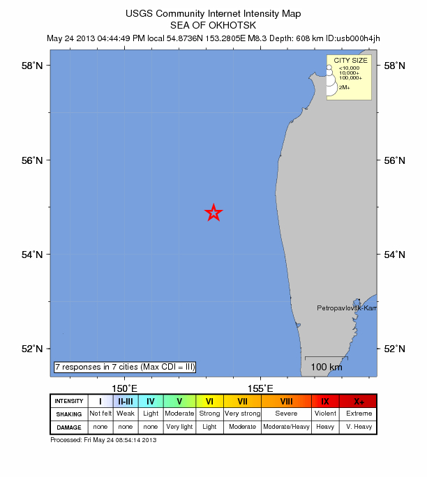
    5/24/2013 -- 8.3M earthquake -- Sea of Okhotsk, Russia -- West Coast USA

    https://www.youtube.com/watch?v=hIf0efpGK0E


    Love Always
    mudra
    Carol
    Carol
    Admin
    Admin


    Posts : 31705
    Join date : 2010-04-07
    Location : Hawaii

    The Earthquake/Seismic Activity Log Empty Re: The Earthquake/Seismic Activity Log

    Post  Carol Fri May 24, 2013 11:09 am

    8.3 Russia, coast of Kamchatka Pennisula
    5.9 Cali + swarms,
    5.8 South Indian Ocean,
    5.0 Iran,
    6.3 Tonga,
    4.6 Algeria,
    7.4 Fiji...


    The Earthquake/Seismic Activity Log Images?q=tbn:ANd9GcRlYpoGcbVFYVnkk3KAJ5iWd9TLcrfVt4BcflVo_kI2tivpM8VH
    Powerful 7.4 and 6.3 earthquakes strikes off coast of Tonga

    May 24, 2013 – TONGA – A strong quake has hit southwest of Tonga, reportedly shaking homes in the capital Nuku’alofa but no damage has been reported. A magnitude 7.4 earthquake has hit about 255 kilometers southwest of Tonga. A tsunami warning has been issued, but no damage is expected due to the quake’s depth of 171 kilometers, the Pacific Tsunami Warning Centre said. The US Geological Survey says the undersea earthquake, which struck at 5:19am local time, was centered 282 kilometers southwest of Tonga’s capital Nuku’alofa. Local media says the quake shook homes and buildings in Nuku’alofa but no damage was reported. It was followed four hours later by a second powerful 6.6 tremor 84 kilometers northwest of the town. The second quake, at a depth of 103 kilometers, also generated a tsunami warning. The two quakes come 12 days after a similar magnitude 6.3 earthquake struck the area, at a depth of 205 kilometers. Tonga lies on the so-called Pacific “Ring of Fire,” where continental plates collide causing frequent seismic activity. –Radio Australia

    Tremors destroy homes in India: Over 60,000 houses and nearly 950 government buildings were damaged in Jammu and Kashmir’s Doda and Kishtwar districts in earthquakes that shook the region since May 1. As many as 33 tremors rocked Bhaderwah-Doda-Kishtwar belt since the beginning of this month with a maximum 11 occurring on May 1. A total of 40,155 houses and 779 government buildings were damaged in quakes in Doda district, officials quoting preliminary assessment reports said. As many as 29,000 houses were damaged partially, 10,500 severely and 655 fully, they said. In Kishtwar district, 18,000 houses were partially damaged, 2,700 severely and 70 fully, the officials said. –Times of India


    _________________
    What is life?
    It is the flash of a firefly in the night, the breath of a buffalo in the wintertime. It is the little shadow which runs across the grass and loses itself in the sunset.

    With deepest respect ~ Aloha & Mahalo, Carol
    Carol
    Carol
    Admin
    Admin


    Posts : 31705
    Join date : 2010-04-07
    Location : Hawaii

    The Earthquake/Seismic Activity Log Empty Re: The Earthquake/Seismic Activity Log

    Post  Carol Fri May 24, 2013 12:27 pm

    The Earthquake/Seismic Activity Log California-may-24
    Shallow 5.7 magnitude northern California earthquake felt across two states
    May 24, 2013 – CALIFORNIA - An earthquake in far northeastern California was felt by thousands of people as far away as San Francisco and in two other states, but there have been no reports of injury or serious damage. The magnitude-5.7 quake broke dishes and shook mirrors when it struck at 8:47 p.m. Thursday, officials said. It was centered near Greenville, about 25 miles southwest of Susanville in far northeastern California, said Rafael Abreu, a geophysicist with the U.S. Geological Survey’s National Earthquake Center in Golden, Colo. There have been several aftershocks, including a magnitude 4.9 that struck early Friday morning. Slight damage has been reported including objects falling from shelves and dishes rattled or broken, according to a report from the National Weather Service. Susan Shephard and her husband Alan Shephard, who run the Quail Lodge at Lake Almanor near Greenville very close to the epicenter, said they were watching “The Hunger Games” on TV when the whole building started shaking. “All of a sudden things started falling off the shelves, mirrors fell off the wall, vases fell down to the floor, everything started crashing,” Shephard told the Redding Record-Searchlight. “It felt like the end of our world.” The Susanville Fire Department said it had received no reports of damage, and a Plumas County Sheriff’s Office dispatcher said calls were flooding into its office but no reports of damage. Thousands of people reported feeling the quake, as far away as the San Francisco Bay area and across the borders into Oregon and Nevada, according to the USGS website. KCRA-TV in Sacramento reported that the Plumas County temblor was felt in downtown Sacramento, about 145 miles south of the epicenter. People in Yuba and Sutter Counties, south of Plumas, said they felt a rolling quake, according to the Marysville Appeal-Democrat. “People in the area felt a strong jolt, but it was not enough to generate serious damage, based on early field reports,” Abreu said. –ABC News


    _________________
    What is life?
    It is the flash of a firefly in the night, the breath of a buffalo in the wintertime. It is the little shadow which runs across the grass and loses itself in the sunset.

    With deepest respect ~ Aloha & Mahalo, Carol
    Carol
    Carol
    Admin
    Admin


    Posts : 31705
    Join date : 2010-04-07
    Location : Hawaii

    The Earthquake/Seismic Activity Log Empty Re: The Earthquake/Seismic Activity Log

    Post  Carol Fri May 24, 2013 12:29 pm

    The Earthquake/Seismic Activity Log Sea-of-okhotsk
    Deep 8.3 magnitude earthquake strikes Sea of Okhotsk in Russia’s Far East
    May 24, 2013 – KAMCHATKA – A magnitude 8.3 earthquake struck off Russia’s eastern coast on Friday, briefly prompting a tsunami scare but causing no casualties or substantial damage, Russian emergency authorities said. The epicenter of the quake was located at a depth of 385 miles in the Sea of Okhotsk, 244 miles west of the nearest city, Petropavlovsk-Kamchatsky, the U.S. Geological Survey said. The quake was felt in Petropavlovsk-Kamchatsky, the main city on the Kamchatka peninsula and home to a nuclear submarine base, and on Sakhalin Island, where Russia’s largest liquefied natural gas project is located. The earthquake struck 608 km (377 miles) below the ocean- diminishing any tsunami risks. Regional emergency authorities issued a tsunami warning for Sakhalin and the Kurile Islands, advising residents of dangerous areas to seek high ground, but lifted the warning several minutes later. Residents of northern Japan felt the quake but there was no tsunami warning from Japan’s meteorological agency. It’s the second major earthquake to strike the planet in 24 hours. A 7.4 earthquake struck the region of Tonga, in the South Pacific, hours earlier. –Reuters

    The Earthquake/Seismic Activity Log Pacific-plate-quakes-may-24
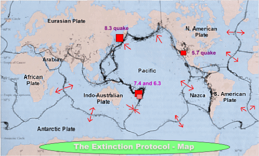
    Pacific Plate turbulence increases: At 103 million square kilometers, the Pacific plate is the largest of the tectonic plates and consequently the most violent. Geological forces are tearing at the integrity and stability of this large lithospheric cross-section of the planet. As I reported several days ago, seismic tension was mounting along the Pacific tectonic plate. The cascading series of earthquakes over the last 24 hours are yet one more indication that dynamic geological change is accelerating within the interior of the planet. These processes of change will have profound implications for the entire Ring of Fire and all subduction zones located within this region.


    _________________
    What is life?
    It is the flash of a firefly in the night, the breath of a buffalo in the wintertime. It is the little shadow which runs across the grass and loses itself in the sunset.

    With deepest respect ~ Aloha & Mahalo, Carol
    Carol
    Carol
    Admin
    Admin


    Posts : 31705
    Join date : 2010-04-07
    Location : Hawaii

    The Earthquake/Seismic Activity Log Empty Re: The Earthquake/Seismic Activity Log

    Post  Carol Sun May 26, 2013 11:13 am

    The Earthquake/Seismic Activity Log Uzbekistan
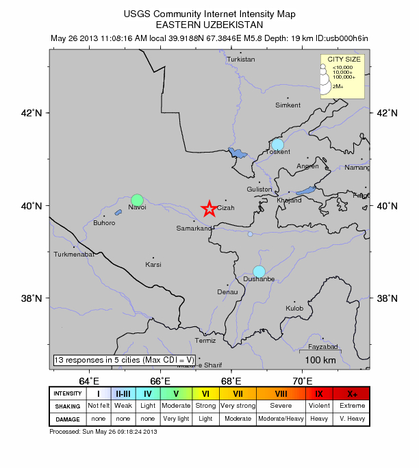
    Twin moderate earthquakes strike region of Eastern Uzbekistan
    May 26, 2013 – UZBEKISTAN – An earthquake with a magnitude of at least 6.0 struck southeast Uzbekistan on Sunday, the U.S. Geological Survey reported. The quake was later downgraded to a 5.8 by the USGS. It was preceded by a 5.5 magnitude earthquake which struck 9km NNW of Buka, Uzbekistan, as a foreshock. The foreshock struck at a depth of 15.8 km. There were no immediate reports of casualties or damage from either quake. –Reuters


    _________________
    What is life?
    It is the flash of a firefly in the night, the breath of a buffalo in the wintertime. It is the little shadow which runs across the grass and loses itself in the sunset.

    With deepest respect ~ Aloha & Mahalo, Carol
    Carol
    Carol
    Admin
    Admin


    Posts : 31705
    Join date : 2010-04-07
    Location : Hawaii

    The Earthquake/Seismic Activity Log Empty Re: The Earthquake/Seismic Activity Log
    Post  Carol Tue May 28, 2013 3:45 pm

    May 28, 2013 – NEW ZEALAND - The equivalent of a magnitude 7 quake is quietly rocking the capital, though until now you’d have only noticed it if you were a geophysicist. The huge underground movement called the Kapiti Slip is responsible, and it’s not over yet. “This is what we call a silent earthquake,” Geonet scientist Caroline Little said on Firstline this morning. “Instead of this movement happening in seconds, this will take around a year to move.” Normal earthquakes release all their energy when one side of a fault suddenly slips past the other, and can be incredibly destructive – as the people of Christchurch know all too well. But in a silent earthquake the energy is released slowly, and in some cases can be predicted in advance. “We started recording with the GPS network in 2002, and since then this is the third Kapiti event we’ve seen,” says Ms. Little. “Both of the previous two have lasted around the year mark. Interestingly it’s occurred every five years – 2003, 2008 and then this one in 2013.” Slow-slip quakes are relatively recent discovery, and their effect on conventional quakes is still being researched. “It does change the stress around the area, and these types of events have been known to interact with conventional earthquakes,” says Ms Little. “We had another event like this around Kapiti in 2008, and that actually caused a swarm of earthquakes – tiny earthquakes – around the Upper Hutt region, around 30 earthquakes around magnitude 2 and 3.” It’s not apparent whether they increase or decrease the likelihood of a major quake, like the one in Christchurch. “It’s both, really, because it changes the stress in different areas. It could go both ways,” says Ms Little. The Kapiti Slip is occurring 40km beneath the Earth’s surface, and stretches 100km between Kapiti and Marlborough. It’s not a phenomenon unique to the area, or even New Zealand. “It happens in four regions in the North Island of New Zealand, and it also happens at all the other subduction zones around the world like Japan and North America,” says Ms Little. A slow-slip quake happens in the Hawke’s Bay and Gisborne every one-to-two years, at only 10 to 15km deep. GeoNet estimates around 40 percent of the North Island’s tectonic plate movement occurs in slow slips. -3News


    _________________
    What is life?
    It is the flash of a firefly in the night, the breath of a buffalo in the wintertime. It is the little shadow which runs across the grass and loses itself in the sunset.

    With deepest respect ~ Aloha & Mahalo, Carol
    Carol
    Carol
    Admin
    Admin


    Posts : 31705
    Join date : 2010-04-07
    Location : Hawaii

    The Earthquake/Seismic Activity Log Empty Re: The Earthquake/Seismic Activity Log

    Post  Carol Wed May 29, 2013 11:18 am

    The Earthquake/Seismic Activity Log Article-2332531-1A0BA3B7000005DC-891_634x584
    http://www.independent.co.uk/news/uk/home-news/north-wales-earthquake-tremors-felt-as-far-away-as-merseyside-8635535.html
    Earthquake in Irish Sea causes intense shaking in North Wales: largest quake in 29 years
    The Earthquake/Seismic Activity Log _67873802_0513_llynpeninsula_tremor
    May 29, 2013 – WALES – An earthquake on the North Wales shoreline has been felt over an area of 140 km. People were woken by the quake which happened at around 4.15 am and was felt as far away as Southport in Merseyside. The epicenter was 13km northwest of the town of Abersoch, Gwynedd, on the Lleyn Peninsula and measured a magnitude of 3.8, the British Geological Survey (BGS) said. Some 180 reports from people who felt the earthquake have been made to the BGS, who said the majority were within a 50 to 75 km radius. Assistant seismologist Julian Bukits of the BGS said: “This was the biggest in the area since a 4.3 in August 1984, which was an aftershock to the 5.4 earthquake in July 1984, which was the biggest on shore earthquake in the UK ever. An earthquake of 3.8 magnitude might occur once every 12 to 18 months. It was felt in the Isle of Man to the north, Southport to the north east, and the east coast of Ireland to the west.” Mr. Bukits said the quake, the epicentre of which was at a depth of 8 km, was not big enough to cause damage. “People were woken from their sleep and have described the shaking as moderate,” he said. “They described the shaking as a trembling feeling. People reported windows and crockery rattling.” The epicenter was 20km south west of the 5.4 Lleyn Peninsula quake in July 1984, which did cause some minor damage. Tom Coleman, of Talysarn, Gwynedd, told the BBC: “I was awoken at about 4.15am this morning by what sounded like a deep rumble of thunder then strong shuddering, some of the bedroom furniture rattled. It must have lasted for about half a minute. At first I thought it was just a loud clap of thunder but when the furniture started shaking I realized it must be some sort of earth tremor.” And Janet Bord, of Ruthin, Denbighshire, told the BBC: “I was woken around 4.15 am by a sensation like the bed was ‘rippling’. It was over very quickly and I put it down to imagination – until I heard there had been an earthquake. When I checked the time and found it had happened at 4.16, I realised that that is what I must have felt.” The Irish National Seismic Network (INSN) said tremors were felt in counties in south-east Ireland and its seismic stations in Valentia off the south-west coast, Donegal and Galway all recorded the earthquake. Tom Blake, INSN director and from the school of cosmic physics in the Dublin Institute for Advanced Studies, said there has been a significant increase in seismic activity in the area in recent months. “It is unlikely that the magnitude of today’s earthquake will be exceeded in the Irish Sea in the coming days but aftershocks can be expected in the hours and days ahead, although many will be too weak to be felt,” he said. The BGS later reported that the earthquake had also been felt in Liverpool, Mold, Cardigan, and Wicklow, Ireland. –Independent UK


    _________________
    What is life?
    It is the flash of a firefly in the night, the breath of a buffalo in the wintertime. It is the little shadow which runs across the grass and loses itself in the sunset.

    With deepest respect ~ Aloha & Mahalo, Carol
    Carol
    Carol
    Admin
    Admin


    Posts : 31705
    Join date : 2010-04-07
    Location : Hawaii

    The Earthquake/Seismic Activity Log Empty Re: The Earthquake/Seismic Activity Log

    Post  Carol Wed May 29, 2013 11:21 am

    The Earthquake/Seismic Activity Log 99bbd-shane-warren-new-madrid-earthquake-fault-line The Earthquake/Seismic Activity Log Images?q=tbn:ANd9GcQs8B8tf4jJDilnBklcCsRevo_7cNhl1_-x-8LI-igUCfYcSssRnA
    Another major earthquake on New Madrid is inevitable, geologists say it’s only a matter of time
    The Earthquake/Seismic Activity Log Reelfoot_Rift
    May 27, 2013 – MISSOURI – It’s a bleak scenario. A massive earthquake along the New Madrid fault kills or injures 60,000 people in Tennessee. A quarter of a million people are homeless. The Memphis airport — the country’s biggest air terminal for packages — goes off-line. Major oil and gas pipelines across Tennessee rupture, causing shortages in the Northeast. In Missouri, another 15,000 people are hurt or dead. Cities and towns throughout the central U.S. lose power and water for months. Losses stack up to hundreds of billions of dollars. Fortunately, this magnitude 7.7 temblor is not real but rather a scenario imagined by the Mid-America Earthquake Center and the Institute for Crisis, Disaster and Risk Management at George Washington University. The goal of their 2008 analysis was to plan for a modern recurrence of quakes that happened along the New Madrid fault more than 200 years ago, in 1811 and 1812. No one alive has experienced a major earthquake in the Midwest, yet geologists say it’s only a matter of time. That puts a lot of uncertainty on disaster officials. Their earthquake precautions — quake-resistant building codes, for example — have never been reality tested. Some question if enough has been done to strengthen existing buildings, schools and other infrastructure. It is difficult to prepare for a geological catastrophe the public cannot see and has never experienced. “We mostly react to disasters, and it’s been extremely rare that we get ahead of things,” said Claire Rubin, a disaster response specialist in Arlington, Va. “A lot of hard problems don’t get solved. They get moved around and passed along.” Steven L. Lueker is among disaster response officials who worry about the New Madrid fault and another fault to the north, in the Wabash Valley. He’s the emergency management coordinator for Jefferson County in Southern Illinois, and he rattles off likely impact statistics. One of the most important: The New Madrid fault is expected to generate a large-scale earthquake within the next 50 years. “I may not be here when it happens,” said Lueker. “Or it may happen while we’re talking. You don’t know.” When it does happen, Lueker said Mount Vernon, the Jefferson County seat, likely will be a staging area for support flowing into Tennessee and Missouri — unless the Mount Vernon airport itself is too damaged. He doesn’t — can’t — know. Uncertainty is the maddening aspect of earthquakes. They can’t be predicted, even very big ones. We know they happen frequently along the Earth’s tectonic plates. We also know there are no such plates in the central United States, yet that part of the country has had major earthquakes in three zones: the New Madrid fault, which on computer models looks like Harry Potter’s scar slashing across Arkansas, Missouri and Tennessee; the Wabash Valley fault in Illinois and Indiana; and the East Tennessee Seismic Zone that runs into Alabama. These are not like the faults in California, which last had a major earthquake in 1994, when the magnitude 6.7 Northridge temblor killed 57 people and caused $20 billion in damages. The mid-continent faults rupture less often; New Madrid gets the shakes maybe 200 times a year, about a tenth the number in California. And earthquakes in the central United States tend to be smaller. The New Madrid fault appears to have a big rupture every 300 years or so; the Wabash Valley has one perhaps every 500 years. But when quakes do hit the central United States, geology means they are felt much farther away, because the Earth’s crust in the region does not absorb the shock waves in the way it does in the Western United States. “The Northridge earthquake was barely felt in Las Vegas, 250 miles away,” said Gary Patterson, director of education and outreach at the Center for Earthquake Research and Information at the University of Memphis. “Here, a large quake would be felt 1,200 miles away in Canada.” Not everyone thinks the New Madrid fault will produce another big earthquake. Seth Stein, a geologist at Northwestern University, has argued that the small quakes occurring along the fault are not the kind that suggests the Earth is gathering energy for a large one. “He’s a smart guy,” said Patterson. “But it’s interesting that you have to go 500 miles away from the fault to find a scientist who disagrees with the consensus” that another New Madrid quake is inevitable. At the same time, Patterson and others concede it is difficult to explain why the faults in the central United States are active at all. –DDC http://daltondailycitizen.com/local/x1167597345/The-Big-One-Preparing-for-mid-America-earthquake


    _________________
    What is life?
    It is the flash of a firefly in the night, the breath of a buffalo in the wintertime. It is the little shadow which runs across the grass and loses itself in the sunset.

    With deepest respect ~ Aloha & Mahalo, Carol
    Carol
    Carol
    Admin
    Admin


    Posts : 31705
    Join date : 2010-04-07
    Location : Hawaii

    The Earthquake/Seismic Activity Log Empty Re: The Earthquake/Seismic Activity Log
    Post  Carol Sun Jun 02, 2013 9:45 am

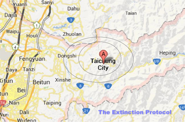
    The Earthquake/Seismic Activity Log Taiwan-june-2
    6.2 magnitude earthquake strikes region of Taiwan- 1 dead
    June 2, 2013 – TAIWAN – A strong earthquake jolted Taiwan on Sunday, killing one person and injuring at least 18 others and causing panicked shoppers to rush out of a shaking multi-story department store, officials said. Another earthquake jolted the southern Philippines late Saturday, injuring at least 33 people and damaging more than 140 houses. The tremor that hit Taiwan on Sunday afternoon was felt all over the island, but most severely in the central and southern regions. The magnitude-6.3 quake’s epicenter was near Jenai township in Nantou County in central Taiwan, about 250 kilometers (155 miles) south of Taipei, the Central Weather Bureau said. In Mountain Ali in the southern part of the island, a person was killed by a rockslide while driving a car on a mountain road, the Taiwan Fire Agency said in a statement. Rockslides at a scenic mountainous area near the epicenter injured several people, the agency said. In all, 18 people were injured by the earthquake, many by fallen objects. The Central Weather Bureau said the tremor had a relatively shallow depth of 10 kilometers (6 miles). The U.S. Geological Survey put the magnitude at 6.5. Shoppers screamed and ran out of a 12-story department store that shook violently for nearly a minute, TV stations reported from the central city of Taichung. Households elsewhere in central Taiwan reported cracks on the walls or ceilings falling, the reports said. Earthquakes frequently rattle Taiwan, but most are minor and cause little or no damage. Nantou is near the epicenter of a magnitude-7.6 earthquake that struck Taiwan in 1999 and killed more than 2,300 people. In the southern Philippines, a magnitude-5.7 earthquake rattled North Cotabato province and nearby areas late Saturday as people slept, damaging more than 140 houses and several school buildings and setting off a landslide that partially blocked a road with boulders, officials said. At least 33 people, including children, were injured by collapsed walls and falling debris in the hard-hit North Cotabato villages of Kimadzil and Kibugtongan, said Hermes Daquipa, a Philippine Institute of Volcanology and Seismology official who joined a government team that surveyed the hilly villages. The quake, which was set off by the movement of a nearby fault, damaged the approaches to two bridges and concrete pipes that cut off water supply to the two villages. Some of the damaged school buildings will not be able to be used for Monday’s resumption of classes after a summer break for safety reasons, North Cotabato Governor Emmylou Tolentino-Mendoza said. Many residents remained jittery Sunday because of continuing aftershocks, said Mendoza, who added that she scrambled out of her home like other villagers when the ground started to shake and objects fell from shelves. “It’s a big relief that no motorist was passing through our highway when boulders rolled down from the mountainside,” she said. The Philippine archipelago is located in the Pacific “Ring of Fire,” where earthquakes and volcanic activity are common. A magnitude-7.7 quake killed nearly 2,000 people on the northern island of Luzon in 1990. –ABC News


    _________________
    What is life?
    It is the flash of a firefly in the night, the breath of a buffalo in the wintertime. It is the little shadow which runs across the grass and loses itself in the sunset.

    With deepest respect ~ Aloha & Mahalo, Carol
    Carol
    Carol
    Admin
    Admin


    Posts : 31705
    Join date : 2010-04-07
    Location : Hawaii

    The Earthquake/Seismic Activity Log Empty Re: The Earthquake/Seismic Activity Log

    Post  Carol Mon Jun 03, 2013 10:28 am

    The Earthquake/Seismic Activity Log Damage-house
    Earthquakes rattle Philippines: one of many houses in Carmen, North Cotabato damaged by the 5.7 magnitude earthquake Saturday
    Philippines: earthquakes in Mindanao to last for months, volcanic anomalies reported underground
    June 3, 2013 – DAVAO CITY, Philippines — The earthquakes experienced today in Carmen town, North Cotabato and the rest of Mindanao will possibly last for weeks or months. This was according to Jenila de Ocampo, Officer-in-charge of the Davao Seismic Station of the Philippine Institute of Volcanology and Seismology (Phivolcs), in a phone interview. She added the intensity might either be “felt” or “unfelt” by humans. On Monday morning, two strong quakes struck Carmen. A 5.7 magnitude was felt at 4:08 AM with epicenter at seven Kilometers (Km) Northeast of the town. It has a depth of 10 Km. The town was placed under Intensity VI. “An Intensity VI in the PEIS (Phivolcs Earthquake Intensity Scale) means there will be a minimal damage to poorly built structures, or those with light materials and even concrete structures which do not meet building standards like the proper placement of steel bars,” De Ocampo explained. At 7:31 AM, another quake jolted Carmen town. A 4.0 magnitude was recorded with epicenter at 7 Km Northeast of the town. It has a depth of 3 Km. Intensity II was felt in Matalam town, North Cotabato. On Saturday evening, a 5.7 magnitude earthquake rocked the town which hurt 5 people, damaged 60 houses in Kimadsil village alone, and destroyed a bridge as well as agricultural facilities, school buildings and health centers. The said quake, according to De Ocampo, “is shallow and tectonic in origin.” Its depth was at 5 Km. “Strong earthquakes which are tectonic will cause aftershocks until the energy dissipates. In the case of Carmen which was hit by shallow quakes, the energy of the quake has little chance to dissipate when it reaches the surface,” she said. As of Sunday afternoon, 80 aftershocks have been recorded by Phivolcs. It was expected, De Ocampo said, but many were not felt even if it showed on their records. With the continuous tremors, affected residents wonder why no evacuation has been ordered. De Ocampo said the decision rests on the hands of the Regional Disaster Risk Reduction and Management Council and the local government unit. “We just help them (by giving our recommendations). Last Sunday, we have personnel from Phivolcs in Kidapawan City who assisted them,” De Ocampo said.

    Volcano awakening? Meanwhile, De Ocampo belied claims of some residents that a new volcano was discovered in Kibudtungan village in Carmen town. Ayna Sison, a resident in the area, said Phivolcs personnel allegedly told her grandfather of a “newly found” volcano located near the site where he lives. The volcano was said to be “inverted.” “My grandfather said he heard a whistling sound like gas exiting from a chamber. When the sound stopped, he said, the earthquakes happened,” recounted Sison. But De Ocampo said “(T)here is no such thing. But, the area though is still within the Mt. Apo complex,” she said. Phivolcs data noted there is no active fault line in the region. But Joel Peeters, a Belgian who has lived in Davao City and has been checking the earthquakes in the country using European-Mediterranean Seismological Centre and US Geological Survey data listing, expressed that the series of quakes could “indicate that an inactive (volcano) is activating again, or forming, or that underground something is brewing.” Albeit not an expert but just an observer on this matter, he said, he believes that it’s “not usual” for a number of earthquakes, especially strong ones, to happen in an area not far from a sleeping volcano, which is the Mt. Apo. “Maybe the Phivolcs could check if the sleeping giant is showing signs of waking up?,” he urged. Mt Apo hasn’t erupted in thousands of years. –Davao Today http://davaotoday.com/main/2013/06/03/earthquakes-in-mindanao-to-last-for-months-phivolcs/


    _________________
    What is life?
    It is the flash of a firefly in the night, the breath of a buffalo in the wintertime. It is the little shadow which runs across the grass and loses itself in the sunset.

    With deepest respect ~ Aloha & Mahalo, Carol
    Carol
    Carol
    Admin
    Admin


    Posts : 31705
    Join date : 2010-04-07
    Location : Hawaii

    The Earthquake/Seismic Activity Log Empty Re: The Earthquake/Seismic Activity Log

    Post  Carol Tue Jun 04, 2013 7:20 pm

    I had just sat on the toilet when the earth moved. Still laughing.

    The Earthquake/Seismic Activity Log 20130605_BRKGearthquake
    5.6 - 53km SE of Pahala, Hawaii
    June 5, 2013 – HAWAII – A moderate earthquake struck in the deep ocean off Hawaii Island this afternoon but did not generate a tsunami, officials said. The quake, with a magnitude of 5.3, struck at about 2:12 p.m. and was centered 34 miles southeast of Pahala and 31 miles south of Kalapana, at a depth of about 25 miles, according to the U.S. Geological Survey. The quake initially was listed as a magnitude 5.2, briefly upgraded to 5.6 before USGS scientists reassessed and downgraded it to a magnitude 5.3. No tsunami was generated but “some areas may have experienced strong shaking,” according to the Pacific Tsunami Warning Center in Ewa Beach. “It was a pretty significant jolt,” said Darryl Oliveira, director of the Hawaii County Civil Defense, who was on his way to the county building for a hearing when the earthquake occurred. The USGS received hundreds of responses from people who reported feeling the shaking, including several from as far as Honolulu, nearly 400 miles from the epicenter. The USGS intensity scale lists the quake as having “moderate” shaking and “very light” damage. There are no immediate reports of any structural damage, said Oliveira. While there is no tsunami threat to the islands, Oliveira said the agency still issued a mass notification via text messages, e-mail and radio broadcasts to inform residents on Hawaii island of what had occurred. “They come to expect us to inform them and that they are not at further risk,” he added. Rick Giese, owner of Hawaiian Island Floral, a wholesale business at Hawaiian Paradise Park, said he was sitting at his desk doing bookkeeping when he heard a deep rumbling sound. A second later, his two-story home started to shake. “I did jump up,” said Giese. He headed toward the door to exit his home when the earthquake stopped a few seconds later. He said the shaking wasn’t as severe as the magnitude 6.7 quake that struck the island in 2006. –Star Adviser


    Last edited by Carol on Thu Jun 06, 2013 11:30 am; edited 1 time in total


    _________________
    What is life?
    It is the flash of a firefly in the night, the breath of a buffalo in the wintertime. It is the little shadow which runs across the grass and loses itself in the sunset.

    With deepest respect ~ Aloha & Mahalo, Carol
    Carol
    Carol
    Admin
    Admin


    Posts : 31705
    Join date : 2010-04-07
    Location : Hawaii

    The Earthquake/Seismic Activity Log Empty Re: The Earthquake/Seismic Activity Log

    Post  Carol Thu Jun 06, 2013 11:28 am

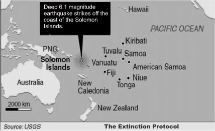
    The Earthquake/Seismic Activity Log Solomon-islands-june-5
    6.1 magnitude earthquake strikes near Solomon Islands
    June 5, 2013 – SOLOMON ISLANDS - A 6.1-magnitude earthquake has struck off the Solomon Islands, the US Geological Survey says, but no immediate tsunami warning has been issued. The tremor, at a depth of 64 kilometers, hit in the Santa Cruz Islands, some 89 kilometers south of the remote town of Lata, where a tsunami left at least 10 people dead in February. Geoscience Australia gave a higher preliminary measurement of 6.6-magnitude, but said it was unlikely to have caused a local tsunami in the quake-prone region. “That magnitude may change over time as we get more data,” duty seismologist Spiro Spiliopoulos told AFP, adding that they measured the depth at about 60 kilometers. “Because of its depth and its somewhat smaller size (to the February quake), I would say it’s unlikely to create a tsunami,” he said. The February tsunami, sparked by an 8.0-magnitude quake, killed at least 10 people, destroyed hundreds of homes and left thousands homeless. The Solomons are part of the “Ring of Fire,” a zone of tectonic activity around the Pacific that is subject to frequent earthquakes and volcanic eruptions. In 2007, a tsunami following an 8.0-magnitude earthquake killed at least 52 people in the Solomons and left thousands homeless. -TVNZ


    _________________
    What is life?
    It is the flash of a firefly in the night, the breath of a buffalo in the wintertime. It is the little shadow which runs across the grass and loses itself in the sunset.

    With deepest respect ~ Aloha & Mahalo, Carol
    Carol
    Carol
    Admin
    Admin


    Posts : 31705
    Join date : 2010-04-07
    Location : Hawaii

    The Earthquake/Seismic Activity Log Empty Re: The Earthquake/Seismic Activity Log

    Post  Carol Thu Jun 13, 2013 11:36 pm

    The Earthquake/Seismic Activity Log Xmas_islands
    Very strong M 6.7 earthquake struck near Christmass Islands
    Strong earthquake registered as M 6.7 (USGS/EMSC) struck near Christmass Islands, south of Java, Indonesia on June 13, 2013 at 16:47 UTC. The epicenter was located 170km (106miles) ENE of Flying Fish Cove, Christmas Islands and 313km (194miles) SSW of Kawalu and Singaparna, Indonesia at coordinates 10.030°S 107.182°E. The epicenter was at depth around 10 km.


    Last edited by Carol on Sun Jun 16, 2013 11:06 am; edited 1 time in total


    _________________
    What is life?
    It is the flash of a firefly in the night, the breath of a buffalo in the wintertime. It is the little shadow which runs across the grass and loses itself in the sunset.

    With deepest respect ~ Aloha & Mahalo, Carol
    Carol
    Carol
    Admin
    Admin


    Posts : 31705
    Join date : 2010-04-07
    Location : Hawaii

    The Earthquake/Seismic Activity Log Empty Re: The Earthquake/Seismic Activity Log

    Post  Carol Sat Jun 15, 2013 6:14 pm

    [th]DATE[/th][th]LAT  [/th][th]LON  [/th][th]MAG  [/th][th]DEPTHkm[/th][th]  REGION[/th]
    15-JUN-2013 20:37:330.66-28.164.620CENTRAL MID-ATLANTIC RIDGE
    15-JUN-2013 18:50:1011.80-87.024.546NEAR COAST OF NICARAGUA
    15-JUN-2013 18:24:5034.3224.994.511CRETE
    15-JUN-2013 18:10:4411.81-86.965.0NEAR COAST OF NICARAGUA
    15-JUN-2013 17:59:0411.84-86.934.938NEAR COAST OF NICARAGUA
    15-JUN-2013 17:34:2911.72-86.986.5NEAR COAST OF NICARAGUA
    15-JUN-2013 17:22:0234.3524.984.93CRETE
    15-JUN-2013 17:02:0534.4124.964.930CRETE
    15-JUN-2013 16:59:3434.2225.054.828CRETE
    15-JUN-2013 16:51:1434.3525.004.624CRETE
    15-JUN-2013 16:28:5634.3425.064.922CRETE
    15-JUN-2013 16:11:0034.4525.046.2CRETE
    15-JUN-2013 14:00:0513.91-92.264.652OFF COAST OF CHIAPAS, MEXICO
    15-JUN-2013 13:58:4813.79-92.144.352OFF COAST OF CHIAPAS, MEXICO
    15-JUN-2013 13:08:4512.98-88.634.486OFF COAST OF CENTRAL AMERICA
    15-JUN-2013 11:48:17-20.27-177.864.5482FIJI ISLANDS REGION
    15-JUN-2013 11:20:34-33.90179.466.0SOUTH OF KERMADEC ISLANDS
    15-JUN-2013 04:21:4915.15-91.754.6140MEXICO-GUATEMALA BORDER REGION
    15-JUN-2013 01:08:114.10-82.654.410SOUTH OF PANAMA


    _________________
    What is life?
    It is the flash of a firefly in the night, the breath of a buffalo in the wintertime. It is the little shadow which runs across the grass and loses itself in the sunset.

    With deepest respect ~ Aloha & Mahalo, Carol
    Carol
    Carol
    Admin
    Admin


    Posts : 31705
    Join date : 2010-04-07
    Location : Hawaii

    The Earthquake/Seismic Activity Log Empty Re: The Earthquake/Seismic Activity Log
    Post  Carol Sun Jun 16, 2013 11:00 am

    The Earthquake/Seismic Activity Log Greece-june-15

    June 16, 2013 – ATHENS — A moderate 6.2-magnitude earthquake rumbled off the southern coast of the Greek island of Crete Saturday, according to the US Geological Survey, but there was no immediate warning of a tsunami. The earthquake struck at 6:11 p.m. (1611 GMT) around 60 kilometers (37 miles) south of the town of Pirgos at a depth of 10 kilometers, the USGS said, adding that there were no immediate reports of casualties or damage. According to the Athens Observatory, it was a “very strong” quake which it put at a magnitude of 5.9 and said its epicenter was located 483 kilometers southeast of Athens in the Mediterranean. The quake was especially felt in the city of Ierapetra on Crete, it added. About 10 days ago, a quake was also registered off of Crete, which did not cause any casualties or damage. Greece is the European country that is most frequently hit by earthquakes. A 6.0 magnitude earthquake also struck south of Kermadec Islands, making this the third 6.0+ magnitude earthquake to strike the planet in 24 hours. –Inquirer


    _________________
    What is life?
    It is the flash of a firefly in the night, the breath of a buffalo in the wintertime. It is the little shadow which runs across the grass and loses itself in the sunset.

    With deepest respect ~ Aloha & Mahalo, Carol
    Carol
    Carol
    Admin
    Admin


    Posts : 31705
    Join date : 2010-04-07
    Location : Hawaii

    The Earthquake/Seismic Activity Log Empty Re: The Earthquake/Seismic Activity Log

    Post  Carol Sun Jun 16, 2013 11:05 am

    The Earthquake/Seismic Activity Log 2009-September-Java-quake-shake-map-USGS


    June 13, 2013 – INDONESIA An earthquake measuring 6.7 on the Richter scale has struck off Indonesia’s most densely-populated island of Java, but there have been no immediate reports of casualties or damage. According to the US Geological Survey, the quake took place at 11:47 pm (1647 GMT) on Thursday and was centered some 170 kilometers (106 miles) east of Flying Fish Cove, on Australia’s Christmas Island. The US Geological Survey also said that the quake was 11 kilometers (7 miles) deep. The tremor has reportedly forced panicked residents and hotel guests to flee into the streets in Kawalu, West Java province. Following the tremor, the Indonesian Meteorology, Climatology and Geophysics Agency issued a statement saying that “There are no immediate reports of damage or casualties, but we know the quake was felt in several parts of Java…There is no potential for a tsunami.” On April 20, a 6.4 -magnitude earthquake jolted Indonesia’s Maluku, but caused no casualties or material damage. On April 6, an earthquake measuring 7.2 on the Richter scale struck eastern Indonesia’s mountainous West Papua province. Indonesia is vulnerable to earthquakes since it is located on the Pacific Ring of Fire, a region known for its seismic and volcanic activity caused by friction between shifting tectonic plates. Last year, a 6.4-magnitude quake rocked the west coast of Sumatra Island, killing at least one person. An 8.7-magnitude earthquake also hit off the city of Banda Aceh in Sumatra Island in May 2012, triggering regional tsunami alerts. A strong quake off the shores of Indonesia triggered a tsunami that killed 230,000 people in 13 countries around the Indian Ocean in 2004. Most of the deaths were in the northern Indonesian province of Aceh. –Press TV


    _________________
    What is life?
    It is the flash of a firefly in the night, the breath of a buffalo in the wintertime. It is the little shadow which runs across the grass and loses itself in the sunset.

    With deepest respect ~ Aloha & Mahalo, Carol
    Carol
    Carol
    Admin
    Admin


    Posts : 31705
    Join date : 2010-04-07
    Location : Hawaii

    The Earthquake/Seismic Activity Log Empty Re: The Earthquake/Seismic Activity Log

    Post  Carol Tue Jun 18, 2013 11:52 am

    The Earthquake/Seismic Activity Log Mexico-june-16


    June 18, 2013 – MEXICO – A powerful two-punch earthquake shook western Mexico early Sunday, knocking out electricity and cellular phone service in parts of this sprawling capital. There were no immediate reports of serious damage or fatalities. Initial readings put the quake at a magnitude of 5.8 at around 12:30 a.m., with the epicenter about 90 miles south of Mexico City in the northern part of Guerrero state, where Acapulco is located. It was felt with marked strength in Mexico City, swaying major apartment buildings, hotels and skyscrapers. Residents scooted from their homes, some in pajamas, or filed out of late-night bars and restaurants. Many remained in the streets long after the quake ended, bracing for aftershocks. The shaking began gently, paused, then gave a good rattling to buildings in much of the capital. Mexico City Mayor Miguel Angel Mancera, whose inspectors immediately took to flight in helicopters and fanned out through city streets, said there were no reports of serious damage but that several neighborhoods were without electricity. Interior Minister Miguel Angel Osorio Chong also said there were no reports of damage at the national level. Mexico is accustomed to such quakes, and a fairly strict system of checks and controls whips into place at the first sign of serious shaking. In 1985, parts of the Mexican capital were destroyed and at least 10,000 people were killed in a devastating quake. –LA Times


    _________________
    What is life?
    It is the flash of a firefly in the night, the breath of a buffalo in the wintertime. It is the little shadow which runs across the grass and loses itself in the sunset.

    With deepest respect ~ Aloha & Mahalo, Carol
    Carol
    Carol
    Admin
    Admin


    Posts : 31705
    Join date : 2010-04-07
    Location : Hawaii

    The Earthquake/Seismic Activity Log Empty Re: The Earthquake/Seismic Activity Log

    Post  Carol Fri Jun 21, 2013 1:34 am

    The Earthquake/Seismic Activity Log F1.large
    Eerie silence from quake zone close to Istanbul: study
    June 19, 2013 – TURKEY – German and Turkish scientists on Tuesday said they had pinpointed an extremely dangerous seismic zone less than 20 kilometers (12 miles) from the historic heart of Istanbul. Running under the Sea of Marmara just south of the city of some 15 million people, this segment of the notorious North Anatolian fault has been worryingly quiet in recent years, which may point to a buildup in tension, they wrote. “The block we identified reaches 10 kilometers (about six miles) deep along the fault zone and has displayed no seismic activity since measurements began over four years ago,” said Marco Bohnhoff, a professor at the German Research Centre for Geosciences (GFZ) in Potsdam, near Berlin. “This could be an indication that the expected Marmara earthquake could originate there.” The North Anatolian fault, created by the collision of the Anatolia Plate with the Eurasia Plate, runs 1,500 kilometers (950 miles) along northern Turkey. At the western tip of the fault, an earthquake took place in 1912 at Ganos near the Aegean Sea. On its eastern side, a domino series of earthquakes in 1939, 1942, 1951, 1967 and 1999 displaced the stress progressively westwards, bringing it ever closer to Istanbul. What is left now is a so-called earthquake gap under the Sea of Marmara, lying between the two fault stretches whose stress has been eased by the quakes. The “gap” itself, however, has not been relieved by an earthquake since 1766. Seeking a more precise view of the gap, the GFZ and Istanbul’s Kandilli Earthquake Observatory set up a network of seismic monitors in the eastern part of the sea. They calculate that the Anatolian fault normally has a westward motion of between 25 and 30 millimeters (one to 1.2 inches) per year.
    But this natural slippage is being blocked by a small section, about 30 km (19 miles) long, located under a chain of nine small islands known as the Princes Islands — a popular destination for day-trippers from Istanbul. “The seismic silence along the Princes Islands segment stands in contrast to the background activity in the broader Izmit-Marmara region,” warns the study published in the journal Nature Communications. The paper says that, conceivably, stress under the Princes Islands is being relieved “aseismically,” in other words, the pressure is being eased so gradually as to be undetectable. But this scenario is unlikely, it says. “Our evidence indicates that this patch is locked and is therefore a potential nucleation point for another Marmara segment earthquake — a potential that has significant natural hazards implications” for Istanbul, it warns. The study does not make any prediction about the size of any future quake or when it could occur. But it notes an estimate published in 2004 that found a 35-to-70 percent probability that the “gap” will be struck by an earthquake greater than magnitude seven by 2034. Other scientists have also pointed to the possibility of several smaller “en echelon” type quakes, which may generate less ground motion but are likelier to cause tsunamis because they displace the sea floor. The last big quakes on the North Anatolian fault in 1999 — a 7.1-magnitude quake in Duzce and 7.4-magnitude quake in Izmit — left some 20,000 people dead. –Space Daily 
    http://www.spacedaily.com/reports/Eerie_silence_from_quake_zone_close_to_Istanbul_study_999.html


    _________________
    What is life?
    It is the flash of a firefly in the night, the breath of a buffalo in the wintertime. It is the little shadow which runs across the grass and loses itself in the sunset.

    With deepest respect ~ Aloha & Mahalo, Carol
    Carol
    Carol
    Admin
    Admin


    Posts : 31705
    Join date : 2010-04-07
    Location : Hawaii

    The Earthquake/Seismic Activity Log Empty Re: The Earthquake/Seismic Activity Log

    Post  Carol Fri Jun 21, 2013 1:36 am

    The Earthquake/Seismic Activity Log Chile-quake


    Magnitude-5.7 Quake Shakes Central Chile

    June 20, 2013 – CHILE – A magnitude-5.7 earthquake shook central Chile on Wednesday, causing buildings to sway in the capital but apparently causing no major damage. The U.S. Geological Survey said the quake struck at 17:29 p.m. local time and its epicenter was about 60 kilometers (37 miles) east-north-east of Los Andes, Chile. Officials discarded the possibility of a tsunami and said there were no immediate reports of deaths or damages. Chile is one of the world’s most earthquake-prone countries. A magnitude-8.8 quake and the tsunami it unleashed in 2010 killed more than 500 people and destroyed 220,000 homes. –ABC  http://abcnews.go.com/International/wireStory/moderate-quake-strikes-central-chile-19440671#.UcL6XToo7IU


    _________________
    What is life?
    It is the flash of a firefly in the night, the breath of a buffalo in the wintertime. It is the little shadow which runs across the grass and loses itself in the sunset.

    With deepest respect ~ Aloha & Mahalo, Carol
    Carol
    Carol
    Admin
    Admin


    Posts : 31705
    Join date : 2010-04-07
    Location : Hawaii

    The Earthquake/Seismic Activity Log Empty Re: The Earthquake/Seismic Activity Log

    Post  Carol Mon Jun 24, 2013 9:42 pm

    [th]DATE and TIME (UTC)[/th][th]LAT  [/th][th]LON  [/th][th]MAG  [/th][th]DEPTHkm[/th][th]  REGION[/th]
    24-JUN-2013 23:12:29
    41.62
    141.83
    4.7
    80
    HOKKAIDO, JAPAN REGION
    24-JUN-2013 22:04:13
    10.73
    -42.62
    6.410NORTHERN MID-ATLANTIC RIDGE
    24-JUN-2013 15:53:36
    2.70
    92.71
    4.2
    30
    OFF W COAST OF NORTHERN SUMATERA
    24-JUN-2013 09:55:45
    -6.52
    148.66
    5.336NEW BRITAIN REGION, P.N.G.
    24-JUN-2013 08:32:20
    -6.46
    148.58
    4.7
    10
    NEW BRITAIN REGION, P.N.G.
    24-JUN-2013 08:12:42
    -6.57
    148.66
    4.7
    10
    NEW BRITAIN REGION, P.N.G.
    24-JUN-2013 08:05:27
    37.43
    69.19
    4.5
    35
    AFGHANISTAN-TAJIKISTAN BORD REG.
    24-JUN-2013 08:01:40
    -6.52
    148.65
    5.510NEW BRITAIN REGION, P.N.G.
    24-JUN-2013 06:34:51
    44.35
    84.29
    4.4
    21
    NORTHERN XINJIANG, CHINA
    24-JUN-2013 05:02:03
    44.33
    84.38
    4.7
    17
    NORTHERN XINJIANG, CHINA
    24-JUN-2013 04:52:21
    -19.51
    -71.22
    4.5
    27
    OFF COAST OF NORTHERN CHILE
    24-JUN-2013 04:15:11
    35.89
    70.89
    4.6
    100
    HINDU KUSH REGION, AFGHANISTAN
    24-JUN-2013 04:13:37
    52.23
    151.40
    4.3
    633
    SEA OF OKHOTSK
    23-JUN-2013 22:43:17
    31.66
    -40.85
    5.014NORTHERN MID-ATLANTIC RIDGE
    23-JUN-2013 21:16:35
    48.05
    33.37
    4.5
    14
    UKRAINE-MOLDOVA-SW RUSSIA REGION
    23-JUN-2013 20:00:36
    10.10
    -85.53
    5.218COSTA RICA
    23-JUN-2013 16:49:19
    16.22
    121.00
    4.4
    10
    LUZON, PHILIPPINE ISLANDS
    23-JUN-2013 15:19:25
    -5.00
    151.30
    5.0138NEW BRITAIN REGION, P.N.G.
    23-JUN-2013 15:01:35
    44.25
    10.23
    4.7
    6
    NORTHERN ITALY
    23-JUN-2013 13:31:18
    -6.36
    147.67
    4.7
    55
    EASTERN NEW GUINEA REG., P.N.G.
    23-JUN-2013 13:13:43
    44.22
    10.23
    4.0
    8
    NORTHERN ITALY
    23-JUN-2013 10:20:26
    39.54
    143.11
    4.5
    29
    OFF EAST COAST OF HONSHU, JAPAN
    23-JUN-2013 07:20:27
    13.77
    146.32
    4.8
    35
    SOUTH OF MARIANA ISLANDS
    23-JUN-2013 02:26:45
    47.73
    154.03
    4.4
    45
    KURIL ISLANDS
    23-JUN-2013 01:46:37
    21.99
    -107.83
    4.8
    10
    OFF COAST OF CENTRAL MEXICO


    _________________
    What is life?
    It is the flash of a firefly in the night, the breath of a buffalo in the wintertime. It is the little shadow which runs across the grass and loses itself in the sunset.

    With deepest respect ~ Aloha & Mahalo, Carol
    Carol
    Carol
    Admin
    Admin


    Posts : 31705
    Join date : 2010-04-07
    Location : Hawaii

    The Earthquake/Seismic Activity Log Empty Re: The Earthquake/Seismic Activity Log

    Post  Carol Mon Jun 24, 2013 9:48 pm

    Update  22:23 UTC : NOAA has published a ‘to be expected’ tsunami bulletin :
    A DESTRUCTIVE WIDESPREAD TSUNAMI THREAT DOES NOT EXIST BASED ON  HISTORICAL EARTHQUAKE AND TSUNAMI DATA.
    HOWEVER – THERE IS THE SMALL POSSIBILITY OF A LOCAL OR REGIONAL  TSUNAMI THAT COULD AFFECT COASTS LOCATED USUALLY NO MORE THAN A  FEW HUNDRED KILOMETERS FROM THE EARTHQUAKE EPICENTER. AUTHORITIES
    IN THE REGION NEAR THE EPICENTER SHOULD BE MADE AWARE OF THIS  POSSIBILITY. (ER : this is standard phrasing but does not apply in this case because the nearest populated shores are more than 1000 km from the epicenter)

    A harmless but very strong earthquake at 1200 km from the nearest populated islands / mainland.
    The Earthquake/Seismic Activity Log Screen-Shot-2013-06-25-at-00.15.18
    1242km (772mi) ENE of Remire-Montjoly, French Guiana
    1248km (775mi) ENE of Cayenne, French Guiana
    1252km (778mi) ENE of Matoury, French Guiana
    1265km (786mi) ENE of Kourou, French Guiana
    1359km (844mi) NNE of Salinopolis, Brazil

    Most important Earthquake Data:
    Magnitude : 6.5
    Local Time (conversion only below land) : Unknown
    GMT/UTC Time : 2013-06-24 22:04:13
    Depth (Hypocenter)  : 10 km


    _________________
    What is life?
    It is the flash of a firefly in the night, the breath of a buffalo in the wintertime. It is the little shadow which runs across the grass and loses itself in the sunset.

    With deepest respect ~ Aloha & Mahalo, Carol
    Carol
    Carol
    Admin
    Admin


    Posts : 31705
    Join date : 2010-04-07
    Location : Hawaii

    The Earthquake/Seismic Activity Log Empty Re: The Earthquake/Seismic Activity Log

    Post  Carol Mon Jun 24, 2013 9:52 pm

    Recent News & How It Is A Confirmation Of An AFC Prediction/Conclusion

    Rare Cape Cod Tsunami HAPPENED 6/13/13; Created By Electromagnetic Weather: As Predicted In Mid-May, Correct Prediction Can Aid In The Future 

    [link to thesandpaper.villagesoup.com] and
    [link to www.sciencedaily.com] and 

    [link to www.capecodonline.com] and
    [link to www.sciencedaily.com

    AFC’s Bold Forecast Came True, Just 1 Week Late ...

    A meteotsunami propagates in the water in the same way and have the same coastal dynamics as a regular tsunami. For an observer on the coast where it strikes the two types would look the same. This one, which caused some to be hospitalized from eight-foot waves, was from an atmospherically-generated large amplitude seiche oscillation (which is pegged back to the dynamics of solar-generated electromagnetics ‘communicating’ inside a storm system).


    Seiches have been observed in seas such as the Adriatic Sea and the Baltic Sea, resulting in flooding of Venice and St. Petersburg respectively.

    Portugal subduction (last link above): increasing Atlantic tectonic activity. More and more news articles are coming out that show the increasing instability of the North Atlantic. When solar magnetics pulse very strongly in the future there could be another tsunami ‘threat window’ that may open again

    From Dr. Simon


    With advanced modeling and atmospheric electromagnetic predictions, by including solar parameters, AFC can provide future warnings of ‘open’ windows of risk for many different types of planetary threats globally.
    Plus ...

    The June 13th, 2013 event in the Northeast wasn't just a "small wave" ... it has been CONFIRMED FOR THE NJ SHORE TOO ... A TSUNAMI OCCURRED.

    [link to www.nbcphiladelphia.com

    The bottom line is that we clearly hit the bullseye with the infamous Tsunami Watch! :-)

    Our prediction was a success. Many have prepared, many now believe in the advanced prediction using electromagnetics. 

    This is a "win" for everyone 'aware'. This NEEDS EVERYONE'S ATTENTION ALONG THE EAST COAST.


    _________________
    What is life?
    It is the flash of a firefly in the night, the breath of a buffalo in the wintertime. It is the little shadow which runs across the grass and loses itself in the sunset.

    With deepest respect ~ Aloha & Mahalo, Carol

      Current date/time is Sun Apr 28, 2024 5:05 am