tMoA

Would you like to react to this message? Create an account in a few clicks or log in to continue.
tMoA

~ The only Home on the Web You'll ever need ~

+21
Aquaries1111
giovonni
arvan33
Floyd
lawlessline
JesterTerrestrial
THEeXchanger
newel
Brook
greybeard
Mercuriel
Sanicle
devakas
hobbit
mudra
burgundia
lindabaker
LeeEllisMusic
MargueriteBee
Carol
HigherLove
25 posters

    The Earthquake/Seismic Activity Log

    Carol
    Carol
    Admin
    Admin


    Posts : 32911
    Join date : 2010-04-07
    Location : Hawaii

    The Earthquake/Seismic Activity Log - Page 34 Empty Re: The Earthquake/Seismic Activity Log

    Post  Carol Tue Jul 24, 2012 10:46 pm

    DATE LAT LON MAG DEPTH km REGION
    25-JUL-2012 00:27:48 2.65 96.19 6.6 45.9 NORTHERN SUMATERA, INDONESIA
    24-JUL-2012 06:56:36 31.78 50.90 4.7 10.3 NORTHERN IRAN
    24-JUL-2012 06:50:06 31.74 50.93 5.3 10.0 NORTHERN IRAN
    24-JUL-2012 05:25:29 16.53 -98.09 4.8 13.1 NEAR COAST OF GUERRERO, MEXICO
    24-JUL-2012 03:02:59 7.66 126.69 4.0 78.8 MINDANAO, PHILIPPINE ISLANDS
    23-JUL-2012 22:58:34 -58.08 -24.10 4.8 35.0 SOUTH SANDWICH ISLANDS REGION
    23-JUL-2012 19:47:09 -30.58 -177.47 5.4 3.7 KERMADEC ISLANDS, NEW ZEALAND
    23-JUL-2012 12:11:06 52.05 -173.88 4.3 65.4 ANDREANOF ISLANDS, ALEUTIAN IS.
    23-JUL-2012 12:10:30 36.08 69.17 4.3 12.7 HINDU KUSH REGION, AFGHANISTAN
    23-JUL-2012 10:44:47 47.25 153.41 4.4 58.6 KURIL ISLANDS
    23-JUL-2012 07:09:35 52.11 -179.79 4.8 157.7 ANDREANOF ISLANDS, ALEUTIAN IS.
    23-JUL-2012 06:54:38 52.25 173.37 5.0 44.8 NEAR ISLANDS, ALEUTIAN ISLANDS
    23-JUL-2012 06:40:40 -16.10 -173.58 4.6 35.0 TONGA ISLANDS
    23-JUL-2012 04:38:45 79.58 3.26 4.7 21.0 GREENLAND SEA
    23-JUL-2012 00:50:00 52.09 -170.41 4.1 28.0 FOX ISLANDS, ALEUTIAN ISLANDS
    23-JUL-2012 00:22:05 -2.52 135.35 5.2 10.0 IRIAN JAYA REGION, INDONESIA
    22-JUL-2012 20:29:41 36.05 87.31 4.5 25.0 SOUTHERN XINJIANG, CHINA
    22-JUL-2012 19:40:46 11.46 -87.16 4.6 53.3 NEAR COAST OF NICARAGUA
    22-JUL-2012 18:15:12 -30.39 -177.43 4.9 29.1 KERMADEC ISLANDS, NEW ZEALAND
    22-JUL-2012 18:02:12 11.70 -87.16 5.0 48.9 NEAR COAST OF NICARAGUA
    22-JUL-2012 16:56:02 -21.80 -175.06 5.3 9.7 TONGA ISLANDS
    22-JUL-2012 16:44:21 29.97 88.03 4.9 35.6 XIZANG
    22-JUL-2012 15:59:33 32.33 49.55 4.1 35.0 WESTERN IRAN
    22-JUL-2012 13:36:58 -14.85 167.36 4.8 132.1 VANUATU ISLANDS
    22-JUL-2012 11:20:02 12.93 50.07 4.8 10.0 EASTERN GULF OF ADEN
    22-JUL-2012 10:36:40 14.50 -89.10 4.4 42.5 GUATEMALA
    22-JUL-2012 10:16:27 32.60 49.94 4.2 14.1 WESTERN IRAN
    22-JUL-2012 09:39:12 2.63 95.84 4.9 15.4 OFF W COAST OF NORTHERN SUMATERA
    22-JUL-2012 09:26:02 37.55 36.38 5.0 7.6 TURKEY
    22-JUL-2012 08:20:28 38.29 142.63 4.2 35.0 NEAR EAST COAST OF HONSHU, JAPAN
    22-JUL-2012 07:02:13 -4.91 149.44 4.2 16.4 BISMARCK SEA
    22-JUL-2012 07:00:04 42.33 141.90 4.3 95.7 HOKKAIDO, JAPAN REGION
    22-JUL-2012 06:32:50 -10.67 164.80 4.2 37.0 SANTA CRUZ ISLANDS REGION
    22-JUL-2012 05:39:14 -4.26 153.44 4.3 46.2 NEW IRELAND REGION, P.N.G.
    22-JUL-2012 04:41:57 42.55 142.84 5.1 57.4 HOKKAIDO, JAPAN REGION
    22-JUL-2012 02:11:11 25.01 96.42 5.1 15.4 MYANMAR
    21-JUL-2012 23:31:37 -21.19 -179.00 4.7 604.3 FIJI ISLANDS REGION
    21-JUL-2012 22:27:16 46.20 149.36 4.3 125.1 KURIL ISLANDS
    21-JUL-2012 20:47:46 -15.36 -173.35 4.9 10.0 TONGA ISLANDS
    21-JUL-2012 16:01:04 -8.09 123.72 4.6 33.4 FLORES REGION, INDONESIA
    21-JUL-2012 12:46:30 -5.39 129.26 5.3 239.9 BANDA SEA
    21-JUL-2012 11:38:58 14.16 -93.60 4.2 35.0 NEAR COAST OF CHIAPAS, MEXICO
    21-JUL-2012 07:32:43 45.12 145.99 4.0 211.7 HOKKAIDO, JAPAN REGION
    21-JUL-2012 07:19:58 49.27 156.10 4.7 10.0 KURIL ISLANDS
    21-JUL-2012 06:37:20 15.39 147.54 4.8 35.0 MARIANA ISLANDS REGION
    21-JUL-2012 06:11:57 -19.18 173.78 5.5 8.9 VANUATU ISLANDS REGION
    21-JUL-2012 06:04:21 40.41 -125.33 4.9 6.1 OFF COAST OF NORTHERN CALIFORNIA
    21-JUL-2012 06:00:33 14.34 -93.48 4.5 10.0 NEAR COAST OF CHIAPAS, MEXICO
    21-JUL-2012 04:54:07 -37.83 179.68 5.8 18.3 OFF E. COAST OF N. ISLAND, N.Z.
    21-JUL-2012 03:01:20 37.79 141.82 4.9 46.1 NEAR EAST COAST OF HONSHU, JAPAN
    21-JUL-2012 02:58:44 29.07 142.45 4.8 35.0 SOUTH OF HONSHU, JAPAN
    21-JUL-2012 01:51:59 40.42 -125.49 5.1 2.5 OFF COAST OF NORTHERN CALIFORNIA
    21-JUL-2012 01:05:18 43.35 82.86 4.5 10.0 NORTHERN XINJIANG, CHINA
    21-JUL-2012 00:34:25 44.15 -128.48 4.0 10.0 OFF COAST OF OREGON
    20-JUL-2012 20:24:19 3.38 125.84 5.1 90.6 TALAUD ISLANDS, INDONESIA
    20-JUL-2012 18:54:11 56.49 -153.43 5.2 23.3 KODIAK ISLAND REGION
    20-JUL-2012 18:52:16 1.99 93.63 4.7 32.2 OFF W COAST OF NORTHERN SUMATERA
    20-JUL-2012 18:14:53 -8.05 123.67 5.3 33.5 FLORES REGION, INDONESIA
    20-JUL-2012 17:44:57 -8.07 123.63 5.0 20.0 FLORES REGION, INDONESIA
    20-JUL-2012 14:03:12 -21.13 -179.15 5.6 612.6 FIJI ISLANDS REGION
    20-JUL-2012 13:51:11 42.50 44.10 4.3 4.9 NORTHWESTERN CAUCASUS
    20-JUL-2012 12:11:52 32.97 119.60 4.9 10.0 SOUTHEASTERN CHINA
    20-JUL-2012 11:35:52 -24.28 -66.97 4.1 159.7 SALTA PROVINCE, ARGENTINA
    20-JUL-2012 09:12:58 49.27 156.45 4.6 42.9 KURIL ISLANDS
    20-JUL-2012 09:11:31 -38.28 146.16 4.6 13.0 NEAR S.E. COAST OF AUSTRALIA
    20-JUL-2012 06:52:47 8.14 -38.12 4.8 10.0 CENTRAL MID-ATLANTIC RIDGE
    20-JUL-2012 06:50:18 24.64 141.58 4.9 122.9 VOLCANO ISLANDS REGION
    20-JUL-2012 06:32:56 49.36 156.14 5.5 10.0 KURIL ISLANDS
    20-JUL-2012 06:27:39 49.12 156.10 4.8 10.0 KURIL ISLANDS
    20-JUL-2012 06:10:25 49.41 155.91 5.9 19.0 KURIL ISLANDS
    20-JUL-2012 03:40:15 49.55 155.61 5.2 39.1 KURIL ISLANDS
    20-JUL-2012 01:26:06 -5.38 146.77 4.4 168.0 EASTERN NEW GUINEA REG., P.N.G.
    20-JUL-2012 01:20:01 49.31 156.03 4.8 44.1 KURIL ISLANDS
    20-JUL-2012 00:16:54 35.51 58.24 4.4 10.0 NORTHERN IRAN


    _________________
    What is life?
    It is the flash of a firefly in the night, the breath of a buffalo in the wintertime. It is the little shadow which runs across the grass and loses itself in the sunset.

    With deepest respect ~ Aloha & Mahalo, Carol
    Carol
    Carol
    Admin
    Admin


    Posts : 32911
    Join date : 2010-04-07
    Location : Hawaii

    The Earthquake/Seismic Activity Log - Page 34 Empty Re: The Earthquake/Seismic Activity Log

    Post  Carol Sat Aug 04, 2012 12:42 pm

    High chance of major Oregon quake: study out August 1, 2012
    http://ca.news.yahoo.com/high-chance-major-oregon-quake-study-221238959.html
    August 2, 2012 – OREGON – The western US state of Oregon has a 40 percent chance in the next half-century of suffering a massive earthquake on the scale of Japan’s 2011 disaster, a study said Wednesday. The Pacific Northwest — from the Oregon-California border to Vancouver Island in Canada — has endured 19 huge earthquakes of around 8.7-9.2 magnitude over the past 10,000 years, Oregon State University researchers said. An additional 22 major earthquakes have impacted only the southern part of the so-called Cascadia fault that runs from the Oregon areas of Coos Bay to Newport, the study said. “The southern margin of Cascadia has a much higher recurrence level for major earthquakes than the northern end and, frankly, it is overdue for a rupture,” the study’s lead author Chris Goldfinger said in a statement. The study, published online by the US Geological Survey, estimated a 40 percent chance of a major earthquake around Coos Bay, Oregon, over the next 50 years. It said that the earthquake could be on the scale of the 9.0-magnitude earthquake that struck in the Pacific Ocean near Japan on March 11, 2011. Some 19,000 people died as the tremor set off a devastating tsunami. But Oregon has far fewer preparations in place than Japan, which is one of the world’s most earthquake-prone nations. The Oregon State University study billed itself as the most comprehensive yet, which is based on 13 years of research including assessments of sediment to determine past seismic events. Oregon already had an oral history of earthquakes, with Native Americans speaking of a giant tremor in around 1700. Earthquake preparedness has triggered a major political debate in Oregon, with advocates warning that many schools and other buildings would be woefully inadequate in the event of a giant disaster. Critics say that the massive cost of upgrading Oregon’s infrastructure could be devoted to more pressing priorities for residents such as building roads. -YN

    Earth Science Information Officer Video
    http://blip.tv/multco-presents/quake-up-call-4582212


    _________________
    What is life?
    It is the flash of a firefly in the night, the breath of a buffalo in the wintertime. It is the little shadow which runs across the grass and loses itself in the sunset.

    With deepest respect ~ Aloha & Mahalo, Carol
    Carol
    Carol
    Admin
    Admin


    Posts : 32911
    Join date : 2010-04-07
    Location : Hawaii

    The Earthquake/Seismic Activity Log - Page 34 Empty Re: The Earthquake/Seismic Activity Log

    Post  Carol Sat Aug 04, 2012 2:33 pm

    The Earthquake/Seismic Activity Log - Page 34 Images?q=tbn:ANd9GcSABxH6mxfAGdD56KOjgZbvYZhvKi5u4wCT-cpZ7KvfkBre-Y3x
    4.2 magnitude earthquake strikes Kuwait, seismologist warns region could be hit by magnitude 8
    August 4, 2012 – KUWAIT CITY - An earthquake of 4.2 magnitude on the Richter scale that struck Kuwait 40 km NW of Salmiya at around 7.30 am Thursday was felt by residents in Salmiya. Though no casualties were reported, some residents complained the quake mildly upset some of their household arrangements. There were a few broken cutlery. Some residents living near the Salmiya garden said they felt the tremor in two short spells in a span of a few seconds. Most of the residents were asleep and came to know about it from neighbors who experienced the tremor. Melissa, a resident, said she first noticed tea rippling in the cup in her hand before she realized that the whole house was shaking a bit. “It was a little scary.” Mujib said it was his first experience of a tremor and initially thought that he was feeling woozy. “It occurred as I was getting up after bending down to pick something up from the floor. I thought I was losing balance as it happens sometimes when you suddenly change positions.” Thambi felt the quake on the street when he was returning after a short walk. “This is my second experience of earthquake, both were in Kuwait. This one was very mild. Last time, I felt the quake like a strong vibration lasting more than 30 seconds.” Thambi faltered in his step when the quake occurred, but that was just for a second or two. “Soon after that, I saw a dog running wildly to and fro, barking intensely.”An online journal had earlier quoted earthquake expert and Assist. Manager of Kuwait University for Scientific Affairs Dr. Ferial Bu Rabee as saying that Kuwait may be vulnerable to a powerful earthquake that can reach up to 8 degrees on Richter scale. The expert said that such an earthquake can strike southern part of Iran and thus impact bordering GCC countries. She further added that an 8.1 tremor on Richter scale hit the same area of southern Iran back in 1945 and caused huge tsunami waves that reached Karachi and Bombay which are approx. 1,100 kms away from Iran. She warned that Bushehr nuclear reactor in Iran may be vulnerable if an earthquake strikes, such seen recently in Japan. She advised GCC countries to give up their ambitions concerning the construction of nuclear power stations, arguing that “they are time bombs that will destroy the region when the anticipated earthquake strikes.” –Arab Times


    _________________
    What is life?
    It is the flash of a firefly in the night, the breath of a buffalo in the wintertime. It is the little shadow which runs across the grass and loses itself in the sunset.

    With deepest respect ~ Aloha & Mahalo, Carol
    avatar
    We Are You


    Posts : 1550
    Join date : 2011-09-19
    Location : Here

    The Earthquake/Seismic Activity Log - Page 34 Empty Re: The Earthquake/Seismic Activity Log

    Post  We Are You Sun Aug 05, 2012 10:50 am

    MILITARY EVACUATING COASTS: INCOMING OBJECT LIKELY CAUSEby Laura Tyco

    MILITARY EVACUATING COASTS: INCOMING OBJECT LIKELY CAUSE


    Saturday, 04 August 2012 15:59
    Written by Kerry Cassidy
    DEVELOPING....

    I have now spoken with Mike Harris's foreign intelligence source and verified that he has a scientific background and that he is convinced that the moon-sized object is headed this way and will pass as close as 1/3 the distance from the Earth to the Sun (if I understood this correctly) sometime between August 17 and September 26th.

    This recent article from NASA is only showing you the resulting affect and not the true cause which is, I am told this incoming object. I am told there have been 3 earthquakes above 6 in the last day or two and this morning we had a quake above 6 on the Argentina coast. Note: USGS has downgraded their quake magnitudes a factor of 1 in order to mislead the public. If you see a "5" be aware this is actually equal to a "6" on the Richter scale.

    There will also likely be some corresponding volcanism resulting from this passing.

    This source also verifies that we are not orbiting the sun as commonly thought but that our entire solar system is part of a helical orbit and that Einstein in fact was aware of this.

    Dr. Bill Deagle has released information on the sudden evacuation of military bases along the coasts. They are saying this is in preparation for war but this is not true, according to this foreign intelligence source. The real reason for the evacuation according to this source is the incoming moon-sized object. Note: I have not been able to verify military evacuation of bases along the coast at this time... Developing....

    I am told the plates are going to move, that the area around Australia and Asia will be heavily impacted and that the West Coast can expect a tsunami 3 meters high...

    For the information from Deagle go here to listen.

    GO TO

    http://www.gcnlive.com/programs/nutrimedical/archives.php

    THEN GO TO AT THE TOP OF PAGE

    Nutrimedical Report Archives

    THEN GO TO

    AUGUST 2012

    THEN GO TO

    August 03, 2012 (hour 3)


    MILITARY EVACUATING COASTS: INCOMING OBJECT LIKELY CAUSE.

    Laura Tyco | August 5, 2012 at 14:14 | Categories: General News | URL: http://wp.me/p1szSk-9F2
    Comment See all comments

    Attachments
    The Earthquake/Seismic Activity Log - Page 34 Attachment880-77.jpg
    You don't have permission to download attachments.
    (8 Kb) Downloaded 0 times
    Carol
    Carol
    Admin
    Admin


    Posts : 32911
    Join date : 2010-04-07
    Location : Hawaii

    The Earthquake/Seismic Activity Log - Page 34 Empty Re: The Earthquake/Seismic Activity Log

    Post  Carol Sun Aug 05, 2012 11:59 am

    I seriously doubt this will happen but if it does I'll say my good-byes now as I plan to be in San Francisco on August 17th, my birthday. Mists will be on its own without an admin as Merc is on vacation until Oct. Be good.


    _________________
    What is life?
    It is the flash of a firefly in the night, the breath of a buffalo in the wintertime. It is the little shadow which runs across the grass and loses itself in the sunset.

    With deepest respect ~ Aloha & Mahalo, Carol
    Carol
    Carol
    Admin
    Admin


    Posts : 32911
    Join date : 2010-04-07
    Location : Hawaii

    The Earthquake/Seismic Activity Log - Page 34 Empty Re: The Earthquake/Seismic Activity Log

    Post  Carol Fri Aug 10, 2012 12:16 am

    Earthquakes Worldwide in the Last 30 Days

    (of magnitude >= 4.0)

    DATE LAT LON MAG DEPTH km REGION
    09-AUG-2012 16:43:25 60.35 -147.48 5.0 23.1 SOUTHERN ALASKA
    09-AUG-2012 15:24:24 40.76 -125.22 4.2 2.5 OFF COAST OF NORTHERN CALIFORNIA
    09-AUG-2012 08:59:23 -1.16 -24.10 4.9 10.0 CENTRAL MID-ATLANTIC RIDGE
    09-AUG-2012 08:10:57 45.18 150.45 4.5 49.3 KURIL ISLANDS
    09-AUG-2012 07:09:46 -33.13 -15.87 5.2 10.1 SOUTHERN MID-ATLANTIC RIDGE
    09-AUG-2012 05:49:57 30.24 94.90 4.4 31.3 XIZANG
    09-AUG-2012 04:18:18 44.57 -129.60 4.5 10.0 OFF COAST OF OREGON
    09-AUG-2012 03:20:45 -10.57 165.86 4.3 172.0 SANTA CRUZ ISLANDS
    09-AUG-2012 02:34:41 19.90 -109.14 5.6 9.6 REVILLA GIGEDO ISLANDS REGION
    09-AUG-2012 01:55:13 -4.53 103.41 4.7 58.7 SOUTHERN SUMATERA, INDONESIA
    08-AUG-2012 22:42:14 -55.75 -26.15 5.2 35.0 SOUTH SANDWICH ISLANDS REGION
    08-AUG-2012 17:45:33 44.43 -128.64 4.9 10.0 OFF COAST OF OREGON
    08-AUG-2012 16:33:22 33.90 -117.79 4.5 9.7 SOUTHERN CALIFORNIA
    08-AUG-2012 16:14:04 -6.29 146.61 4.7 104.8 EASTERN NEW GUINEA REG., P.N.G.
    08-AUG-2012 14:05:19 54.98 -161.22 5.6 55.5 ALASKA PENINSULA
    08-AUG-2012 12:08:19 -15.96 177.81 4.9 10.0 FIJI ISLANDS
    08-AUG-2012 10:57:44 -15.97 178.05 5.9 11.0 FIJI ISLANDS
    08-AUG-2012 10:09:17 -54.98 -27.89 4.7 10.0 SOUTH SANDWICH ISLANDS REGION
    08-AUG-2012 09:00:42 -5.82 154.80 4.5 144.4 SOLOMON ISLANDS
    08-AUG-2012 08:35:14 -9.59 -75.57 4.5 93.6 CENTRAL PERU
    08-AUG-2012 07:11:02 25.88 125.04 5.5 135.0 SOUTHWESTERN RYUKYU ISLANDS
    08-AUG-2012 06:23:34 33.91 -117.78 4.2 8.2 SOUTHERN CALIFORNIA


    _________________
    What is life?
    It is the flash of a firefly in the night, the breath of a buffalo in the wintertime. It is the little shadow which runs across the grass and loses itself in the sunset.

    With deepest respect ~ Aloha & Mahalo, Carol
    lawlessline
    lawlessline


    Posts : 699
    Join date : 2010-04-23
    Age : 51

    The Earthquake/Seismic Activity Log - Page 34 Empty Re: The Earthquake/Seismic Activity Log

    Post  lawlessline Sat Aug 11, 2012 3:40 pm

    ;Iran just had its rocks rock. 2 EQ at over 6 each one 15 mins apart
    Carol
    Carol
    Admin
    Admin


    Posts : 32911
    Join date : 2010-04-07
    Location : Hawaii

    The Earthquake/Seismic Activity Log - Page 34 Empty Re: The Earthquake/Seismic Activity Log

    Post  Carol Sat Aug 11, 2012 6:12 pm


    The Earthquake/Seismic Activity Log - Page 34 Earthquake_Iran_290909
    http://www.google.com/hostednews/afp/article/ALeqM5gCWeFdSBva5RoI2Rkwh-18UFJSbA?docId=CNG.0a4e52814bdbb17f662d0a35c58373db.611
    Twin 6.3 and 6.4 earthquakes strike northwestern Iran: 180 dead, 1350 injured, 6 villages leveled
    Rescuers dig for survivors after quakes kill 180 in Iran
    August 11, 2012 – TEHRAN — Strong earthquakes with magnitudes of 6.3 and 6.4 struck on Saturday near the northwestern Iranian city of Tabriz, Tehran University’s Seismological Centre said. The strong earthquakes were less than 9 minutes apart and created numerous aftershocks. Iranian news agencies made no immediate mention of casualties or damage, but reports were preliminary. The quake hit at 4:43 pm (1223 GMT) with an epicentre about 60 kilometres (40 miles) northeast of Tabriz, at a depth of 10 kilometres (six miles), according to the Seismological Centre. The US Geological Survey, which monitors earthquakes worldwide, confirmed the temblor near the city which has a population of 1.5 million people. It measured 6.2 on the Moment Magnitude Scale used for quakes stronger than 5. -AFP

    Armenia shaken by quakes: Shocks were registered in the territory of Armenia. As “Armenpress” reports according to the data of the European-Mediterranean Seismological Service a strong earthquake was registered in Iran 63 km to the east of the city Tavriz on 60 km depth. Shocks were felt in different administrative regions, also in Region Syunik. The Crisis Management Center of the Armenian Ministry of Emergency Situations informed that shocks were registered in the whole republic territory. Details are being specified. –Armen press

    Death toll expected to rise: 6.3 and 6.4 -magnitude earthquakes killed at least 87 people and injured over 400 others in northwestern Iran on Saturday, state TV said. Iran’s main news channel said the quake hit the towns of Ahar, Haris and Varzaqan in East Azerbaijan province at 4:53 p.m. local time (GMT 12:23), also damaging hundreds of homes. The TV quoted Khalil Saei, local Crisis Committee chief, as saying that 30 people were killed in Ahar, 40 in Varzaqan and 17 others in Haris. The broadcast said at least 60 villages sustained damage ranging from 50 to 80 percent, while 4 other villages had been totally leveled to the ground. The TV said at least three aftershocks — measuring 6.0, 4.7 and 4.1 — jolted the same area and were felt in a wide region near the Caspian Sea. –Time


    _________________
    What is life?
    It is the flash of a firefly in the night, the breath of a buffalo in the wintertime. It is the little shadow which runs across the grass and loses itself in the sunset.

    With deepest respect ~ Aloha & Mahalo, Carol
    Floyd
    Floyd


    Posts : 4104
    Join date : 2010-04-16

    The Earthquake/Seismic Activity Log - Page 34 Empty Re: The Earthquake/Seismic Activity Log

    Post  Floyd Sun Aug 12, 2012 3:35 am

    Unfortunately for them, Iran has a long history of eartquakes.

    http://en.wikipedia.org/wiki/List_of_earthquakes_in_Iran
    Carol
    Carol
    Admin
    Admin


    Posts : 32911
    Join date : 2010-04-07
    Location : Hawaii

    The Earthquake/Seismic Activity Log - Page 34 Empty Re: The Earthquake/Seismic Activity Log

    Post  Carol Sun Aug 12, 2012 12:11 pm

    6.3 magnitude earthquake strikes remote region of China: fourth major quake to rattle the planet in 3 days
    http://www.google.com/hostednews/afp/article/ALeqM5hN8LibaQ32DDHMxAxOdiutllCQWA?docId=CNG.4c48ced992b0b19ea4208b7a3ff09d55.3a1
    August 12, 2012 – CHINA - A shallow 6.3-magnitude earthquake rattled western China Sunday on the border between Xinjiang and Tibet, the US Geological Survey said. The quake’s epicentre, at a shallow depth of nine kilometres (5.6 miles), was in a remote area of the border region some 280 kilometres east of Hotan town, the USGS said. The quake struck at around 6:45 pm (1045 GMT) and there were no immediate reports of damage or casualties. The China Earthquake Networks Centre measured it as a 6.2-magnitude quake, the state-run Xinhua news agency said. A similar 6.3-magnitude quake jolted Xinjiang on June 30, injuring at least 24 people, according to state media. Xinjiang is a vast region with a population of around 20 million, of whom some nine million are Uighurs, a Turkic-speaking, mainly Muslim ethnic minority. -AFP


    _________________
    What is life?
    It is the flash of a firefly in the night, the breath of a buffalo in the wintertime. It is the little shadow which runs across the grass and loses itself in the sunset.

    With deepest respect ~ Aloha & Mahalo, Carol
    Carol
    Carol
    Admin
    Admin


    Posts : 32911
    Join date : 2010-04-07
    Location : Hawaii

    The Earthquake/Seismic Activity Log - Page 34 Empty Re: The Earthquake/Seismic Activity Log

    Post  Carol Tue Aug 14, 2012 1:04 am

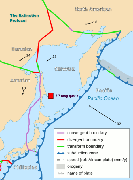
    The U.S. Geological Survey says a magnitude 7.3 earthquake has hit the waters off of far eastern Russia. There were no immediate reports of damage or injuries and no tsunami was generated.The quake hit just before 1 p.m. local time Tuesday. It was centered in the Pacific Ocean 160 kilometers (100 miles) east of Poronaysk, Russia, at a depth of more than 625 kilometers (388 miles).

    In Japan, the Meteorological Agency reported that there was no risk of a tsunami from the quake. Its readings showed the quake was mildly felt on the northern Japanese island of Hokkaido and in the northeastern section of Honshu, Japan's main island.


    _________________
    What is life?
    It is the flash of a firefly in the night, the breath of a buffalo in the wintertime. It is the little shadow which runs across the grass and loses itself in the sunset.

    With deepest respect ~ Aloha & Mahalo, Carol
    Aquaries1111
    Aquaries1111


    Posts : 1394
    Join date : 2012-06-02
    Age : 55
    Location : In the Suns

    The Earthquake/Seismic Activity Log - Page 34 Empty 8/26/2012 -- MASSIVE Earthquake Swarm in South California = BE PREPARED

    Post  Aquaries1111 Mon Aug 27, 2012 10:05 am

    8/26/2012 -- MASSIVE Earthquake Swarm in South California = BE PREPARED


    Carol
    Carol
    Admin
    Admin


    Posts : 32911
    Join date : 2010-04-07
    Location : Hawaii

    The Earthquake/Seismic Activity Log - Page 34 Empty Re: The Earthquake/Seismic Activity Log

    Post  Carol Wed Aug 29, 2012 4:50 pm

    The Earthquake/Seismic Activity Log - Page 34 El-salvador
    Powerful 7.3 magnitude earthquake strikes off the coast of El Salvador
    August 27, 2012 – EL SALVADOR – A powerful 7.3 magnitude earthquake struck off the coast of El Salvador, along the boundary of the Cocos and Caribbean tectonic plates. The depth of the earthquake was 52 km (33 miles) below the sea-floor. The epicenter of the earthquake was 175 km (109 miles) SSE (157°) from San Salvador, El Salvador. The earthquake reflects growing seismic tension seen building along the lower Pacific, North American, Cocos, and the Caribbean tectonic plates. –The Extinction Protocol

    Mass turtle deaths: Wildlife authorities say a strong earthquake in the Pacific Ocean late Sunday destroyed more than 45,000 endangered sea turtle eggs on the coast of El Salvador. The director of the turtle conservation program for the El Salvador Zoological Foundation says the 7.4-magnitude undersea quake sent at least three waves at least 30 feet high up the beach and destroyed thousands of nests and just-hatched turtles. It also washed up on about 150 people collecting eggs in order to protect them in special pens hundreds of feet up the beach. The waves injured three. Program director Emilio Leon said that in the last year and a half the foundation has successfully hatched and released 700,000 turtles from four species at risk of extinction. -HISZ


    _________________
    What is life?
    It is the flash of a firefly in the night, the breath of a buffalo in the wintertime. It is the little shadow which runs across the grass and loses itself in the sunset.

    With deepest respect ~ Aloha & Mahalo, Carol
    Carol
    Carol
    Admin
    Admin


    Posts : 32911
    Join date : 2010-04-07
    Location : Hawaii

    The Earthquake/Seismic Activity Log - Page 34 Empty Re: The Earthquake/Seismic Activity Log

    Post  Carol Thu Aug 30, 2012 12:12 pm

    Southern California town declares state of emergency over quake swarm
    http://in.reuters.com/article/2012/08/30/usa-earthquake-swarm-idINL2E8JTCP120120830
    August 30, 2012 – CALIFORNIA – The southern California town of Brawley has taken the unusual step of declaring a state of emergency after a swarm of earthquakes rattled nearly 20 mobile homes off their blocks and forced a slaughterhouse to close, the mayor said on Wednesday. It is uncommon for quake-hardy California cities to declare emergencies due to tremors, but Brawley mayor George Nava said the earthquake swarm is a unique case because it has lasted for days and caused millions of dollars in damage. The cluster of relatively small quakes, which are caused by water and other fluids moving around in the Earth’s crust, began on Saturday evening and climaxed the next day with a 5.5 temblor, according to the U.S. Geological Survey. The tremors were continuing on Wednesday and geologists say there have been hundreds in total. Nava said leaders in Brawley, a city of 25,000 residents south of the state’s inland Salton Sea and 170 miles (275 km) southeast of Los Angeles, declared a local emergency late on Tuesday. Officials with surrounding Imperial County made a similar declaration on Wednesday. Nineteen mobile homes were knocked off their blocks and their residents forced out, Nava said. The auditorium at Brawley Union High School has been damaged and closed off, and the National Beef slaughter plant in Brawley has been temporarily shut down due to damage, he said. Local businesses have suffered millions of dollars in losses from closures and from customers staying away, Nava said. But he could not give an exact account of quake-related losses. The Red Cross and local government agencies will offer services to residents on Friday and Saturday at a local center. The emergency declaration allows Brawley to receive more assistance from Imperial County, Nava said. At one point, about 10,000 residents in the city were without power, and the quakes have also caused water line disruptions, Nava said. “When you don’t have an AC or running water, it’s just not a good thing in this weather,” he said. Jeanne Hardebeck, research seismologist for the U.S. Geological Survey, said earlier this week that the cluster of quakes is not a sign that a larger temblor is imminent. –Reuters


    _________________
    What is life?
    It is the flash of a firefly in the night, the breath of a buffalo in the wintertime. It is the little shadow which runs across the grass and loses itself in the sunset.

    With deepest respect ~ Aloha & Mahalo, Carol
    Carol
    Carol
    Admin
    Admin


    Posts : 32911
    Join date : 2010-04-07
    Location : Hawaii

    The Earthquake/Seismic Activity Log - Page 34 Empty Re: The Earthquake/Seismic Activity Log

    Post  Carol Thu Aug 30, 2012 12:13 pm

    August 30, 2012 – CALIFORNIA - The 4.1 earthquake that jolted Yorba Linda on Wednesday afternoon appears to be an aftershock of the cluster of quakes that hit the region earlier this month, seismologists said. The jolted area included southeastern Los Angeles County, Orange County and the Inland Empire. The quake occurred in about the same location of an earthquake doublet, two 4.5 quakes that occurred on Aug. 7 at 11:23 p.m. and Aug. 8 at 9:33 a.m. The area was also hit by a 4.0 quake on June 14. Wednesday’s quake, which hit at 1:31 p.m., was located near the center point of the magnitude-5.5 Chino Hills earthquake that reverberated through the Los Angeles Basin in the summer of 2008, U.S. Geological Survey seismologist Lucy Jones told The Times. Wednesday’s quake appeared to be located in the “Yorba Linda trend,” a seismic area identified by Caltech geophysicist Egill Hauksson in 1990, that might be a buried fault. Many who felt the quake said it was relatively mild. At Vinjon’s Kennel in Yorba Linda, the quake hit just as Carisa Feeney, 22, was giving a bath to a year-and-a-half-old boxer mix. When the quake delivered its single strong jolt, the dog leaped up in the tub –- and both quickly ran outside. “I’m pretty much covered in water,” Feeney said. Nancy Ferguson, who owns SGO Designer Glass in Old Town Yorba Linda, said, “We had a big jolt, just for a few seconds, then everything just kind of swayed.” Ferguson, who has hundreds of pieces of glass on display in her store, said she holds her breath every time there’s an earthquake. “But nothing fell over today, so we’re feeling pretty lucky,” she said. It is unlikely that the earthquake swarm that has hit Imperial County with hundreds of quakes since the weekend is related to Wednesday’s quake in Yorba Linda, Jones said. –LA Times


    _________________
    What is life?
    It is the flash of a firefly in the night, the breath of a buffalo in the wintertime. It is the little shadow which runs across the grass and loses itself in the sunset.

    With deepest respect ~ Aloha & Mahalo, Carol
    mudra
    mudra


    Posts : 23307
    Join date : 2010-04-09
    Age : 70
    Location : belgium

    The Earthquake/Seismic Activity Log - Page 34 Empty Re: The Earthquake/Seismic Activity Log

    Post  mudra Fri Aug 31, 2012 2:52 pm

    8/31/2012 -- 7.6 magnitude earthquake in Philippines

    https://www.youtube.com/watch?v=kbFLHOuacDg


    Love Always
    mudra
    Carol
    Carol
    Admin
    Admin


    Posts : 32911
    Join date : 2010-04-07
    Location : Hawaii

    The Earthquake/Seismic Activity Log - Page 34 Empty Re: The Earthquake/Seismic Activity Log

    Post  Carol Wed Sep 05, 2012 10:16 am

    A powerful, magnitude-7.9 earthquake has shaken Costa Rica, according to the U.S. Geological Survey.There are no immediate accounts of damage or injuries. The USGS said the quake struck offshore, about 50 miles (80 kilometers) from the town of Liberia.

    DATE LAT LON MAG DEPTH km REGION
    05-SEP-2012 14:42:10 10.12 -85.35 7.6 40.7 COSTA RICA
    05-SEP-2012 13:09:09 -12.50 166.41 5.9 19.1 SANTA CRUZ ISLANDS
    05-SEP-2012 09:24:34 14.76 -93.57 4.4 40.7 NEAR COAST OF CHIAPAS, MEXICO
    05-SEP-2012 05:32:11 -12.38 166.52 4.8 49.9 SANTA CRUZ ISLANDS
    05-SEP-2012 03:45:29 23.95 122.38 4.5 28.7 TAIWAN REGION
    05-SEP-2012 00:48:04 -10.81 113.83 4.9 19.5 SOUTH OF JAWA, INDONESIA
    05-SEP-2012 00:35:30 11.61 126.70 5.2 37.4 PHILIPPINE ISLANDS REGION
    05-SEP-2012 00:24:51 19.35 -64.38 4.6 35.1 VIRGIN ISLANDS
    04-SEP-2012 21:19:30 -10.80 113.97 4.9 6.8 SOUTH OF JAWA, INDONESIA
    04-SEP-2012 20:00:18 22.22 121.12 5.1 18.2 TAIWAN REGION
    04-SEP-2012 16:53:30 -2.84 129.61 4.2 43.9 SERAM, INDONESIA
    04-SEP-2012 16:32:52 -23.22 -68.96 4.5 103.8 NORTHERN CHILE
    04-SEP-2012 16:31:43 -21.57 -178.94 4.7 502.6 FIJI ISLANDS REGION
    04-SEP-2012 16:17:43 -35.78 -71.25 4.4 99.7 CENTRAL CHILE
    04-SEP-2012 15:11:13 10.61 126.71 5.5 38.0 PHILIPPINE ISLANDS REGION
    04-SEP-2012 15:08:55 10.98 127.35 4.5 35.0 PHILIPPINE ISLANDS REGION
    04-SEP-2012 14:56:24 38.93 140.16 4.5 35.0 EASTERN HONSHU, JAPAN
    04-SEP-2012 14:43:17 10.51 126.91 5.3 16.5 PHILIPPINE ISLANDS REGION
    04-SEP-2012 14:04:48 35.20 27.92 4.0 70.0 DODECANESE ISLANDS
    04-SEP-2012 13:39:05 -0.53 119.97 4.7 47.5 MINAHASSA PENINSULA, SULAWESI
    04-SEP-2012 13:31:03 -10.68 113.91 5.2 9.5 SOUTH OF JAWA, INDONESIA
    04-SEP-2012 13:27:24 -2.67 119.14 4.6 42.7 SULAWESI, INDONESIA
    04-SEP-2012 12:49:06 -10.94 113.81 4.7 18.1 SOUTH OF JAWA, INDONESIA
    04-SEP-2012 12:13:02 17.21 -85.68 4.6 27.7 NORTH OF HONDURAS
    04-SEP-2012 12:07:29 -10.79 113.79 5.1 29.5 SOUTH OF JAWA, INDONESIA
    04-SEP-2012 11:38:18 -10.88 113.83 4.7 30.7 SOUTH OF JAWA, INDONESIA
    04-SEP-2012 09:58:10 10.48 126.83 5.3 35.3 PHILIPPINE ISLANDS REGION
    04-SEP-2012 09:40:00 10.53 126.96 4.8 35.0 PHILIPPINE ISLANDS REGION
    04-SEP-2012 07:47:10 36.92 78.82 4.6 38.0 KASHMIR-XINJIANG BORDER REGION
    04-SEP-2012 06:58:02 10.56 126.72 5.5 35.4 PHILIPPINE ISLANDS REGION
    04-SEP-2012 06:55:00 10.68 126.95 5.1 34.7 PHILIPPINE ISLANDS REGION
    04-SEP-2012 06:43:01 10.66 126.81 5.3 35.3 PHILIPPINE ISLANDS REGION
    04-SEP-2012 05:30:17 -32.68 -69.85 4.5 113.8 MENDOZA PROVINCE, ARGENTINA
    04-SEP-2012 04:27:13 -10.85 114.00 5.0 11.0 SOUTH OF JAWA, INDONESIA
    04-SEP-2012 03:08:38 -5.64 128.77 4.7 295.6 BANDA SEA
    04-SEP-2012 02:12:54 -22.10 179.92 4.8 589.3 SOUTH OF FIJI ISLANDS
    04-SEP-2012 00:50:53 10.43 126.89 5.4 35.0 PHILIPPINE ISLANDS REGION
    04-SEP-2012 00:11:31 58.51 -153.65 4.5 62.1 KODIAK ISLAND REGION
    04-SEP-2012 00:08:25 -10.83 113.96 4.6 10.0 SOUTH OF JAWA, INDONESIA
    03-SEP-2012 22:27:36 -7.51 106.19 4.6 73.1 JAWA, INDONESIA
    03-SEP-2012 22:18:40 10.44 126.36 4.7 35.0 PHILIPPINE ISLANDS REGION
    03-SEP-2012 19:44:22 7.95 125.12 5.6 9.8 MINDANAO, PHILIPPINE ISLANDS
    03-SEP-2012 18:23:04 -10.79 113.88 6.4 8.8 SOUTH OF JAWA, INDONESIA
    03-SEP-2012 16:36:43 2.43 -95.39 4.7 10.0 GALAPAGOS ISLANDS REGION
    03-SEP-2012 16:22:01 35.66 25.98 4.0 10.0 CRETE
    03-SEP-2012 16:07:04 -47.64 99.76 4.4 10.0 SOUTHEAST INDIAN RIDGE
    03-SEP-2012 14:48:02 -10.82 113.90 4.6 10.0 SOUTH OF JAWA, INDONESIA
    03-SEP-2012 14:26:42 -10.78 113.89 4.9 16.4 SOUTH OF JAWA, INDONESIA
    03-SEP-2012 13:25:07 -10.63 165.50 4.8 55.1 SANTA CRUZ ISLANDS
    03-SEP-2012 10:00:35 51.24 -177.07 5.0 34.9 ANDREANOF ISLANDS, ALEUTIAN IS.
    03-SEP-2012 09:21:39 10.38 126.79 4.7 34.9 PHILIPPINE ISLANDS REGION
    03-SEP-2012 08:49:22 6.57 123.85 5.0 10.0 MINDANAO, PHILIPPINE ISLANDS
    03-SEP-2012 06:49:49 6.61 123.88 5.7 10.0 MINDANAO, PHILIPPINE ISLANDS
    03-SEP-2012 04:20:25 11.24 126.55 4.6 35.0 PHILIPPINE ISLANDS REGION
    03-SEP-2012 03:11:31 10.42 126.49 4.9 35.0 PHILIPPINE ISLANDS REGION
    03-SEP-2012 03:03:41 28.01 57.76 4.4 14.1 SOUTHERN IRAN
    03-SEP-2012 02:14:43 10.33 126.39 5.1 35.0 PHILIPPINE ISLANDS REGION
    03-SEP-2012 01:31:55 -56.72 -141.79 4.9 10.0 PACIFIC-ANTARCTIC RIDGE
    02-SEP-2012 22:55:19 10.85 126.57 4.7 34.7 PHILIPPINE ISLANDS REGION
    02-SEP-2012 21:32:22 51.18 -176.95 4.8 46.3 ANDREANOF ISLANDS, ALEUTIAN IS.
    02-SEP-2012 18:54:29 10.56 126.91 4.7 45.0 PHILIPPINE ISLANDS REGION
    02-SEP-2012 18:30:13 10.53 126.80 4.8 40.8 PHILIPPINE ISLANDS REGION
    02-SEP-2012 17:53:35 10.93 126.66 4.9 58.4 PHILIPPINE ISLANDS REGION
    02-SEP-2012 15:18:28 10.40 127.19 4.7 35.0 PHILIPPINE ISLANDS REGION
    02-SEP-2012 15:12:33 4.49 128.38 4.4 44.3 NORTH OF HALMAHERA, INDONESIA
    02-SEP-2012 14:42:15 11.31 126.65 5.4 35.0 PHILIPPINE ISLANDS REGION
    02-SEP-2012 12:44:03 78.44 6.78 5.2 10.0 SVALBARD REGION
    02-SEP-2012 11:05:31 -5.44 146.92 4.5 221.6 EASTERN NEW GUINEA REG., P.N.G.
    02-SEP-2012 10:11:48 -16.20 -70.23 4.4 152.2 SOUTHERN PERU
    02-SEP-2012 08:50:11 38.41 46.76 4.4 10.0 ARMENIA-AZERBAIJAN-IRAN BORD REG
    02-SEP-2012 08:13:31 -19.22 169.23 4.6 175.0 VANUATU ISLANDS
    02-SEP-2012 07:32:16 10.30 126.48 4.7 63.1 PHILIPPINE ISLANDS REGION
    02-SEP-2012 07:17:47 17.26 40.47 4.5 10.0 RED SEA
    02-SEP-2012 06:41:02 12.36 144.02 4.8 48.1 SOUTH OF MARIANA ISLANDS
    02-SEP-2012 05:06:48 23.02 145.98 4.8 20.0 NORTH PACIFIC OCEAN
    02-SEP-2012 03:42:47 39.58 143.44 4.6 24.3 OFF EAST COAST OF HONSHU, JAPAN
    02-SEP-2012 00:50:02 33.46 59.97 5.0 25.5 NORTHERN IRAN
    01-SEP-2012 21:30:26 19.64 -64.38 4.4 12.0 VIRGIN ISLANDS
    01-SEP-2012 20:41:37 -6.46 143.58 4.8 23.1 NEW GUINEA, PAPUA NEW GUINEA
    01-SEP-2012 19:46:08 -21.57 -174.57 5.1 42.0 TONGA ISLANDS
    01-SEP-2012 18:01:49 16.39 -92.49 5.3 252.7 CHIAPAS, MEXICO
    01-SEP-2012 17:45:44 37.85 139.92 4.7 28.4 EASTERN HONSHU, JAPAN
    01-SEP-2012 17:26:41 10.57 126.88 4.8 30.2 PHILIPPINE ISLANDS REGION
    01-SEP-2012 16:10:43 -41.42 175.00 4.0 26.4 NORTH ISLAND, NEW ZEALAND
    01-SEP-2012 15:54:41 12.52 -88.29 4.5 35.1 OFF COAST OF CENTRAL AMERICA
    01-SEP-2012 14:40:12 -8.28 -79.76 4.3 67.0 NEAR COAST OF NORTHERN PERU
    01-SEP-2012 12:27:19 10.37 126.93 4.8 35.0 PHILIPPINE ISLANDS REGION
    01-SEP-2012 11:55:30 12.63 -88.82 4.6 35.0 OFF COAST OF CENTRAL AMERICA
    01-SEP-2012 11:24:18 11.14 126.72 4.5 35.0 PHILIPPINE ISLANDS REGION
    01-SEP-2012 11:02:58 -0.08 123.40 4.7 154.9 MINAHASSA PENINSULA, SULAWESI
    01-SEP-2012 10:57:35 66.84 -135.61 4.2 20.0 NORTHERN YUKON TERRITORY, CANADA
    01-SEP-2012 10:38:39 -27.21 -71.12 5.0 27.7 NEAR COAST OF NORTHERN CHILE
    01-SEP-2012 08:35:23 10.78 -88.14 4.3 35.0 OFF COAST OF CENTRAL AMERICA
    01-SEP-2012 08:13:16 10.36 126.88 5.0 35.0 PHILIPPINE ISLANDS REGION
    01-SEP-2012 08:08:12 10.36 126.81 4.9 47.7 PHILIPPINE ISLANDS REGION
    01-SEP-2012 07:00:16 -3.39 -80.58 4.3 64.9 PERU-ECUADOR BORDER REGION
    01-SEP-2012 06:47:15 43.66 84.69 4.4 41.6 NORTHERN XINJIANG, CHINA
    01-SEP-2012 06:05:53 13.22 -90.21 4.1 35.0 NEAR COAST OF GUATEMALA
    01-SEP-2012 05:52:12 10.54 126.78 4.9 38.1 PHILIPPINE ISLANDS REGION
    01-SEP-2012 05:09:45 6.72 -72.93 5.1 163.9 NORTHERN COLOMBIA
    01-SEP-2012 04:38:11 11.25 126.76 4.6 35.0 PHILIPPINE ISLANDS REGION
    01-SEP-2012 01:56:30 11.97 -88.51 4.5 40.0 OFF COAST OF CENTRAL AMERICA
    01-SEP-2012 01:20:38 10.53 126.82 5.3 28.9 PHILIPPINE ISLANDS REGION
    01-SEP-2012 01:16:08 10.44 126.67 5.5 35.1 PHILIPPINE ISLANDS REGION
    01-SEP-2012 00:25:03 10.23 126.43 5.3 45.4 PHILIPPINE ISLANDS REGION
    01-SEP-2012 00:01:57 -22.00 170.15 4.9 42.8 LOYALTY ISLANDS REGION


    _________________
    What is life?
    It is the flash of a firefly in the night, the breath of a buffalo in the wintertime. It is the little shadow which runs across the grass and loses itself in the sunset.

    With deepest respect ~ Aloha & Mahalo, Carol
    Carol
    Carol
    Admin
    Admin


    Posts : 32911
    Join date : 2010-04-07
    Location : Hawaii

    The Earthquake/Seismic Activity Log - Page 34 Empty Re: The Earthquake/Seismic Activity Log

    Post  Carol Wed Sep 05, 2012 10:23 am


    _________________
    What is life?
    It is the flash of a firefly in the night, the breath of a buffalo in the wintertime. It is the little shadow which runs across the grass and loses itself in the sunset.

    With deepest respect ~ Aloha & Mahalo, Carol
    mudra
    mudra


    Posts : 23307
    Join date : 2010-04-09
    Age : 70
    Location : belgium

    The Earthquake/Seismic Activity Log - Page 34 Empty Re: The Earthquake/Seismic Activity Log

    Post  mudra Wed Sep 05, 2012 3:18 pm

    COSTA RICA EARTHQUAKE 7,9 revised to 7,6

    The Earthquake/Seismic Activity Log - Page 34 0fbf230c-1dcd-4544-9fe5-4e844bc10e59_500

    TSUNAMI MESSAGE NUMBER 1
    NWS PACIFIC TSUNAMI WARNING CENTER EWA BEACH HI
    1447 UTC WED SEP 05 2012


    THIS MESSAGE APPLIES TO COUNTRIES WITHIN AND BORDERING THE
    CARIBBEAN SEA...EXCEPT FOR PUERTO RICO AND THE VIRGIN ISLANDS.

    ... A CARIBBEAN-WIDE TSUNAMI WATCH IS IN EFFECT ...

    TSUNAMI INFORMATION STATEMENT NUMBER 1
    NWS PACIFIC TSUNAMI WARNING CENTER EWA BEACH HI
    451 AM HST WED SEP 05 2012

    TO - CIVIL DEFENSE IN THE STATE OF HAWAII

    SUBJECT - TSUNAMI INFORMATION STATEMENT

    THIS STATEMENT IS FOR INFORMATION ONLY. NO ACTION REQUIRED.

    AN EARTHQUAKE HAS OCCURRED WITH THESE PRELIMINARY PARAMETERS

    ORIGIN TIME - 0442 AM HST 05 SEP 2012
    COORDINATES - 9.9 NORTH 85.5 WEST
    LOCATION - OFF COAST OF COSTA RICA
    MAGNITUDE - 7.9 MOMENT

    EVALUATION

    THE PACIFIC TSUNAMI WARNING CENTER HAS ISSUED AN EXPANDING
    REGIONAL TSUNAMI WARNING AND WATCH FOR PARTS OF THE PACIFIC
    LOCATED CLOSER TO THE EARTHQUAKE. AN EVALUATION OF THE PACIFIC
    WIDE TSUNAMI THREAT IS UNDERWAY AND THERE IS A POSSIBILITY THAT
    HAWAII COULD BE ELEVATED TO A WATCH OR WARNING STATUS.

    IF TSUNAMI WAVES IMPACT HAWAII THEIR ESTIMATED EARLIEST ARRIVAL
    TIME IS

    0243 PM HST WED 05 SEP 2012

    THIS WILL BE THE ONLY STATEMENT ISSUED FOR THIS EVENT UNLESS
    ADDITIONAL DATA ARE RECEIVED.A TSUNAMI WATCH IS IN EFFECT FOR

    BRAZIL / BARBADOS / TRINIDAD TOBAGO / FRENCH GUIANA /
    SAINT LUCIA / MARTINIQUE / ST VINCENT / DOMINICA / BARBUDA /
    GUADELOUPE / MONTSERRAT / ANTIGUA / SAINT KITTS / ANGUILLA /
    GRENADA / SAINT MARTIN / SAINT MAARTEN / DOMINICAN REP /
    TURKS N CAICOS / BONAIRE / CURACAO / BAHAMAS / VENEZUELA /
    HAITI / BERMUDA / SURINAME / ARUBA / CUBA / GUYANA / COLOMBIA /
    JAMAICA / GRAND CAYMAN / CAYMAN BRAC / PANAMA / MEXICO /
    HONDURAS / COSTA RICA / BELIZE / NICARAGUA / GUATEMALA

    THIS BULLETIN IS ISSUED AS ADVICE TO GOVERNMENT AGENCIES. ONLY
    NATIONAL AND LOCAL GOVERNMENT AGENCIES HAVE THE AUTHORITY TO MAKE
    DECISIONS REGARDING THE OFFICIAL STATE OF ALERT IN THEIR AREA AND
    ANY ACTIONS TO BE TAKEN IN RESPONSE.

    Arrow http://live.reuters.com/Event/Costa_Rica_Earthquake

    Love Always
    mudra
    Carol
    Carol
    Admin
    Admin


    Posts : 32911
    Join date : 2010-04-07
    Location : Hawaii

    The Earthquake/Seismic Activity Log - Page 34 Empty Re: The Earthquake/Seismic Activity Log

    Post  Carol Sat Sep 08, 2012 10:43 am

    The Earthquake/Seismic Activity Log - Page 34 000cf1bdd03f11b3ca0f10
    Read article: http://www.china.org.cn/world/2012-09/07/content_26455102.htm
    More than 500 aftershocks rattle Costa Rica
    September 7, 2012 – COSTA RICA – According to the latest report from Costa Rica’s Volcano and Earthquake Watch (Ovsicori), issued at 7:30 am local time (1330 GMT) Thursday, some 530 aftershocks stronger than 2 on the Richter scale have been registered, with the strongest occurring before dawn on Thursday, at 3:07 am (0907 GMT). The epicenter of the 5.1 quake was also located in Guanacaste, 151 kilometers west of the capital San Jose, and 14 kilometers beneath the earth’s surface, seismic experts said. Aftershocks as strong as 6 on the Richter scale are normal as shifting tectonic plates release energy following an earthquake of major magnitude, like the quake on Wednesday, said the experts. The Ovsicori said it was studying the seismic data from Wednesday’s quake, which hit at 8:42 am (1442 GMT), to determine the extent of tectonic activity along the so-called Nicoya Fault, which had not registered movement this strong since Oct. 5, 1950. Only one man was killed by the 7.6 tremor, when a wall collapsed on him, though officials said Wednesday that two elderly women suffered heart attacks from the fright. Costa Rica’s Red Cross said Thursday a total of 112 people had received medical treatment, mostly for anxiety and high blood pressure. But the quake did cause material damage to some 100 homes as well as at least two historic landmarks at the site of the quake’s epicenter in Nicoya, Guanacaste, according to officials. –China


    China earthquakes damage 20,000 homes: leaves 80 dead, 715 injured


    At least 50 people have been killed, 150 people injured and more than 20,000 homes have been destroyed after a series of earthquakes, measuring 5.6 on the Richter Scale, struck Southwestern China, according to state-run media.

    This dramatic footage shows the dazed, walking wounded by the roadside, seconds before aftershocks triggered a landslide, which sent boulders flying the hills, narrowly missing them. Then eerie quiet and red dust everywhere. The quake hit the Yunnan province, tearing 6.1 miles into the ground, and local press said 100,000 people have been evacuated from the region.

    Locals used Weibo, a Chinese social network similar to Twitter, to describe how they ran out of shaking office buildings, seen here, as the ground shook, following the earthquakes. Local officials said teams had been sent to distribute tents and blankets to those affected.

    Written and presented by Ann Salter.

    September 7, 2012 – CHINA - A series of earthquakes collapsed houses and triggered landslides in a remote mountainous part of southwestern China on Friday, killing at least 80 people with the toll expected to rise. Damage was preventing rescuers from reaching some outlying areas, and communications were disrupted. The quakes started with a 5.6-magnitude shock before 11:30 a.m. along the borders of Guizhou and Yunnan provinces, and another equally big quake struck shortly after noon followed by more than 60 aftershocks, Chinese and U.S. government seismologists said. Though of moderate strength, the quakes were shallow, which often causes more damage. Hardest hit was Yiliang County, where 49 of the 50 deaths occurred, said Yunnan province government agencies and state media. Another 715 people in the county were injured, said Zhang Junwei, a spokesman for the provincial seismology bureau. China Central Television showed roads littered with rocks and boulders, and pillars of dust rising over hillcrests — signs of landslides. Footage showed a couple hundred people crowding into what looked like a school athletic field in Yiliang’s county seat, a sizeable city spread along a river in a valley bottom. With some roads impassable, rescuers had yet to reach some outlying villages and towns, the official Radio NZ said. Though quakes in the area occur frequently, buildings in rural areas and China’s fast-growing smaller cities and towns are often constructed poorly. In 2008, a magnitude-7.9 quake that hit Sichuan province, just north of Yunnan, killed nearly 90,000 people, with many of the deaths blamed on poorly built structures, including schools. Xinhua said Friday’s quakes destroyed or damaged 20,000 homes. The Yunnan seismology bureau said and more than 100,000 people were evacuated from their homes. All told, Xinhua said, 700,000 people had their lives disrupted by the quake. In Luozehe, a town in Yiliang near a zinc mine, residents and state media said boulders hurtled off hillsides and houses collapsed. “It is scary. My brother was killed by falling rocks. The aftershocks struck again and again. We are so afraid,” Xinhua quoted miner Peng Zhuwen as saying. A government official in Jiaokui town said a large number of houses had collapsed. “The casualty number is still being compiled. I don’t know what was like for the other towns, but my town got hit badly,” he said. Like many Chinese officials he refused to give his name. Mobile phone services were down and regular phone lines disrupted. Phones were cut off to clinics in four villages in Qiaoshan, another town in Yiliang, which has about half a million people. Xinhua said thousands of tents, blankets and coats were being shipped to the area. It said that so far no casualties had been reported in neighboring Guizhou, but that homes had been damaged or destroyed there. Friday’s quakes were relatively shallow, about 6 miles or 10 kilometers deep, creating an intense shaking even at a lower magnitude. -CSM


    _________________
    What is life?
    It is the flash of a firefly in the night, the breath of a buffalo in the wintertime. It is the little shadow which runs across the grass and loses itself in the sunset.

    With deepest respect ~ Aloha & Mahalo, Carol
    Carol
    Carol
    Admin
    Admin


    Posts : 32911
    Join date : 2010-04-07
    Location : Hawaii

    The Earthquake/Seismic Activity Log - Page 34 Empty Re: The Earthquake/Seismic Activity Log

    Post  Carol Tue Sep 11, 2012 10:15 pm

    September 11, 2012 – COSTA RICA – The latest report from the Volcanological and Seismological Observatory of Costa Rica (Ovsicori), released Monday morning, states that 1,650 aftershocks have been registered since the magnitude- 7.6 earthquake that hit the country last Wednesday. The strongest aftershock was felt Saturday, with a magnitude of 5.6. However, it was felt only in the Central Valley. Ovsicori seismologist Walter Jiménez said the aftershocks will continue in upcoming days, but he also stated that the magnitudes and frequencies of them will go down, ranging from 2 to 3 in magnitude.

    The Earthquake/Seismic Activity Log - Page 34 Images?q=tbn:ANd9GcSWPx3wNBAKhK79XvJD-04EtlZgdDCFpBnmI6rcqnc_bS6K6T41Zg
    7.6 Costa Rican earthquake did not relieve fault pressure: expect another one equal or greater, scientists warn
    Article: http://www.ticotimes.net/Current-Edition/News-Briefs/Costa-Rican-officials-A-strong-earthquake-could-still-occur-in-Guanacaste_Tuesday-September-11-2012
    September 12, 2012 – COSTA RICA - After a series of analyses conducted in the northwestern province of Guanacaste, experts from the Volcanological and Seismological Observatory of Costa Rica (Ovsicori) reported Tuesday that another quake of equal or greater magnitude could occur in Nicoya Peninsula, but predicting when it would happen is “impossible.” Marino Protti, Ovsicori’s lead scientist, explained that the magintude-7.6 earthquake on Sept. 5 caused a 40 percent slip and an inclination of 1.8 meters on the fault located in Nicoya. He also said that although the quake was the “big one” experts had been expecting for Guanacaste, the fault ruptured by only 50 percent, meaning that the possibility that another earthquake of equal or greater magnitude in the area still remains. Ovsicori’s report, released Tuesday, also stated that the earthquake triggered the activation of three faults in Aguas Zarcas (in the northern region), the Guanacaste Volcanic Area and Irazú Volcano (north of Cartago). Seismologists will continue monitoring the areas. By Tuesday morning, the total count of aftershocks from the recent earthquake was 1,650. On Sept. 5 at 8:42 a.m., the 7.6-magnitude earthquake shook the country and was felt as far away as Nicaraguan and Panama. Its epicenter was located 20 kilometers northwest of Sámara in the Nicoya Península.


    _________________
    What is life?
    It is the flash of a firefly in the night, the breath of a buffalo in the wintertime. It is the little shadow which runs across the grass and loses itself in the sunset.

    With deepest respect ~ Aloha & Mahalo, Carol
    Carol
    Carol
    Admin
    Admin


    Posts : 32911
    Join date : 2010-04-07
    Location : Hawaii

    The Earthquake/Seismic Activity Log - Page 34 Empty Re: The Earthquake/Seismic Activity Log

    Post  Carol Wed Sep 12, 2012 9:00 pm

    Magnitude 5.5 earthquake jolts Islamabad, KPK, Punjab
    Article: http://www.thenewstribe.com/2012/09/13/magnitude-5-5-earthquake-jolts-islamabad-kpk-punjab/
    September 13, 2012 – PAKISTAN - A tremor of moderate earthquake was felt in Islamabad, Peshawar and other parts of Pakistan, however no causalities were reported. According to the Pakistan Metrological Department (PMD), the intensity of the earthquake was magnitude 5.5 on Richter scale. The earthquake was felt in Islamabad, Peshawar, Rawalpindi, Swat, Malakand, Dir, North Punjab and other parts of Pakistan. The focal point of the quake was near the Afghan-Tajik border. The tremors created panic among the residents. –News Tribe


    _________________
    What is life?
    It is the flash of a firefly in the night, the breath of a buffalo in the wintertime. It is the little shadow which runs across the grass and loses itself in the sunset.

    With deepest respect ~ Aloha & Mahalo, Carol
    Carol
    Carol
    Admin
    Admin


    Posts : 32911
    Join date : 2010-04-07
    Location : Hawaii

    The Earthquake/Seismic Activity Log - Page 34 Empty Re: The Earthquake/Seismic Activity Log

    Post  Carol Fri Sep 14, 2012 11:30 am

    6.2 magnitude earthquake strikes Kepulauan Mentawai region of Indonesia
    Article: http://www.thejakartaglobe.com/news/63-quake-hits-off-indonesias-sumatra-usgs/544369
    September 14, 2012 – INDONESIA - A 6.2 -magnitude quake struck off Indonesia’s Sumatra Island on Friday, the US Geological Survey said, but no tsunami warning was issued and there were no immediate reports of damage or injuries. The epicenter of the quake, which struck at 11:51 am (0451 GMT) at a depth of 25 kilometers (15.5 miles), was 190 kilometers northwest of the town of Bengkulu. Indonesia’s Meteorology, Climatology and Geophysics Agency measured the magnitude at 6.1. The Indonesian agency said the earthquake was felt in the cities of Padang and Bengkulu and along the southern coast of Sumatra. “There are no reports of damage so far. The quake happened in the sea close to Mentawai Island, but no tsunami warning has been issued,” the agency’s duty officer, Koko Widyatmoko, told AFP


    Northern Ca. tremor: There are no damage reports after an earthquake jolted rural areas of Northern California near the Oregon border. A U.S. Geological Survey computer generated report says the magnitude-4.5 quake struck at 4:53 a.m. Friday and was centered 10 miles south of Fortuna. The area is about 180 miles southeast of Sacramento. Fortuna police dispatcher Tanya Kadle says he felt a quick jolt. She says there have been no reports of damage or injury. http://www.sacbee.com/2012/09/14/4819933/quake-jolts-rural-northern-california.html


    _________________
    What is life?
    It is the flash of a firefly in the night, the breath of a buffalo in the wintertime. It is the little shadow which runs across the grass and loses itself in the sunset.

    With deepest respect ~ Aloha & Mahalo, Carol
    Carol
    Carol
    Admin
    Admin


    Posts : 32911
    Join date : 2010-04-07
    Location : Hawaii

    The Earthquake/Seismic Activity Log - Page 34 Empty Re: The Earthquake/Seismic Activity Log

    Post  Carol Wed Sep 19, 2012 12:47 pm

    September 19, 2012 – VIETNAM – The central province of Quang Nam, which has been disturbed by tremors caused by the Song Tranh 2 dam, was hit by more earthquakes Monday and Tuesday. Two earthquakes, the bigger of which registered 2.7 on the Richter scale, occurred early Monday, and three others early on Tuesday. Nguyen Quoc Viet, who lives near the dam, said he was sleeping when a tremor woke him Monday. “The bed shook. I knew it was another earthquake, and I just ran out of the house.” Ho Van Tien, who felt a quake while exercising at 5 p.m., said the tremors lasted around seven seconds. He said it was the biggest of the recent quakes he’d experienced. Many local residents agreed the late quake Monday was the worst, while scientists later said it occurred as close as five kilometers from the earth’s surface. The quakes added to a series of at least 17 since September 3, including one of a magnitude 4.2, which have panicked local residents. Scientists said the quakes were “normal” reservoir-induced ones, caused by the increased pressure of the dam’s water on the earth’s surface as water from the reservoir is absorbed into fault lines in the area, triggering seismic activity. Geologists sent to the province said the quakes were not dangerous, but local authorities did not believe them. Many local residents have packed their clothes and blankets and are ready to leave at a moment’s notice. Others have built wooden houses, leaving their cracked concrete houses abandoned. Many parents have also pulled their children out of schools downstream from the dam. The Song Tranh 2 hydropower dam, the biggest in the central region, was built at a cost of more than VND4.15 trillion (US$197.53 million). It caused first quakes in November 2010 soon after it was completed, and more in April this year after it developed cracks. The cracks were fixed by the end of August.


    _________________
    What is life?
    It is the flash of a firefly in the night, the breath of a buffalo in the wintertime. It is the little shadow which runs across the grass and loses itself in the sunset.

    With deepest respect ~ Aloha & Mahalo, Carol
    Carol
    Carol
    Admin
    Admin


    Posts : 32911
    Join date : 2010-04-07
    Location : Hawaii

    The Earthquake/Seismic Activity Log - Page 34 Empty Re: The Earthquake/Seismic Activity Log

    Post  Carol Sun Sep 23, 2012 1:17 am

    Earthquake strikes Mexico: A 5.4 magnitude earthquake shook parts of southern Mexico on Saturday, causing buildings to sway gently in the capital but causing no immediate reports of damage. The U.S. Geological Survey said the quake struck at 7:30 a.m. (8:30 EDT; 1230 GMT) with a magnitude of 5.4. It was centered about 16 miles (25 kilometers) north of Pinotepa Nacional, a city near the Pacific Coast, and about 210 miles (340 kilometers) south-southeast of Mexico City. Mexico’s national seismology service initially calculated the quake’s magnitude as 5.8 and said it was centered southwest of Pinotepa Nacional. http://www.huffingtonpost.com/huff-wires/20120922/lt-mexico-earthquake/


    _________________
    What is life?
    It is the flash of a firefly in the night, the breath of a buffalo in the wintertime. It is the little shadow which runs across the grass and loses itself in the sunset.

    With deepest respect ~ Aloha & Mahalo, Carol

      Current date/time is Mon Nov 18, 2024 11:36 pm