tMoA

Would you like to react to this message? Create an account in a few clicks or log in to continue.
tMoA

~ The only Home on the Web You'll ever need ~

+21
Aquaries1111
giovonni
arvan33
Floyd
lawlessline
JesterTerrestrial
THEeXchanger
newel
Brook
greybeard
Mercuriel
Sanicle
devakas
hobbit
mudra
burgundia
lindabaker
LeeEllisMusic
MargueriteBee
Carol
HigherLove
25 posters

    The Earthquake/Seismic Activity Log

    HigherLove
    HigherLove


    Posts : 2357
    Join date : 2011-01-27
    Age : 58

    The Earthquake/Seismic Activity Log - Page 20 Empty Re: The Earthquake/Seismic Activity Log

    Post  HigherLove Fri Oct 28, 2011 5:58 pm

    Magnitude
    6.9
    Date-Time
    Friday, October 28, 2011 at 18:54:33 UTC
    Friday, October 28, 2011 at 01:54:33 PM at epicenter
    Time of Earthquake in other Time Zones
    Location
    14.515°S, 76.009°W
    Depth
    23.9 km (14.9 miles)
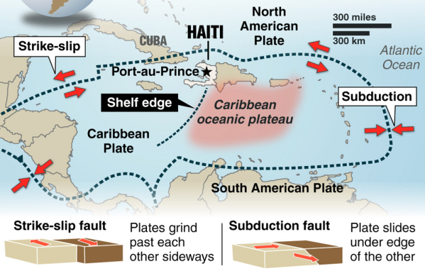
    Region
    NEAR THE COAST OF CENTRAL PERU
    Distances
    51 km (31 miles) SSW of Ica, Peru
    112 km (69 miles) S of Chincha Alta, Peru
    201 km (124 miles) W of Puquio, Peru
    288 km (178 miles) SSE of LIMA, Peru
    Location Uncertainty
    horizontal +/- 16.5 km (10.3 miles); depth +/- 2.7 km (1.7 miles)
    Parameters
    NST=507, Nph=517, Dmin=293.9 km, Rmss=1.12 sec, Gp= 50°,
    M-type=regional moment magnitude (Mw), Version=8
    Source
    Magnitude: USGS NEIC (WDCS-D)
    Location: USGS NEIC (WDCS-D)
    Event ID
    usb0006fv2


    Earthquakes list October 28, 2011
    Very dangerous : PERU

    http://earthquake-report.com/

    The Earthquake/Seismic Activity Log - Page 20 S_amer10


    LIMA, Peru -- A magnitude-6.9 earthquake centered off Peru's central coast sent people running panicked into the streets Friday in cities badly damaged by a killer quake four years earlier. There were no reports of damage or injuries.

    People who had lost loved ones and homes in the earlier quake were badly shaken and some broke into tears.

    "It felt like the one in 2007 because it was very strong," Felix Sihuas told RPP radio. He said he was buried under rubble for six hours in the Aug. 15, 2007, quake, which killed 596 people and largely destroyed the town of Pisco.

    Friday's quake was considerably less violent in Lima, a city of 8.5 million people. The capital shook for about 30 seconds in a series of moderate, swaying movements.

    http://www.huffingtonpost.com/2011/10/28/peru-earthquake-2011-magnitude_n_1064323.html
    MAP 3.1 2011/10/28 22:24:13 60.630 -150.012 46.4 KENAI PENINSULA, ALASKA
    MAP 5.0 2011/10/28 22:00:02 -14.684 -76.038 5.9 NEAR THE COAST OF CENTRAL PERU
    MAP 4.9 2011/10/28 21:51:59 -14.492 -76.040 21.7 NEAR THE COAST OF CENTRAL PERU
    MAP 4.7 2011/10/28 20:26:50 -14.425 -76.046 22.7 NEAR THE COAST OF CENTRAL PERU
    MAP 6.9 2011/10/28 18:54:34 -14.515 -76.009 23.9 NEAR THE COAST OF CENTRAL PERU
    MAP 4.8 2011/10/28 18:19:50 54.420 -165.667 101.5 FOX ISLANDS, ALEUTIAN ISLANDS, ALASKA
    MAP 4.4 2011/10/28 17:11:25 50.876 176.146 50.0 RAT ISLANDS, ALEUTIAN ISLANDS, ALASKA
    MAP 4.9 2011/10/28 16:55:55 51.547 176.521 48.0 RAT ISLANDS, ALEUTIAN ISLANDS, ALASKA
    MAP 4.9 2011/10/28 16:50:34 -6.796 143.955 10.0 NEW GUINEA, PAPUA NEW GUINEA
    MAP 4.5 2011/10/28 16:34:12 38.709 43.793 5.0 EASTERN TURKEY
    MAP 2.5 2011/10/28 15:43:34 35.357 -92.270 6.6 ARKANSAS
    MAP 2.5 2011/10/28 15:11:28 35.618 -117.703 22.7 SOUTHERN CALIFORNIA
    MAP 3.5 2011/10/28 13:03:15 18.975 -64.308 19.8 VIRGIN ISLANDS REGION
    MAP 5.4 2011/10/28 11:06:58 -28.559 -175.929 35.5 KERMADEC ISLANDS REGION
    MAP 4.3 2011/10/28 09:47:58 38.502 43.569 9.9 EASTERN TURKEY
    MAP 2.5 2011/10/28 09:30:54 35.959 -117.343 3.8 CENTRAL CALIFORNIA
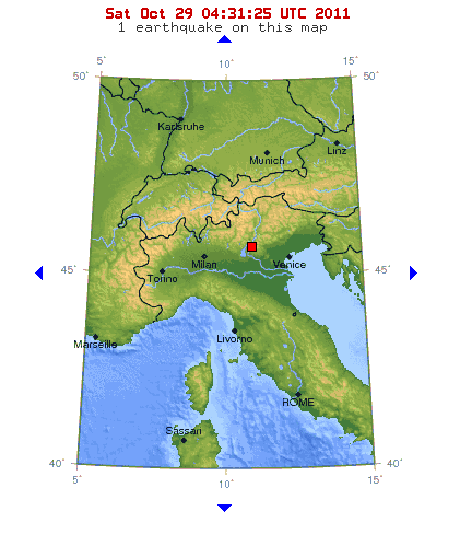
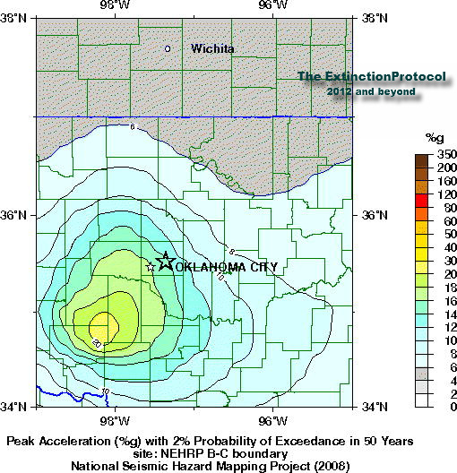
    MAP 3.5 2011/10/28 09:18:46 35.532 -97.366 5.0 OKLAHOMA CITY URBAN AREA, OKLAHOMA
    MAP 4.7 2011/10/28 09:08:38 -40.633 126.422 10.0 SOUTH OF AUSTRALIA
    MAP 4.6 2011/10/28 08:48:10 38.547 43.717 9.9 EASTERN TURKEY
    MAP 4.9 2011/10/28 08:14:28 5.039 94.167 50.0 NORTHERN SUMATRA, INDONESIA
    MAP 3.0 2011/10/28 07:21:36 19.271 -67.840 67.0 DOMINICAN REPUBLIC REGION
    MAP 3.3 2011/10/28 06:24:58 35.523 -97.359 5.0 OKLAHOMA CITY URBAN AREA, OKLAHOMA
    MAP 5.2 2011/10/28 05:57:14 -10.614 161.415 54.1 SOLOMON ISLANDS
    MAP 4.9 2011/10/28 04:27:19 -26.344 -70.736 42.2 OFFSHORE ATACAMA, CHILE
    MAP 5.5 2011/10/28 01:35:31 52.038 -171.514 53.3 FOX ISLANDS, ALEUTIAN ISLANDS, ALASKA
    MAP 4.4 2011/10/28 00:25:36 38.468 43.279 10.0 EASTERN TURKEY

    The Earthquake/Seismic Activity Log - Page 20 Untitl34

    Extremely dangerous earthquake on the coast of Central Peru – 20 people injured and 35 houses collapsed so far

    http://earthquake-report.com/2011/10/28/very-strong-dangerous-earthquake-in-peru/
    Carol
    Carol
    Admin
    Admin


    Posts : 31744
    Join date : 2010-04-07
    Location : Hawaii

    The Earthquake/Seismic Activity Log - Page 20 Empty Re: The Earthquake/Seismic Activity Log

    Post  Carol Sat Oct 29, 2011 8:42 pm


    link to the blog with a data screenshot: http://sincedutch.wordpress.com/2011/10/28/10282011-6-9-magnitude-earthquake-...

    Also, Links to dozens of earthquake monitoring sites worldwide:
    http://www.geology.ar.gov/geohazards/ark_seismic_network.htm

    http://www.skimountaineer.com/CascadeSki/CascadeWebCams.php?weather=true

    http://bigthink.com/ideas/26619

    http://www.ldeo.columbia.edu/cgi-bin/LCSN/WebSeis/24hr_heli.pl?id=

    http://www.ssn.unam.mx/

    http://seismologie.oma.be/index.php?LANG=NL&LEVEL=210

    http://www.prsn.uprm.edu/lantex/

    http://mbvrc.wwu.edu/index.shtml

    http://www.phivolcs.dost.gov.ph/

    http://earthquakescanada.nrcan.gc.ca/recent/index-eng.php

    http://earthquakescanada.nrcan.gc.ca/stndon/wf-fo/trace_app.php?target=MNTQ.BHZ

    http://www.ceme.gsras.ru/ccd.htm

    http://www.gsi.go.jp/ENGLISH/index.html

    http://www.seis.com.au/

    http://www.ga.gov.au/earthquakes/

    http://www.avo.alaska.edu/

    http://www.knmi.nl/seismologie/aardbevingen-nederland.html

    http://folkworm.ceri.memphis.edu/heli/heli_sp_mkta/

    http://folkworm.ceri.memphis.edu/heli_bb_slu/

    http://folkworm.ceri.memphis.edu/heli/heli_sp_nmad/

    http://folkworm.ceri.memphis.edu/heli/heli_sp_athn/

    http://folkworm.ceri.memphis.edu/heli/heli_sp_lnxt/

    http://folkworm.ceri.memphis.edu/heli/heli_sp_mttn/

    http://folkworm.ceri.memphis.edu/heli/heli_sp_ceri/

    http://folkworm.ceri.memphis.edu/heli/heli_uky/

    http://quake.crowe.co.nz/Mobile/

    http://aslwww.cr.usgs.gov/Seismic_Data/telemetry_data/

    http://www.oe-files.de/gmaps/eqmashup.html

    http://www.fs.fed.us/gpnf/volcanocams/msh/

    http://pasadena.wr.usgs.gov/webicorder/

    http://earthquake.usgs.gov/monitoring/anss/

    http://aslwww.cr.usgs.gov/Seismic_Data/telemetry_data/map_sta_eq.shtml

    http://www.earthquakes.bgs.ac.uk/helicorder/heli.html

    http://earthquake.usgs.gov/

    http://aslwww.cr.usgs.gov/Seismic_Data/heli2.shtml

    http://download.cnet.com/Earthquake-3D/3000-2054_4-10395116.html

    http://www.volcano.si.edu/reports/usgs/

    http://hawaii.wr.usgs.gov/

    http://cnt.rm.ingv.it

    http://www.emsc-csem.org/Earthquake/Map/jsmap.php?key=1&typ=world

    http://www.emsc-csem.org/Earthquake/index.php

    http://www.emsc-csem.org/Earthquake/Map/index.php

    http://earthquakescanada.nrcan.gc.ca/recent/maps-cartes/index-eng.php

    http://www.goandroam.com/webcams/japan/mt_fuji

    http://earthquake.usgs.gov/monitoring/netquakes/

    http://earthquake.usgs.gov/monitoring/netquakes/station/NQ079_NM_01/

    http://www.showme.net/~fkeller/quake/maps.htm

    http://www.nps.gov/yell/photosmultimedia/webcams.htm

    http://www.pnsn.org/WEBICORDER/BETTER/pnsn_staweb/index.html

    http://www.quake.utah.edu/helicorder/

    http://tux.wr.usgs.gov/

    http://mbmgquake.mtech.edu/earthworm/wavef_disp/current/welcome.html

    http://www.isthisthingon.org/Yellowstone/daythumbs.php

    http://www.nps.gov/yell/photosmultimedia/webcams.htm

    http://www.fujigoko.tv/live/shotList.cgi


    _________________
    What is life?
    It is the flash of a firefly in the night, the breath of a buffalo in the wintertime. It is the little shadow which runs across the grass and loses itself in the sunset.

    With deepest respect ~ Aloha & Mahalo, Carol
    HigherLove
    HigherLove


    Posts : 2357
    Join date : 2011-01-27
    Age : 58

    The Earthquake/Seismic Activity Log - Page 20 Empty Re: The Earthquake/Seismic Activity Log

    Post  HigherLove Sun Oct 30, 2011 7:16 am

    I won another lottery! Thanks.

    Cheerful

    I included the links on the first page, but I still need to go back and organize everything. jocolor

    _____________________________________________________________

    Location, location, location:

    - Based on all what follows Earthquake-Report.com predicts that PEVOLCA will meet very soon. Main reason : The increasing strength of the earthquakes.

    - The strongest earthquake since October 8 (a M 4.4 quake at the time), now a Magnitude 3.9 quake, occurred at 07:46 this morning in the El Golfo bay. Its epicenter was close to the Frontera coast line. The 4.4 earthquake on October 8 was the start of a number of events like the beginning of harmonic tremor and the start of the green stain (eruption) soon after. The depth is still a secure 22 km. Some scientists are linking however the magma area below the El Golfo to the still continuing eruption to the south of La Restinga. These are however speculations who cannot be proofed.

    - At earthquake-report.com we do not consider quakes up to Magnitude 5 as dangerous for houses, although indirect damage can be triggered by rockfall and landslides in mountainous areas like El Hierro. Authorities will certainly follow up the El Hierro landscape scars when the quakes get again to Magnitudes 4 to 5. This will be a major concern for the El Hierro authorities from now on.

    http://earthquake-report.com/2011/09/25/el-hierro-canary-islands-spain-volcanic-risk-alert-increased-to-yellow/


    From a 4.0

    Earthquake shakes Quito, Ecuador – Landslides and cracks in houses

    Earthquake overview : An earthquake with a Magnitude of 4 at a depth of 10 km occurred at the outskirts of the Ecuadorian capital of Quito.

    http://earthquake-report.com/2011/10/29/earthquake-shakes-quito-ecuador/
    HigherLove
    HigherLove


    Posts : 2357
    Join date : 2011-01-27
    Age : 58

    The Earthquake/Seismic Activity Log - Page 20 Empty Re: The Earthquake/Seismic Activity Log

    Post  HigherLove Sun Oct 30, 2011 7:18 am

    Hello!

    Magnitude
    5.9
    Date-Time
    Sunday, October 30, 2011 at 11:52:27 UTC
    Sunday, October 30, 2011 at 06:52:27 PM at epicenter
    Time of Earthquake in other Time Zones
    Location
    3.341°S, 101.310°E
    Depth
    39.9 km (24.8 miles)
    Region
    SOUTHERN SUMATRA, INDONESIA
    Distances
    117 km (72 miles) WNW of Bengkulu, Sumatra, Indonesia
    172 km (106 miles) W of Lubuklinggau, Sumatra, Indonesia
    585 km (363 miles) SSW of SINGAPORE
    688 km (427 miles) WNW of JAKARTA, Java, Indonesia
    Location Uncertainty
    horizontal +/- 14.9 km (9.3 miles); depth +/- 9.4 km (5.8 miles)
    Parameters
    NST= 76, Nph= 76, Dmin=214.8 km, Rmss=1.42 sec, Gp= 50°,
    M-type=regional moment magnitude (Mw), Version=7
    Source
    Magnitude: USGS NEIC (WDCS-D)
    Location: USGS NEIC (WDCS-D)
    Event ID
    usb0006gju

    Downgrade to 5.6

    Moderately dangerous earthquake along the Bengkulu coast, Sumatra, Indonesia
    Last update: October 30, 2011 at 1:16 pm by By Armand Vervaeck - James Daniell - Szombath Balazs

    http://earthquake-report.com/2011/10/30/moderately-dangerous-earthquake-along-the-bengkulu-coast-sumatra-indonesia/
    HigherLove
    HigherLove


    Posts : 2357
    Join date : 2011-01-27
    Age : 58

    The Earthquake/Seismic Activity Log - Page 20 Empty Re: The Earthquake/Seismic Activity Log

    Post  HigherLove Sun Oct 30, 2011 9:11 am

    MAP 3.5 2011/10/30 13:26:42 35.975 -120.023 0.0 7 km ( 4 mi) SW of Kettleman City, CA
    MAP 4.1 2011/10/30 13:25:19 39.604 -120.473 14.0 15 km ( 9 mi) SSE of Whitehawk, CA

    Details en route...

    Magnitude
    3.5
    Date-Time
    Sunday, October 30, 2011 at 13:26:42 UTC
    Sunday, October 30, 2011 at 06:26:42 AM at epicenter
    Time of Earthquake in other Time Zones
    Location
    35.975°N, 120.023°W
    Depth
    0 km (~0 mile) (poorly constrained)
    Region
    CENTRAL CALIFORNIA
    Distances
    7 km (4 miles) SW (235°) from Kettleman City, CA
    10 km (6 miles) ESE (122°) from Avenal, CA
    26 km (16 miles) SSE (165°) from Huron, CA
    35 km (22 miles) ESE (121°) from Coalinga, CA
    52 km (32 miles) SW (220°) from Hanford, CA
    226 km (140 miles) SE (132°) from San Jose City Hall, CA
    Location Uncertainty
    horizontal +/- 0.6 km (0.4 miles); depth +/- 4.5 km (2.8 miles)
    Parameters
    Nph= 50, Dmin=14 km, Rmss=0.36 sec, Gp= 65°,
    M-type=regional moment magnitude (Mw), Version=5
    Source
    California Integrated Seismic Net:
    USGS Caltech CGS UCB UCSD UNR
    Event ID
    nc71673001

    Magnitude
    4.1
    Date-Time
    Sunday, October 30, 2011 at 13:25:19 UTC
    Sunday, October 30, 2011 at 06:25:19 AM at epicenter
    Time of Earthquake in other Time Zones
    Location
    39.604°N, 120.473°W
    Depth
    14 km (8.7 miles)
    Region
    NORTHERN CALIFORNIA
    Distances
    15 km (9 miles) SSE (154°) from Whitehawk, CA
    20 km (12 miles) SSE (151°) from C-Road, CA
    21 km (13 miles) S (175°) from Iron Horse, CA
    37 km (23 miles) NW (322°) from Truckee, CA
    56 km (35 miles) W (279°) from Reno, NV
    145 km (90 miles) NE (36°) from Sacramento, CA
    Location Uncertainty
    horizontal +/- 0.4 km (0.2 miles); depth +/- 0.7 km (0.4 miles)
    Parameters
    Nph= 17, Dmin=2 km, Rmss=0.09 sec, Gp= 79°,
    M-type=local magnitude (ML), Version=4
    Source
    California Integrated Seismic Net:
    USGS Caltech CGS UCB UCSD UNR
    Event ID
    nc71672996

    The Earthquake/Seismic Activity Log - Page 20 39_41_10


    The Earthquake/Seismic Activity Log - Page 20 Indexf12

    What is going on in Tahoe National Forest?
    HigherLove
    HigherLove


    Posts : 2357
    Join date : 2011-01-27
    Age : 58

    The Earthquake/Seismic Activity Log - Page 20 Empty Re: The Earthquake/Seismic Activity Log

    Post  HigherLove Sun Oct 30, 2011 9:44 am

    Oh my, my, my...this cannot be happening: Gregg wants to spend the day in San Francisco.

    Crazy Happy

    We'll see...a change of scenery would be nice, but no walking on suspension bridges. :op

    Love y'all
    Carol
    Carol
    Admin
    Admin


    Posts : 31744
    Join date : 2010-04-07
    Location : Hawaii

    The Earthquake/Seismic Activity Log - Page 20 Empty Re: The Earthquake/Seismic Activity Log

    Post  Carol Sun Oct 30, 2011 10:33 am

    I hope you have two have fun. Do you plan to go before or after the quake? Crazy Happy The Earthquake/Seismic Activity Log - Page 20 Scfsbpjl

    I do love the city. Maybe next time Phantom plays we'll fly over to see it. cheers

    Geologists closely monitoring surge in Arkansas earthquakes
    October 29, 2011 – LITTLE ROCK — The Arkansas Geological Survey says it is stepping up its monitoring of seismic activity in central Arkansas after dozens of small earthquakes in the region. Six minor quakes were recorded Friday near Quitman, the latest of more than 50 temblors in October. The Friday tremors began with a 2.0-magnitude quake around 7:45 a.m. and peaked with a 2.5 quake later in the morning. The shaking follows more than 1,000 earthquakes centered between Guy and Greenbrier from September 2010 to July of this year, when the Arkansas Oil and Gas Commission ordered four gas disposal wells shut down and voted to create a large moratorium area in which no future disposal wells could be drilled. Geologists said the activity – which involves injecting pressurized liquid into the ground – was likely contributing to the shaking. The quakes between Guy and Greenbrier tailed off significantly in August, but more quakes began occurring in October closer to Quitman. It sits about 10 miles northeast of Guy. That distance is potentially concerning, warned Scott Ausbrooks, geo-hazards supervisor for the Arkansas Geological Survey. The Quitman quakes are occurring along the same line as the Guy-Greenbrier ones, but there’s a miles-long gap between Guy and Quitman in which no quakes have been recorded. That might suggest that the tension is building, possibly leading up to a larger quake centered on that gap along the fault. A similar-sized gap occurred on the southern end of the Guy-Greenbrier fault and it in February unleashed a 4.7-magnitude quake, the largest of any of the recent tremors. Anytime there is a gap in seismicity along an active fault, it “bears watching,” Ausbrooks said. “I’m not saying that’s what it is,” he said. “I don’t want to scare people and I don’t want to say it’s going to happen. It’s just something we’re looking at.” The 4.7 tremor was felt across Arkansas and in neighboring states, though no injuries or major damage was reported. It and the other hundreds of smaller quakes that rumbled the area helped convince the Oil and Gas Commission to take action. So why is the shaking continuing if the drilling has stopped? Ausbrooks has a few ideas, though he said the phenomenon is still very much under investigation. Officials have already placed one temporary quake-monitoring station near Center Ridge and he said another will likely be placed elsewhere in the region in the next two weeks. “We’re kind of beefing back up because of this renewed seismicity,” he said. Ausbrooks said the shaking could be purely natural. Earthquakes continued for years after drilling ended at the Rocky Mountain Arsenal in Colorado, where an injection well is thought to have initially triggered seismic activity. –Arkansas Online


    The Earthquake/Seismic Activity Log - Page 20 It-10-29
    4.4 magnitude earthquake shakes northern Italy
    October 29, 2011 – ITALY – A 4.4 magnitude earthquake struck northern Italy. The earthquake struck at a depth of 11.6 km (7.2 miles). The epicenter of the earthquake was 33 km (20 miles) N of Verona, Italy and 445 km (276 miles) NNW of ROME, Italy. Italy has been battered by an increase in seismic activity over the last few months.

    The Earthquake/Seismic Activity Log - Page 20 Zz-1
    Seismic awakening? Earthquakes are increasing in Oklahoma and no one knows why
    October 29, 2011 – OKLAHOMA – Two small earthquakes were reported in Oklahoma County early Friday, authorities report. (See seismic hazard map above) A 3.5-magnitude earthquake has been reported Friday by the U.S. Geological Survey. The quake was at 3:18 a.m. Friday 2 miles north of Spencer and 4 miles northwest of Nicoma Park. No reports of property damage or injuries were made. Also, a 3.3 magnitude earthquake was reported at 12:24 a.m. a mile northeast of Spencer. No damages were reported from that earthquake either. –Newsok

    Earthquakes are increasing in Oklahoma. There are many faults in Oklahoma. Far more than anyone could count, Austin Holland, seismologist for the Oklahoma Geological Survey has said on several occasions. Oklahoma is home to the Meers Fault which is located in the southwestern part of the state. State geologists feel Meers is just one part of Oklahoma’s complex geology that makes the state capable of producing an earthquake up to a potential 6.5 magnitude however, that doesn’t account for the latest series of tremors breaking out near Oklahoma City. Austin Holland, with the Oklahoma Geological Survey, told KRMG that there had been a significant increase in the number of quakes in the past year or so. Holland says the central part of Oklahoma has always been a hotbed for small-scale seismic activity. “Over the past two years it’s been especially active, but not alarmingly so. We’ve had more than ten times as many earthquakes but they’ve all been magnitude 3 or less.” One exception was the Norman quake. The U.S. Geological Survey confirms 18 quakes in the area in the past six months on their website.1


    _________________
    What is life?
    It is the flash of a firefly in the night, the breath of a buffalo in the wintertime. It is the little shadow which runs across the grass and loses itself in the sunset.

    With deepest respect ~ Aloha & Mahalo, Carol
    HigherLove
    HigherLove


    Posts : 2357
    Join date : 2011-01-27
    Age : 58

    The Earthquake/Seismic Activity Log - Page 20 Empty Re: The Earthquake/Seismic Activity Log

    Post  HigherLove Tue Nov 01, 2011 8:17 am

    Before or after? hehehe :)

    ________________________________

    Magnitude
    6.5
    Date-Time
    Tuesday, November 01, 2011 at 12:32:00 UTC
    Tuesday, November 01, 2011 at 05:32:00 AM at epicenter
    Time of Earthquake in other Time Zones
    Location
    19.889°N, 109.174°W
    Depth
    5 km (3.1 miles)
    Region
    REVILLA GIGEDO ISLANDS REGION
    Distances
    227 km (141 miles) NE of Socorro Island, Mexico
    333 km (206 miles) SSE of Cabo San Lucas, Baja Calif. Sur, Mexico
    419 km (260 miles) W of Puerto Vallarta, Jalisco, Mexico
    1050 km (652 miles) W of MEXICO CITY, D.F., Mexico
    Location Uncertainty
    horizontal +/- 21.5 km (13.4 miles); depth +/- 2.8 km (1.7 miles)
    Parameters
    NST=359, Nph=359, Dmin=428.6 km, Rmss=1.01 sec, Gp=162°,
    M-type=regional moment magnitude (Mw), Version=C
    Source
    Magnitude: NOAA, Pacific Tsunami Warning Center, Honolulu, Hawaii
    Location: USGS NEIC (WDCS-D)
    Event ID
    usb0006hfg

    Dangerous earthquake in Xinjiang, China – At least 50 rooms collapsed, damage to agricultural facilities.
    Last update: November 1, 2011 at 8:55 am by By Armand Vervaeck - James Daniell - Szombath Balazs

    http://earthquake-report.com/2011/11/01/extremely-dangerous-earthquake-in-xinjiang-china/
    Carol
    Carol
    Admin
    Admin


    Posts : 31744
    Join date : 2010-04-07
    Location : Hawaii

    The Earthquake/Seismic Activity Log - Page 20 Empty Re: The Earthquake/Seismic Activity Log

    Post  Carol Tue Nov 01, 2011 6:22 pm

    4.1 magnitude earthquake strikes northeast of Los Angeles, Ca
    http://theextinctionprotocol.files.wordpress.com/2011/11/california-11-1.gif?w=456&h=499
    November 1, 2011 – LOS ANGELES, CA. – A shallow 4.1 magnitude earthquake struck southern California today- surprising some area residents. The depth of the earthquake was 4.7 km (2.9 miles) and occurred at 08:38 am. The epicenter of the earthquake was 9 km (6 miles) NE from Ridgecrest, CA and about 190 km (118 miles) NNE from downtown Los Angeles, CA. The state has been rattled by an increasing number of tremors in recents weeks. There were no immediate reports of damages from today’s earthquake.


    The Earthquake/Seismic Activity Log - Page 20 Photo_1320115074783-2-0
    Double moderate earthquakes ripple across China
    November 1, 2011 – CHINA – A moderate earthquake in remote northwestern China has destroyed dozens of houses and damaged many more, but there have been no reported casualties, government officials and state media said Tuesday. More than 50 houses collapsed and hundreds of homes were damaged after the 5.4-magnitude quake jolted the border area of Yining and Gongliu counties in Xinjiang, the local earthquake bureau said on its official microblog. The quake, which the US Geological Survey revised down to 5.4 from an initial reading of 6.0, struck at 8:21am (0021 GMT) around 96 kilometres (59 miles) east of the city of Yining, at a depth of 27 kilometres. The China Earthquake Administration said the quake was believed to have caused “major damage” and “strong shaking” was felt in neighboring counties, the official Xinhua news agency reported. A special working group had been dispatched to the area to assess the damage and coordinate relief efforts, it added. Xinjiang is a vast region with a population of around 20 million, of which roughly nine million are Uighurs, a Turkic-speaking mainly Muslim ethnic minority. A 5.2-magnitude earthquake struck the region in August, injuring at least 26 people, three of them critically, and destroying more than 30 residential buildings. Earlier on Tuesday, another moderate earthquake measuring 5.5 hit the Sichuan-Gansu border area in China’s southwest, a region devastated by an 8.0-magnitude quake in 2008. –Yahoo News


    [
    size=18]Powerful 6.3 magnitude earthquake shakes Revilla Gigedo Islands regions[/size]
    http://theextinctionprotocol.files.wordpress.com/2011/11/rg-2.png?w=527&h=300
    November 1, 2011 – MEXICO – A very powerful and shallow 6.3 (downgraded from 6.5) magnitude earthquake struck the Revilla Gigedo Islands region off the west coast of Mexico. The earthquake was very shallow, only 5 km or 3.1 miles in depth and initially generated some tsunami concerns but the NOAA said no Pacific coast warnings would be issued for the event. The epicenter of the earthquake was 227 km (141 miles) NE of Socorro Island, Mexico, some 333 km (206 miles) SSE of the popular resort area of Cabo San Lucas, Baja Calif. Sur, Mexico. The earthquake struck on the junction of the oposing Pacific and Cocos tectonic plates. Today’s tectonic earthquake should come as another wake-up call to the increased risks of heightened seismicity the planet will be facing as the geological dynamism of the planet continues to shift and tectonic plate stability steadily erodes.

    The Earthquake/Seismic Activity Log - Page 20 Ev0201111112324
    Tsunami concerns: A strong earthquake has occurred, but a tsunami IS NOT expected along the California, Oregon, Washington, British Columbia, or Alaska coast. NO tsunami warning, watch or advisory is in effect for these areas. Based on the earthquake magnitude, location and historic tsunami records, a damaging tsunami IS NOT expected along the California, Oregon, Washington, British Columbia, and Alaska coasts. -NOAA


    _________________
    What is life?
    It is the flash of a firefly in the night, the breath of a buffalo in the wintertime. It is the little shadow which runs across the grass and loses itself in the sunset.

    With deepest respect ~ Aloha & Mahalo, Carol
    Carol
    Carol
    Admin
    Admin


    Posts : 31744
    Join date : 2010-04-07
    Location : Hawaii

    The Earthquake/Seismic Activity Log - Page 20 Empty Re: The Earthquake/Seismic Activity Log

    Post  Carol Tue Nov 01, 2011 11:27 pm

    PUBLIC TSUNAMI INFORMATION STATEMENT NUMBER 1
    NWS WEST COAST/ALASKA TSUNAMI WARNING CENTER PALMER AK
    542 AM PDT TUE NOV 1 2011
    ...A STRONG EARTHQUAKE HAS OCCURRED BUT A TSUNAMI IS NOT EXPECTED
    BASED ON THE EARTHQUAKE MAGNITUDE... LOCATION AND HISTORIC
    AT 532 AM PACIFIC DAYLIGHT TIME ON NOVEMBER 1 AN EARTHQUAKE WITH
    PRELIMINARY MAGNITUDE 6.5 OCCURRED
    NEAR THE REVILLA GIGEDO ISLANDS MEXICO REGION.


    _________________
    What is life?
    It is the flash of a firefly in the night, the breath of a buffalo in the wintertime. It is the little shadow which runs across the grass and loses itself in the sunset.

    With deepest respect ~ Aloha & Mahalo, Carol
    Carol
    Carol
    Admin
    Admin


    Posts : 31744
    Join date : 2010-04-07
    Location : Hawaii

    The Earthquake/Seismic Activity Log - Page 20 Empty Re: The Earthquake/Seismic Activity Log

    Post  Carol Wed Nov 02, 2011 9:47 pm

    Increased seismic turbulence seen at the southern pole- 4 days, 4 earthquakes
    November 2, 2011 – ANTARCTICA – A 6.2 magnitude earthquake struck the Pacific-Antarctic Ridge region today at the shallow depth of 1.1 km. The earthquake is the fourth earthquake to rattle the southern region of the globe in four consecutive days. On November 1, a 4.8 magnitude earthquake struck the Western Indian-Antarctica Ridge. On October 31, a 5.1 struck the tectonic plate conjunction of the Southeast East Pacific Rise and on October 30, the Southeast Indian Ridge was hit by a 4.5 magnitude earthquake. Tectonic plate agitation has diffused across the planet over the last 45 days and we’re seeing more unrest in places which typically don’t have earthquakes like the 6.3 magnitude earthquake which struck Revilla Gigedo Island region west of Mexico on November 1. Whether this latest series of earthquakes, shaking the southernmost hemisphere, signals a major shift in planetary seismic stress or a further erosion of planetary magnetism remains to be seen. We will be watching developments very closely over the next few days.


    The Earthquake/Seismic Activity Log - Page 20 Cr-11-2
    5.4 magnitude earthquake rattles Costa Rica
    November 2, 2011 – COSTA RICA – A 5.4 magnitude earthquake struck off the west coast of Costa Rica. The depth of the earthquake was 39.6 km (24.6 miles). The epicenter of the earthquake was 83 km (51 miles) WSW of SAN JOSE, Costa Rica and 162 km (100 miles) S of San Carlos, Nicaragua. The earthquake was tectonic in nature and represents yet another stress release on the Cocos tectonic plate which experienced a 6.3 earthquake at Revilla Gigedo Islands west of Mexico on November 1. Costa Rica is a tri-junction tension point lodged between the Cocos, Caribbean and Nazca tectonic plate. There were no immediate reports of damage.

    [
    size=18]4.4 and 4.3 magnitude earthquakes strikes north of El Hierro[/size]

    November 2, 2011 – CANARY ISLANDS – An earthquake of 4.3 magnitude on the Richter scale occurred at 07:54 hours (local time) on the Spanish island of El Hierro in the Canaries archipelago, according to the National Geographic Institute (IGN). This earthquake, one of about 50 registered today by IGN was felt by residents of the island, and took place about twenty feet deep northwest of the town of Frontera, in the north of El Hierro. Most earthquakes in recent days have been recorded in the north of the island, while some are produced in the area of ​​the municipality of El Pinar, in the south, where there has been an underwater volcanic eruption. Scientists do not rule out the possibility that a new eruption could be imminent. The Emergency Military Unit (UME) has moved shelters to El Hierro which can accommodate 2,000 people at the request of Civil Protection Plan for Volcanic Risk Islands (Pevolca), in case there is need of a new evacuation. The first evacuation took place in the fishing village of La Restinga in the south of El Hierro, where neighbors have returned after the threat passed from a potential eruption. -Radioondaazul translated

    The earthquake was followed mere hours later by a much stronger 4.4 magnitude earthquake which struck at a depth of 23 km. Seismicity link http://www.01.ign.es/ign/layoutIn/volcaListadoTerremotos.do?zona=2&cantidad_dias=10


    _________________
    What is life?
    It is the flash of a firefly in the night, the breath of a buffalo in the wintertime. It is the little shadow which runs across the grass and loses itself in the sunset.

    With deepest respect ~ Aloha & Mahalo, Carol
    HigherLove
    HigherLove


    Posts : 2357
    Join date : 2011-01-27
    Age : 58

    The Earthquake/Seismic Activity Log - Page 20 Empty Re: The Earthquake/Seismic Activity Log

    Post  HigherLove Sat Nov 05, 2011 9:34 am

    Three earthquakes recorded in ... Oklahoma?

    No reports of injuries; USGS says first quake had a magnitude of 4.7


    OKLAHOMA CITY — At least three earthquakes shook much of central Oklahoma early Saturday, the U.S. Geological Survey said.

    A 4.7 magnitude quake struck at 2:12 a.m. (3:12 a.m. ET), with an epicenter about six miles north of Prague in southern Lincoln County, the USGS reported on its website. That is about 50 miles east of Oklahoma City.

    The USGS said a 3.4 magnitude quake was also recorded at 2:27 a.m. and a 2.7 magnitude quake at 2:44 a.m.

    People felt rumbling as far away as Oklahoma City, Tulsa and outside of the state in Wichita, Kan. and Kansas City, Mo., NewsOK reported. http://www.msnbc.msn.com/id/45173167/ns/us_news-life/

    MAP 3.4 2011/11/05 13:42:26 35.530 -96.766 5.0 9 km ( 5 mi) NW of Prague, OK
    MAP 3.1 2011/11/05 12:58:39 59.853 -153.070 105.1 60 km ( 37 mi) E of Pedro Bay, AK
    MAP 3.3 2011/11/05 11:24:15 35.521 -96.778 5.0 9 km ( 6 mi) WNW of Prague, OK
    MAP 3.3 2011/11/05 09:12:11 35.591 -96.788 4.9 4 km ( 2 mi) SE of Sparks, OK
    MAP 3.4 2011/11/05 07:27:20 35.566 -96.698 5.0 9 km ( 6 mi) N of Prague, OK
    MAP 4.7 2011/11/05 07:12:45 35.570 -96.703 4.9 9 km ( 6 mi) N of Prague, OK
    MAP 3.2 2011/11/05 05:18:04 18.870 -67.623 4.9 69 km ( 43 mi) NW of Aguadilla, PR
    MAP 3.6 2011/11/05 03:29:52 52.195 -180.325 43.8 254 km (158 mi) W of Adak, AK
    MAP 4.4 2011/11/05 00:57:21 59.490 -153.433 110.4 51 km ( 32 mi) SE of Pedro Bay, AK

    "We have a solid house on a slab, and it felt like it was coming apart," Joe Bill Moad, who lives west of Oklahoma City in Yukon, told the newspaper.
    HigherLove
    HigherLove


    Posts : 2357
    Join date : 2011-01-27
    Age : 58

    The Earthquake/Seismic Activity Log - Page 20 Empty Re: The Earthquake/Seismic Activity Log

    Post  HigherLove Sat Nov 05, 2011 9:49 am

    Just had another while I was typing -

    Magnitude
    3.6
    Date-Time
    Saturday, November 05, 2011 at 14:36:30 UTC
    Saturday, November 05, 2011 at 09:36:30 AM at epicenter
    Location
    35.584°N, 96.789°W
    Depth
    4.9 km (3.0 miles)
    Region
    OKLAHOMA
    Distances
    4 km (2 miles) SE (136°) from Sparks, OK
    14 km (8 miles) NE (45°) from Meeker, OK
    14 km (9 miles) NW (320°) from Prague, OK
    30 km (19 miles) NNE (26°) from Shawnee, OK
    68 km (42 miles) E (80°) from Oklahoma City, OK
    310 km (192 miles) N (360°) from Dallas, TX
    Location Uncertainty
    horizontal +/- 13.6 km (8.5 miles); depth +/- 3.1 km (1.9 miles)
    Parameters
    NST= 25, Nph= 26, Dmin=96.8 km, Rmss=0.75 sec, Gp= 58°,
    M-type="Nuttli" surface wave magnitude (mbLg), Version=5
    Source
    Magnitude: USGS NEIC (WDCS-D)
    Location: USGS NEIC (WDCS-D)
    Event ID
    usb0006kdy

    Somebody make some sense out of this. Dutch? Mom!!!!!!!!!!!!!!!!!!!!

    At this point all signs are pointing to more fracking.
    Carol
    Carol
    Admin
    Admin


    Posts : 31744
    Join date : 2010-04-07
    Location : Hawaii

    The Earthquake/Seismic Activity Log - Page 20 Empty Re: The Earthquake/Seismic Activity Log

    Post  Carol Sat Nov 05, 2011 5:12 pm

    The Earthquake/Seismic Activity Log - Page 20 Ch-2
    5.7 magnitude earthquake strikes coastline of northern Chile
    November 5, 2011 – SANTIAGO (Reuters) – A 5.7 magnitude earthquake shook northern Chile early on Saturday, but there were no immediate reports of any damage to property or copper mines in the area, emergency and mine officials said. The temblor struck at 3:13 a.m. EDT and was centered 13 miles northeast of Antofagasta, at a depth of 20.5 miles, the U.S. Geological Survey reported, revising the quake down from an original reading of 6.0 magnitude. State emergency office ONEMI said the temblor had knocked out cell phone services in some areas, but it had received no reports of damages. A union official at Anglo American’s 90,000 tonne per year Mantos Blancos deposit near the epicenter said workers had felt the tremor, but operations were not affected. –Yahoo News

    This earthquake is the latest disturbance to erupt from the seismic tension still agitating the Nazca tectonic plate boundary bordering Chile. The Nazca Plate is subducting under the South American tectonic plate along the Peru-Chile Trench. Second only to the U.S. west coast, it is the longest and most violent subduction of a tectonic plate along a major land mass in the world. The largest earthquake in recorded history, a 9.5 magnitude, occurred in Chile in 1960. The powerful earthquake killed 1655 people and left more than 2 million people homeless.

    The Earthquake/Seismic Activity Log - Page 20 Usb0006k8b_ciim
    November 5, 2011 – OKLAHOMA CITY, OK — A rare magnitude 4.7 earthquake shook the central US state of Oklahoma early Saturday, the US Geological Survey reported. The epicenter of the tremor, which occurred at 2:12 am (0712 GMT), was located nine kilometers (six miles) north of the town of Prague and about 75 km (46 miles) east of Oklahoma City. The earthquake was shallow- 4.9 km or just 3 miles below the surface. There were no immediate reports of casualties or damage. Residents reported buildings and houses were shaken by the incident. Some people were awakened from sleep. A flurry of aftershocks has followed the initial earthquake, as both the state and its residents continue to reel from the seismic event. The earthquake was the 3rd largest in the state’s history and was felt as far away as Plano, Texas, Arkansas, Missouri, and Levanworth, Kansas. Some days ago, I wrote about the seismic awakening of Oklahoma.

    According to the USGS, that first aftershock was a 3.5-magnitude temblor northeast of Shawnee. The next two aftershocks, one at 2:44 a.m. and the other at 2:50 a.m., were 2.7-magnitude. That was followed by the most recent 3.3-magnitude quake. Prague resident and KOCO photojournalist Sam Muzny said he was watching television when the initial earthquake shook at 2:12 a.m. “Everything fell off the shelves,” he said. “The refrigerator moved six inches. We are picking up the debris. Duration was 50 seconds, and we could not stand up.” –KOCO


    The Earthquake/Seismic Activity Log - Page 20 4689772
    Probability of powerful quake rises for NZ city
    November 4, 2011 – CHRISTCHURCH, NZ – Scientists warned on Friday of an increased probability that another powerful earthquake will hit the earthquake-stricken New Zealand city of Christchurch in the next year. Christchurch, New Zealand’s second largest city, is already facing a repair bill worth NZ$20 billion ($15.8 billion) after a 6.3-magnitude quake struck in February, killing 181 people and destroying much of the downtown area. In a new report, government scientists said there was a 15 percent probability of a magnitude 6.0 to 6.4 quake in the next 12 months, up from 10 percent in September. The chance of a 5.5-5.9 magnitude quake was put at 46 percent from 37 percent two months ago. The announcement of increased probabilities comes only a month after the government’s earthquake monitoring unit GNS Science said they were decreasing. “Nothing has changed inside the earth to increase the risk of an earthquake, it’s just that there is a change in the way the probabilities are calculated,” said Kelvin Berryman, the natural hazards research manager. He said the forecasting technique was changed to reflect a longer-term outlook now that the aftershock sequence is 13 months on from the initial 7.0 quake that rocked the city and weakened its infrastructure. “The aftershocks are behaving as expected. They are declining in frequency quite quickly. “But now the possibility of triggered earthquakes at greater distances is becoming a prominent component of the total hazard, so that is being reflected in the more complex forecast model,” Berryman said. The February 22 quake, which struck at lunchtime when streets were packed, was the deadliest earthquake in New Zealand since a 7.8 magnitude quake in Hawke’s Bay claimed 256 lives in 1931. New Zealand sits on the so-called “Ring of Fire”, the boundary of the Australian and Pacific tectonic plates, and experiences up to 15,000 tremors a year. -Khaleejtimes


    _________________
    What is life?
    It is the flash of a firefly in the night, the breath of a buffalo in the wintertime. It is the little shadow which runs across the grass and loses itself in the sunset.

    With deepest respect ~ Aloha & Mahalo, Carol
    HigherLove
    HigherLove


    Posts : 2357
    Join date : 2011-01-27
    Age : 58

    The Earthquake/Seismic Activity Log - Page 20 Empty Re: The Earthquake/Seismic Activity Log

    Post  HigherLove Sun Nov 06, 2011 8:05 am

    5.6 earthquake hits central Oklahoma after earlier shakers

    Tremor is felt across wide area; chimneys, walls collapse; roads buckle


    OKLAHOMA CITY — A 5.6 magnitude earthquake shook central Oklahoma late Saturday, the U.S. Geological Survey reported.

    What could be the largest temblor in the state's history damaged homes, shook buildings, caused cracks and rattled a college football stadium 50 miles from the epicenter.

    Emergency management officials in Lincoln County were reporting significant damage, NBC station KJRH of Tulsa reported.

    Chimneys collapsed through roofs of homes, KJRH reported. Damage to the Prague library included collapsed air conditioning ducts and a collapsed wall. http://www.msnbc.msn.com/id/45173167/ns/us_news-life/

    Magnitude
    5.6
    Date-Time
    Sunday, November 06, 2011 at 03:53:10 UTC
    Saturday, November 05, 2011 at 10:53:10 PM at epicenter
    Time of Earthquake in other Time Zones
    Location
    35.537°N, 96.747°W
    Depth
    5 km (3.1 miles)
    Region
    OKLAHOMA
    Distances
    34 km (21 miles) NNE of Shawnee, Oklahoma
    63 km (39 miles) SSE of Stillwater, Oklahoma
    68 km (42 miles) ESE of Guthrie, Oklahoma
    71 km (44 miles) ENE of OKLAHOMA CITY, Oklahoma
    Location Uncertainty
    horizontal +/- 10.5 km (6.5 miles); depth +/- 2.8 km (1.7 miles)
    Parameters
    NST=189, Nph=192, Dmin=26.7 km, Rmss=1.06 sec, Gp= 29°,
    M-type=centroid moment magnitude (Mw), Version=C
    Source
    Magnitude: USGS NEIC (WDCS-D)
    Location: USGS NEIC (WDCS-D)
    Event ID
    usb0006klz

    ______________________________

    Oklahoma / Tulsa M 4.7 and M 5.6 earthquakes – NO collapsed houses or severely injured people reported until now
    Last update: November 6, 2011 at 10:03 am by By Armand Vervaeck and James Daniell

    http://earthquake-report.com/2011/11/05/magnitude-4-7-earthquake-hits-the-greater-oklahoma-city-area/

    The Earthquake/Seismic Activity Log - Page 20 Usb00010

    HigherLove
    HigherLove


    Posts : 2357
    Join date : 2011-01-27
    Age : 58

    The Earthquake/Seismic Activity Log - Page 20 Empty Re: The Earthquake/Seismic Activity Log

    Post  HigherLove Sun Nov 06, 2011 8:32 am

    http://www.kjrh.com/dpp/news/local_news/strong-5.2-earthquake-rattles-oklahoma

    Comment section:

    Gloria Murray

    There has now been 20 quakes there in the last 24 hrs. 4 so far this morning. This is from man not nature. It is the Fracking done here like it was being done over in Arkansas and they made the Oklahoma City-based Chesapeake Energy to stop this. Greed talks a pretty story about it is not harmful, but that just isn't so. Some say they are now trying to use methods that doesn't force polutants into the cracks to expand them but we dont' have enough watchdogs on duty and once the groundwater is poluted with that stuff, it will be forever. I vote to outlaw Fracking, we need to put other things ahead of Greed for gas and oil.

    Jerry Powers

    I don't know how started the gossip about this being caused from fracking. However, if you speak with your local geology expert they will tell you that a large anticline runs through that area. The tectonic pressures from the anticline have caused many earthquakes over the past several years.

    Josh McCormick

    The Oklahoma Geological Survey researched previous shallow-depth Oklahoma quakes. and then strongly indicated that fracking as a cause.

    Read more: http://www.kjrh.com/dpp/news/local_news/strong-5.2-earthquake-rattles-oklahoma#ixzz1cw4CkijY

    Shale Shocked: “Highly Probable” Fracking Caused U.K. Earthquakes, and It’s Linked to Oklahoma Temblors

    http://thinkprogress.org/romm/2011/11/02/360014/shale-fracking-earthquakes/

    The Earthquake/Seismic Activity Log - Page 20 Fracki10
    HigherLove
    HigherLove


    Posts : 2357
    Join date : 2011-01-27
    Age : 58

    The Earthquake/Seismic Activity Log - Page 20 Empty Re: The Earthquake/Seismic Activity Log

    Post  HigherLove Tue Nov 08, 2011 9:54 am

    I missed this. Guess I was sleeping on the job.

    Magnitude
    6.9
    Date-Time
    Tuesday, November 08, 2011 at 02:59:06 UTC
    Tuesday, November 08, 2011 at 11:59:06 AM at epicenter
    Time of Earthquake in other Time Zones
    Location
    27.291°N, 125.868°E
    Depth
    209.5 km (130.2 miles)
    Region
    NORTHEAST OF TAIWAN
    Distances
    215 km (133 miles) NW of Naha, Okinawa, Japan
    361 km (224 miles) NNE of Ishigaki-jima, Ryukyu Islands, Japan
    500 km (310 miles) ENE of TAIPEI, Taiwan
    1144 km (710 miles) S of SEOUL, South Korea
    Location Uncertainty
    horizontal +/- 14.2 km (8.8 miles); depth +/- 12.7 km (7.9 miles)
    Parameters
    NST= 81, Nph= 90, Dmin=243.8 km, Rmss=1.34 sec, Gp= 32°,
    M-type=regional moment magnitude (Mw), Version=6
    Source
    Magnitude: USGS NEIC (WDCS-D)
    Location: USGS NEIC (WDCS-D)
    Event ID
    usb0006lpm

    Earthquake Today: Large 6.9 Earthquake Hits Japan, No Tsunami Warning Issued

    http://global.christianpost.com/news/earthquake-today-large-6-9-earthquake-hits-japan-no-tsunami-warning-issued-60916/

    A powerful earthquake of a 6.9 magnitude has hit off the shores of Japan's southern Okinawa Island at about 11.59 a.m. local time on Tuesday Nov. 8.

    Initial reports state that the quake struck about 135 miles northwest of Naha, Okinawa, and 497 kilometers (309 miles) from Taipei, Taiwan, the United States Geological Survey has reported.

    Despite the trembler’s apparent strength the Pacific Tsunami Warning Center did not issue any alerts, saying there was no tsunami generated by the quake.

    The Earthquake/Seismic Activity Log - Page 20 125_2510

    HigherLove
    HigherLove


    Posts : 2357
    Join date : 2011-01-27
    Age : 58

    The Earthquake/Seismic Activity Log - Page 20 Empty Re: The Earthquake/Seismic Activity Log

    Post  HigherLove Wed Nov 09, 2011 5:02 pm

    5.7 quake topples Turkey buildings, kills at least 3, traps dozens

    Tremor hits eastern province 2 weeks after a 7.2 earthquake there killed 600


    http://www.msnbc.msn.com/id/45228125/ns/world_news-europe/


    ANKARA, Turkey — An earthquake struck eastern Turkey on Wednesday night, killing at least three people and leaving dozens trapped in the rubble of toppled buildings damaged in the previous temblor, which had killed 600 people.

    About 20 buildings collapsed in the provincial capital of Van following a 5.7-magnitude quake, according to media reports.
    Carol
    Carol
    Admin
    Admin


    Posts : 31744
    Join date : 2010-04-07
    Location : Hawaii

    The Earthquake/Seismic Activity Log - Page 20 Empty Re: The Earthquake/Seismic Activity Log

    Post  Carol Wed Nov 09, 2011 5:08 pm

    Injuries and damage reported from moderate earthquake in the Philippines
    November 9, 2011 – CAGAYAN DE ORO CITY, Philippines – A 5.2 magnitude earthquake rocked some parts of Bukidnon province in Mindanao late Monday afternoon, injuring about 16 people and damaging several structures, including a shopping mall, department stores, a grocery mart and a hospital, the Philippine Institute of Volcanology and Seismology (Phivolcs) said. Phivolcs Researcher Julius Galdiano based in Sinait, Ilocos Sur said the quake occurred at 5:43 p.m. with its epicenter traced at 32 kilometers southwest of Malaybalay, Bukidnon in Mindanao with a depth of 1 kilometer. It was tectonic in origin. Initial Phivolcs report said that Intensity 5 was felt in Valencia City, Bukidnon, and Intensity 3 in Quezon, Bukidnon.The tremor was also felt in some parts of Northern Mindanao, northwest of Davao, and northeast of Cotabato. Sketchy reports said the Roy Plaza Shopping Complex, Gaisano Mall, Baoseng Enterprises, the Valencia Sanitarium Hospital, and some grocery marts and stores sustained cracks due to the tremor. “At least 23 houses within the city proper were also reported affected by the tremor,” said Major Eugene Julio C. Osias lV, the Army’s 4th Infantry (Diamond) Division spokesperson. Patients confined to the Valencia Sanitarium Hospital were safely transferred to other hospitals in that city, according to Valencia City social worker Jerrys Timogan. In an interview, Bukidnon Governor Alex P. Calingasan said the quake caused brownout in Valencia. The Office of Civil Defense (OCD-Region 10) could not establish as of press time the worth of damage brought about by the earthquake. -Tempo

    November 9, 2011 – VAN, Turkey – A strong and very shallow 5.6 magnitude aftershock (4.8 km) struck the eastern region of Van, Turkey- the site of the deadly October 23, 2011 7.1 magnitude earthquake that left 601 people dead and damaged more than 11, 232 buildings, leaving as many as 60,000 people homeless. Today’s shallow earthquake was less than 5 km in depth and is reported to have caused many buildings, which survived the initial October earthquake, to collapse. The epicenter of the earthquake was 16 km (9 miles) S of Van, Turkey Iran’s and 929 km (577 miles) E of ANKARA, Turkey. Today’s devastating aftershock adds additional misery to a nation which has already seen one of its eastern most populous urban centers reduced to ruins in a matter of 50 seconds. There is no word yet on casualities.


    _________________
    What is life?
    It is the flash of a firefly in the night, the breath of a buffalo in the wintertime. It is the little shadow which runs across the grass and loses itself in the sunset.

    With deepest respect ~ Aloha & Mahalo, Carol
    HigherLove
    HigherLove


    Posts : 2357
    Join date : 2011-01-27
    Age : 58

    The Earthquake/Seismic Activity Log - Page 20 Empty Re: The Earthquake/Seismic Activity Log

    Post  HigherLove Thu Nov 10, 2011 8:24 am

    The Earthquake/Seismic Activity Log - Page 20 Index11

    Latest Earthquakes M3.0+ in the USA - Past 7 days

    Update time = Thu Nov 10 14:17:53 UTC 2011


    MAP 3.2 2011/11/10 08:36:38 35.505 -96.834 4.9 6 km ( 4 mi) E of Meeker, OK
    MAP 3.3 2011/11/10 07:28:36 58.509 -154.307 0.0 95 km ( 59 mi) WNW of Aleneva, AK
    MAP 3.3 2011/11/10 07:03:20 19.361 -155.601 13.0 22 km ( 13 mi) NW of Pahala, HI
    MAP 4.1 2011/11/10 04:27:45 39.292 -111.129 0.1 10 km ( 6 mi) NW of Orangeville, UT
    MAP 3.5 2011/11/09 13:11:09 58.482 -154.466 9.9 101 km ( 63 mi) N of Karluk, AK
    MAP 3.0 2011/11/09 12:08:36 35.531 -96.770 4.9 9 km ( 6 mi) NW of Prague, OK
    MAP 4.0 2011/11/09 06:56:57 36.390 -125.757 5.0 303 km (188 mi) SW of Point Reyes, CA
    MAP 4.0 2011/11/09 06:40:23 39.297 -115.746 0.0 30 km ( 19 mi) SE of Eureka, NV
    MAP 3.0 2011/11/09 06:15:08 18.372 -67.293 116.3 6 km ( 3 mi) NW of Rinc�n, PR
    MAP 3.0 2011/11/08 19:32:44 38.819 -122.786 2.4 3 km ( 2 mi) NE of The Geysers, CA
    MAP 3.6 2011/11/08 19:05:17 35.535 -96.797 5.1 9 km ( 5 mi) SSE of Sparks, OK
    MAP 3.0 2011/11/08 18:27:32 32.913 -116.358 11.1 18 km ( 11 mi) ENE of Pine Valley, CA
    MAP 3.1 2011/11/08 15:08:01 56.705 -152.242 5.8 85 km ( 53 mi) SE of Old Harbor, AK
    MAP 4.0 2011/11/08 09:47:18 60.339 -153.005 135.2 73 km ( 46 mi) ENE of Port Alsworth, AK
    MAP 3.1 2011/11/08 06:49:15 62.354 -148.995 11.6 56 km ( 35 mi) E of Chase, AK
    MAP 3.6 2011/11/08 03:29:37 51.902 -171.734 30.9 173 km (107 mi) E of Atka, AK
    MAP 3.8 2011/11/08 03:02:40 18.905 -68.841 93.9 26 km ( 16 mi) NE of El Seybo, Dominican Republic
    MAP 4.7 2011/11/08 02:46:57 35.541 -96.754 5.0 9 km ( 5 mi) NW of Prague, OK
    MAP 3.1 2011/11/07 23:06:19 51.919 -171.775 52.4 170 km (105 mi) E of Atka, AK
    MAP 3.2 2011/11/07 20:14:49 52.337 -169.060 22.1 69 km ( 43 mi) S of Nikolski, AK
    MAP 3.8 2011/11/07 19:40:04 51.395 -177.271 33.9 69 km ( 43 mi) SW of Adak, AK
    MAP 3.9 2011/11/07 11:46:44 19.432 -154.827 44.5 11 km ( 7 mi) ESE of Leilani Estates, HI
    MAP 3.8 2011/11/07 06:26:13 53.053 -169.818 228.8 65 km ( 41 mi) W of Nikolski, AK
    MAP 3.1 2011/11/07 05:30:41 40.786 -115.100 0.0 33 km ( 20 mi) NW of Sprucemont, NV
    MAP 3.4 2011/11/07 01:26:31 35.519 -96.758 4.9 7 km ( 5 mi) WNW of Prague, OK
    MAP 3.3 2011/11/07 01:17:13 35.525 -96.773 5.0 9 km ( 5 mi) WNW of Prague, OK
    MAP 3.6 2011/11/06 22:57:56 31.517 -114.329 10.0 77 km ( 48 mi) NE of San Felipe, Mexico
    MAP 3.3 2011/11/06 19:48:56 54.227 -162.547 40.2 87 km ( 54 mi) SE of False Pass, AK
    MAP 3.2 2011/11/06 19:40:57 51.727 -172.757 28.5 113 km ( 70 mi) ESE of Atka, AK
    MAP 3.3 2011/11/06 18:26:56 35.478 -96.864 5.0 4 km ( 2 mi) SE of Meeker, OK
    MAP 3.7 2011/11/06 17:52:34 35.547 -96.819 5.0 7 km ( 4 mi) S of Sparks, OK
    MAP 3.9 2011/11/06 15:07:05 35.535 -96.909 5.0 4 km ( 3 mi) NNW of Meeker, OK
    MAP 3.3 2011/11/06 14:57:38 61.605 -151.007 70.3 23 km ( 15 mi) WNW of Susitna, AK
    MAP 3.2 2011/11/06 12:22:26 54.268 -162.553 13.2 83 km ( 51 mi) SE of False Pass, AK
    MAP 3.2 2011/11/06 11:20:23 35.525 -96.883 5.0 3 km ( 2 mi) NNE of Meeker, OK
    MAP 3.0 2011/11/06 11:16:20 35.523 -96.844 4.9 6 km ( 3 mi) ENE of Meeker, OK
    MAP 3.4 2011/11/06 11:03:52 35.539 -96.825 5.0 8 km ( 5 mi) S of Sparks, OK
    MAP 3.9 2011/11/06 10:52:35 35.567 -96.797 5.0 5 km ( 3 mi) SSE of Sparks, OK
    MAP 5.2 2011/11/06 10:41:03 54.206 -162.624 30.4 85 km ( 53 mi) SE of False Pass, AK
    MAP 3.3 2011/11/06 10:00:03 54.246 -162.577 13.2 84 km ( 52 mi) SE of False Pass, AK
    MAP 3.6 2011/11/06 09:44:57 54.217 -162.532 13.2 88 km ( 55 mi) SE of False Pass, AK
    MAP 4.0 2011/11/06 09:39:57 35.506 -96.865 5.0 3 km ( 2 mi) ENE of Meeker, OK
    MAP 3.3 2011/11/06 09:29:56 54.261 -162.527 33.9 85 km ( 53 mi) SE of False Pass, AK
    MAP 3.4 2011/11/06 09:22:04 35.585 -96.823 5.0 3 km ( 2 mi) S of Sparks, OK
    MAP 3.0 2011/11/06 09:21:54 54.221 -162.541 9.6 87 km ( 54 mi) SE of False Pass, AK
    MAP 3.1 2011/11/06 09:20:52 51.837 -172.506 27.8 124 km ( 77 mi) ESE of Atka, AK
    MAP 4.8 2011/11/06 09:05:00 54.213 -162.574 48.6 87 km ( 54 mi) SE of False Pass, AK
    MAP 3.2 2011/11/06 08:30:22 54.214 -162.533 13.2 88 km ( 55 mi) SE of False Pass, AK
    MAP 3.4 2011/11/06 08:12:20 54.253 -162.605 13.4 82 km ( 51 mi) SE of False Pass, AK
    MAP 5.3 2011/11/06 08:08:14 54.108 -162.504 24.9 99 km ( 61 mi) SE of False Pass, AK
    MAP 3.2 2011/11/06 07:32:40 35.544 -96.901 4.9 5 km ( 3 mi) N of Meeker, OK
    MAP 3.8 2011/11/06 06:31:10 35.559 -96.874 5.0 7 km ( 4 mi) NNE of Meeker, OK
    MAP 3.0 2011/11/06 04:54:00 35.540 -96.687 5.0 6 km ( 4 mi) N of Prague, OK
    MAP 3.7 2011/11/06 04:31:49 35.539 -96.758 5.0 9 km ( 5 mi) NW of Prague, OK
    MAP 3.6 2011/11/06 04:03:41 35.554 -96.760 5.0 8 km ( 5 mi) SE of Sparks, OK
    MAP 5.6 2011/11/06 03:53:10 35.537 -96.747 5.0 8 km ( 5 mi) NW of Prague, OK
    MAP 3.1 2011/11/05 21:52:18 37.846 -122.241 6.0 3 km ( 2 mi) NNW of Piedmont, CA
    MAP 3.1 2011/11/05 21:43:34 18.250 -68.306 46.0 59 km ( 37 mi) SE of Hig�ey, Dominican Republic
    MAP 4.3 2011/11/05 20:46:42 56.654 -135.967 1.8 61 km ( 38 mi) SW of Sitka, AK
    MAP 3.5 2011/11/05 15:24:46 51.877 -170.839 43.5 179 km (111 mi) SW of Nikolski, AK
    MAP 3.6 2011/11/05 14:36:30 35.584 -96.789 4.9 4 km ( 2 mi) SE of Sparks, OK
    MAP 3.4 2011/11/05 13:42:26 35.530 -96.766 5.0 9 km ( 5 mi) NW of Prague, OK
    MAP 3.3 2011/11/05 11:24:15 35.521 -96.778 5.0 9 km ( 6 mi) WNW of Prague, OK
    MAP 3.3 2011/11/05 09:12:11 35.591 -96.788 4.9 4 km ( 2 mi) SE of Sparks, OK
    MAP 3.4 2011/11/05 07:27:20 35.566 -96.698 5.0 9 km ( 6 mi) N of Prague, OK
    MAP 4.7 2011/11/05 07:12:45 35.553 -96.748 4.0 9 km ( 6 mi) SE of Sparks, OK
    MAP 3.5 2011/11/05 06:43:47 52.789 -169.606 12.3 53 km ( 33 mi) WSW of Nikolski, AK
    MAP 3.2 2011/11/05 05:18:04 18.870 -67.623 4.9 69 km ( 43 mi) NW of Aguadilla, PR
    MAP 3.7 2011/11/05 03:29:51 52.097 -180.424 46.1 260 km (161 mi) W of Adak, AK
    MAP 4.6 2011/11/05 00:57:21 59.493 -153.404 109.6 52 km ( 32 mi) SE of Pedro Bay, AK
    MAP 3.2 2011/11/04 09:18:13 58.252 -154.216 81.0 75 km ( 47 mi) N of Karluk, AK
    MAP 3.2 2011/11/04 00:54:06 18.938 -67.734 22.0 83 km ( 52 mi) NW of Aguadilla, PR
    MAP 3.3 2011/11/03 20:41:28 51.069 -176.019 25.7 100 km ( 62 mi) SSE of Adak, AK
    MAP 4.1 2011/11/03 20:23:52 51.181 -176.038 25.8 89 km ( 55 mi) SSE of Adak, AK
    MAP 3.0 2011/11/03 20:10:55 18.983 -67.517 20.0 72 km ( 45 mi) NW of Cab�n, PR
    MAP 3.1 2011/11/03 16:01:47 51.982 -171.444 41.4 191 km (118 mi) E of Atka, AK


    I removed data from this list related to the Virgin Islands. They have already had 3 quakes greater than a 3 today, with one of them being a 3.8, just a few minutes ago.
    HigherLove
    HigherLove


    Posts : 2357
    Join date : 2011-01-27
    Age : 58

    The Earthquake/Seismic Activity Log - Page 20 Empty Re: The Earthquake/Seismic Activity Log

    Post  HigherLove Thu Nov 10, 2011 8:41 am

    Virgin Islands -

    The Earthquake/Seismic Activity Log - Page 20 18_20_10

    MAP 3.8 2011/11/10 13:18:52 19.193 -64.347 9.0 52 km ( 32 mi) N of Settlement, British Virgin Islands
    MAP 3.3 2011/11/10 12:11:58 18.977 -64.108 56.0 35 km ( 22 mi) NE of Settlement, British Virgin Islands
    MAP 3.0 2011/11/10 12:10:59 19.124 -64.344 10.8 44 km ( 27 mi) N of Settlement, British Virgin Islands
    MAP 2.2 2011/11/10 12:09:31 18.906 -64.015 61.0 38 km ( 23 mi) ENE of Settlement, British Virgin Islands
    MAP 3.8 2011/11/09 20:18:56 19.367 -64.263 123.7 71 km ( 44 mi) N of Settlement, British Virgin Islands
    MAP 3.6 2011/11/07 07:16:25 19.039 -64.342 65.9 34 km ( 21 mi) N of Settlement, British Virgin Islands
    MAP 3.6 2011/11/07 02:13:44 18.887 -64.297 36.6 18 km ( 11 mi) N of Settlement, British Virgin Islands
    MAP 2.6 2011/11/06 19:24:33 18.920 -64.342 29.8 21 km ( 13 mi) N of Settlement, British Virgin Islands
    MAP 3.1 2011/11/06 15:51:04 18.907 -64.341 36.0 20 km ( 12 mi) N of Settlement, British Virgin Islands
    MAP 2.9 2011/11/06 15:44:01 18.947 -64.369 35.0 25 km ( 15 mi) NNW of Settlement, British Virgin Islands
    MAP 3.6 2011/11/06 15:22:51 18.915 -64.343 34.0 21 km ( 13 mi) N of Settlement, British Virgin Islands
    MAP 3.0 2011/11/05 19:57:57 18.879 -64.496 33.5 25 km ( 15 mi) NW of Settlement, British Virgin Islands
    MAP 2.9 2011/11/05 13:12:07 18.826 -64.782 5.5 45 km ( 28 mi) N of Little Harbour, British Virgin Islands
    MAP 2.8 2011/11/05 04:39:46 19.084 -64.825 17.1 66 km ( 41 mi) NW of Settlement, British Virgin Islands
    Carol
    Carol
    Admin
    Admin


    Posts : 31744
    Join date : 2010-04-07
    Location : Hawaii

    The Earthquake/Seismic Activity Log - Page 20 Empty Re: The Earthquake/Seismic Activity Log

    Post  Carol Wed Nov 16, 2011 8:32 pm

    The Earthquake/Seismic Activity Log - Page 20 Caribbean
    A quake in Haiti, swarms in the Virgin Islands, Puerto Rico- tension mounts on Caribbean plate
    November 16, 2011 – VIRGIN ISLANDS – Seven quakes have rocked Caribbean islands as of Saturday and another tremor occurred in Haiti this Monday, raising concern among experts about a likely seismic reactivation in the area. “For some days we have observed an unusual activity that seems to be linked to the subduction of the Caribbean tectonic plate,” Saint Lucian seismologist Bruce Kleever told Prensa Latina. Seven tremors were felt in the British overseas territories in East Caribbean over the weekend, according to the Disaster Management Department of the Virgin Islands. “The seismic events were of 3.5-4.6 magnitude and could also be felt in Puerto Rico. We’re following closely the situation in the area,” said Kleever. A 4.3-magnitude quake rocked southern Haiti early morning today, one year, ten months and two days after the worst seism in the history of this country occurred. No damages or fatalities have been reported so far, but the people panicked as they relived the nightmare. According to the expert, the tremor might indicate an area of seismic activity also in the northern Caribbean plate. For years, the specialists have feared the likelihood of powerful quakes and ensuing tsunamis in the Caribbean because of the existence in the area of important focuses of danger of tectonic movement. One of them is located near Dominica, considered the point with the largest number of potentially active volcanoes in the world. However, Kleever said panic must not be triggered among the population. “Just remain on alert and take steps in case of any tremor,” he said. Steps include going to open, safer spaces, mainly in highlands, far from buildings. The Caribbean currently lacks a tsunami early warning system. Such a device would be likely available by year 2014. Watch over the area is carried out from the Hawaii-based Tsunami Warning Center, in the Pacific. At least 88 tsunamis have occurred in the Caribbean in the past 500 years, the worst of them in 1946, killing some 1,600 people. -RSOE


    _________________
    What is life?
    It is the flash of a firefly in the night, the breath of a buffalo in the wintertime. It is the little shadow which runs across the grass and loses itself in the sunset.

    With deepest respect ~ Aloha & Mahalo, Carol
    Carol
    Carol
    Admin
    Admin


    Posts : 31744
    Join date : 2010-04-07
    Location : Hawaii

    The Earthquake/Seismic Activity Log - Page 20 Empty Re: The Earthquake/Seismic Activity Log

    Post  Carol Wed Nov 16, 2011 8:41 pm

    Turkey: living on fear, desperation and trembling as quakes continue
    November 17, 2011 – TURKEY – Thousands of displaced Turks are living in tents after losing their homes to earthquakes and to make matters worse; Turkey was hit by another powerful 5.2-magnitude earthquake yesterday morning. This is the nation’s third major quake in a matter of weeks, not including the dozens of tremors and aftershocks the people in the Van area have experienced. This quake follows another 5.7-magnitude quake last week and a 7.2-magnitude earthquake that killed over 600 people at the end of October. The string of violent disasters littered by tremors and aftershocks has thrown the citizens of eastern Turkey into a frenzy of fear. International Mission Board reports that most people don’t feel safe. Thousands are living in tents between damaged buildings. Many lost family and friends in the initial quake. Survivors sleep in tents in sub-freezing weather without proper clothing. IMB notes these now-homeless people run the risk of developing bronchitis and other illnesses from the cold, as well as from the smoky fires lit inside the tents for warmth. IMB associates met one woman who had only just fled Afghanistan as a refugee in Turkey when the first quake hit. Buildings continue to crumble, and relief workers are doing all they can to tend to physical needs. The emotional scars of fear surrounding these disasters need a great deal of tending as well. “There aren’t many of us, and we are tired,” a member of the Van church told IMB, “but we are doing all we can. They see the love, and they are able to hear why we do this.” Keep praying for Turkey. Pray for physical safety and spiritual healing. Turkey is a staunchly-Muslim nation, but as rampant fear spreads, people are looking for peace. -ONN


    _________________
    What is life?
    It is the flash of a firefly in the night, the breath of a buffalo in the wintertime. It is the little shadow which runs across the grass and loses itself in the sunset.

    With deepest respect ~ Aloha & Mahalo, Carol
    Carol
    Carol
    Admin
    Admin


    Posts : 31744
    Join date : 2010-04-07
    Location : Hawaii

    The Earthquake/Seismic Activity Log - Page 20 Empty Re: The Earthquake/Seismic Activity Log

    Post  Carol Thu Nov 17, 2011 6:22 pm

    The Earthquake/Seismic Activity Log - Page 20 G-1
    Stress-tension eruption on Caribbean plate boundary triggers spasm of quakes in Guatemala
    November 17, 2011 – GUATEMALA – A spasm of quakes erupted from stress tension of the convergent tectonic boundary where the Cocos plate is subducting under the Caribbean plate near Guatemala. A trio of earthquakes followed. Normally, we see seismic events in such a cluster rising in depth and diminishing in magnitude intensity- but today’s event was just the reverse. A 4.6 magnitude offshore earthquake struck at a depth of 38.7 km, followed by a 5.0 magnitude event at 74 km and finally a 5.1 earthquake which struck even deeper at a depth of 96.6 km. All are clear indications of the subduction power which buckles large land masses underneath another. On the East end of the Caribbean plate, earthquake swarms and tremors have also recently plagued Puerto Rico, the Virgin Islands and more recently, a 4.3 magnitude earthquake struck the island nation of Haiti. In September of this year, another cluster of four earthquakes struck the southern region of Guatemala along a fault, killing one person. The largest quake in that series was a 5.8 magnitude. President Alvaro Colom told a frightened public, “There is no reason to think there will be anything bigger.”1 This region will continue to see an increased amount of stress as tectonic plates across the globe succumb to new agitation brought on by the planet’s rapidly evolving geological dynamism.


    _________________
    What is life?
    It is the flash of a firefly in the night, the breath of a buffalo in the wintertime. It is the little shadow which runs across the grass and loses itself in the sunset.

    With deepest respect ~ Aloha & Mahalo, Carol
    HigherLove
    HigherLove


    Posts : 2357
    Join date : 2011-01-27
    Age : 58

    The Earthquake/Seismic Activity Log - Page 20 Empty Re: The Earthquake/Seismic Activity Log

    Post  HigherLove Fri Nov 18, 2011 11:07 am

    Magnitude
    4.6
    Date-Time
    Friday, November 18, 2011 at 13:09:00 UTC
    Friday, November 18, 2011 at 05:09:00 AM at epicenter
    Time of Earthquake in other Time Zones
    Location
    48.469°N, 119.607°W
    Depth
    11.9 km (7.4 miles) set by location program
    Region
    WASHINGTON
    Distances
    8 km (5 miles) WSW (243°) from Riverside, WA
    9 km (6 miles) NW (317°) from Omak, WA
    12 km (7 miles) N (350°) from Okanogan, WA
    186 km (115 miles) WNW (299°) from Spokane, WA
    223 km (139 miles) ENE (64°) from Seattle, WA
    Location Uncertainty
    horizontal +/- 0.9 km (0.6 miles); depth fixed by location program
    Parameters
    NST= 18, Nph= 18, Dmin=23 km, Rmss=0.26 sec, Gp=119°,
    M-type=duration magnitude (Md), Version=1
    Source
    Pacific Northwest Seismograph Network
    Event ID
    uw11181309

    The Earthquake/Seismic Activity Log - Page 20 Untitl35

    MAP 3.3 2011/11/18 14:14:35 32.792 -116.163 5.9 SOUTHERN CALIFORNIA
    MAP 4.5 2011/11/18 14:00:11 52.631 157.909 109.6 KAMCHATKA PENINSULA, RUSSIA
    MAP 4.7 2011/11/18 13:55:03 39.768 142.390 38.3 NEAR THE EAST COAST OF HONSHU, JAPAN
    MAP 4.6 2011/11/18 13:09:01 48.469 -119.607 11.9 WASHINGTON
    MAP 4.7 2011/11/18 12:23:51 -11.040 113.658 14.7 SOUTH OF JAVA, INDONESIA
    MAP 4.5 2011/11/18 11:56:43 17.329 -94.238 139.9 VERACRUZ, MEXICO
    MAP 3.2 2011/11/18 10:59:48 38.824 -122.853 2.6 NORTHERN CALIFORNIA
    MAP 4.3 2011/11/18 10:54:20 -0.277 124.185 81.5 MOLUCCA SEA
    MAP 3.2 2011/11/18 10:49:29 64.966 -148.937 13.2 CENTRAL ALASKA
    MAP 3.7 2011/11/18 10:46:23 64.941 -148.482 11.9 CENTRAL ALASKA
    MAP 3.3 2011/11/18 10:46:07 64.971 -148.873 27.5 CENTRAL ALASKA
    MAP 5.1 2011/11/18 08:56:07 -6.294 149.267 24.2 NEW BRITAIN REGION, PAPUA NEW GUINEA
    MAP 4.7 2011/11/18 08:35:23 -4.840 130.706 61.7 BANDA SEA
    MAP 6.0 2011/11/18 07:51:27 -37.558 179.311 26.8 OFF EAST COAST OF THE NORTH ISLAND, N.Z.
    MAP 3.2 2011/11/18 07:51:02 18.238 -67.651 118.0 MONA PASSAGE, PUERTO RICO
    MAP 2.7 2011/11/18 07:41:08 35.527 -96.749 4.8 OKLAHOMA
    MAP 4.7 2011/11/18 07:31:41 37.371 72.138 216.3 TAJIKISTAN
    MAP 4.7 2011/11/18 06:57:54 1.218 97.130 40.4 NIAS REGION, INDONESIA
    MAP 3.1 2011/11/18 06:42:36 19.015 -65.001 20.1 VIRGIN ISLANDS REGION
    MAP 3.1 2011/11/18 06:21:07 63.590 -147.799 0.2 CENTRAL ALASKA
    MAP 3.3 2011/11/18 06:18:04 19.008 -65.015 22.0 VIRGIN ISLANDS REGION
    MAP 2.6 2011/11/18 06:12:38 35.536 -97.295 5.0 OKLAHOMA
    MAP 5.3 2011/11/18 06:00:54 33.711 -38.509 9.9 NORTHERN MID-ATLANTIC RIDGE
    MAP 5.7 2011/11/18 04:34:07 -37.586 179.292 20.1 OFF EAST COAST OF THE NORTH ISLAND, N.Z.
    MAP 3.0 2011/11/18 04:33:21 35.151 -119.389 0.5 CENTRAL CALIFORNIA
    MAP 2.8 2011/11/18 04:17:35 19.539 -155.923 10.4 ISLAND OF HAWAII, HAWAII
    MAP 3.0 2011/11/18 03:08:43 18.578 -67.657 117.5 PUERTO RICO REGION
    MAP 5.2 2011/11/18 02:43:54 -37.763 179.418 18.4 OFF EAST COAST OF THE NORTH ISLAND, N.Z.
    MAP 3.8 2011/11/18 01:10:18 55.914 -160.309 144.8 ALASKA PENINSULA


    Larger quakes in California -

    MAP 3.3 2011/11/18 06:14:35 32.792N 116.163W 5.9 17 KM (10 MI) WNW OF OCOTILLO, CA
    MAP 3.2 2011/11/18 02:59:48 38.824N 122.853W 2.6 5 KM ( 3 MI) NW OF THE GEYSERS, CA
    MAP 3.0 2011/11/17 20:33:20 35.151N 119.389W 0.5 6 KM ( 3 MI) ENE OF TAFT, CA
    MAP 3.3 2011/11/16 19:13:21 40.415N 125.041W 1.3 65 KM (40 MI) W OF PETROLIA, CA
    (Gorda plate / subduction zone)
    MAP 3.1 2011/11/16 05:59:59 32.115N 115.216W 10.0 22 KM (14 MI) SSW OF GUADALUPE VICTORIA, BAJA CALIFORNIA, MEXICO
    MAP 3.0 2011/11/15 13:30:53 36.703N 121.334W 3.2 10 KM ( 6 MI) S OF TRES PINOS, CA
    MAP 3.1 2011/11/15 01:44:08 38.593N 118.509W 11.0 12 KM ( 8 MI) NE OF HAWTHORNE, NV
    MAP 3.4 2011/11/14 16:40:18 36.227N 118.319W 3.8 28 KM (18 MI) WSW OF CARTAGO, CA
    MAP 3.5 2011/11/14 14:33:33 37.487N 118.838W 4.5 16 KM (10 MI) WSW OF TOMS PLACE, CA
    MAP 3.0 2011/11/13 20:59:18 33.970N 117.226W 12.0 5 KM ( 3 MI) N OF MORENO VALLEY, CA
    MAP 3.0 2011/11/12 15:13:17 32.291N 115.507W 5.6 37 KM (23 MI) W OF GUADALUPE VICTORIA, BAJA CALIFORNIA, MEXICO


      Current date/time is Wed May 08, 2024 1:01 am