El Hierro Volcano (Canary Islands) : Red alert – people denied to enter their own houses while returning home Update 11/10 – 17:17 UTC : People in La Restinga have been evacuated to Valverde with buses and private vehicles. They are asked to stay with family if possible or can spend the night in a student home or in tents in Valverde. La Restinga people who were not at home when the Red Alert was called were denied to enter their homes. This happened also to people living in the higher parts of La Restinga! Police threatened people protesting against the fact they could not get belongings from their houses with high fines. Only the press is admitted to La Restinga!
http://earthquake-report.com/2011/09/25/el-hierro-canary-islands-spain-volcanic-risk-alert-increased-to-yellow/
RED ALERT – Phase pre-eruptive. It involves the initiation of a preventive evacuation. Make yourself available to the authorities.
FASE PRE-ERUPTIVA. Implica el inicio de la evacuación preventiva. Póngase a disposición de las autoridades.
____________________________________
http://www.guardian.co.uk/world/2011/oct/11/canary-islands-volcano?newsfeed=true_____________________________________
2011-10-11 15:45:37.0
3hr 24min ago
27.66 N 18.02 W 17 2.7 CANARY ISLANDS, SPAIN REGION
2011-10-10 14:57:04.7 27.71 N 18.05 W 13 2.5 CANARY ISLANDS, SPAIN REGION
2011-10-10 09:58:43.0 27.64 N 18.03 W 15 2.9 CANARY ISLANDS, SPAIN REGION
2011-10-09 16:43:38.5 27.61 N 18.01 W 18 3.1 CANARY ISLANDS, SPAIN REGION
2011-10-09 14:35:00.8 27.63 N 18.02 W 13 3.6 CANARY ISLANDS, SPAIN REGION
2011-10-09 07:14:07.6 27.64 N 18.02 W 13 2.7 CANARY ISLANDS, SPAIN REGION
2011-10-08 20:34:46.0 27.65 N 18.02 W 12 4.3 CANARY ISLANDS, SPAIN REGION
2011-10-08 20:11:50.9 27.65 N 18.03 W 13 2.8 CANARY ISLANDS, SPAIN REGION
2011-10-08 08:00:27.0 27.63 N 18.04 W 16 3.5 CANARY ISLANDS, SPAIN REGION
2011-10-08 04:48:11.1 27.67 N 18.02 W 13 2.6 CANARY ISLANDS, SPAIN REGION
2011-10-08 04:02:07.6 27.65 N 18.01 W 14 2.5 CANARY ISLANDS, SPAIN REGION
2011-10-08 02:50:52.9 27.68 N 18.02 W 12 2.9 CANARY ISLANDS, SPAIN REGION
2011-10-08 02:45:40.3 27.67 N 18.03 W 12 3.2 CANARY ISLANDS, SPAIN REGION
2011-10-08 02:24:26.1 27.64 N 18.01 W 12 3.0 CANARY ISLANDS, SPAIN REGION
2011-10-08 01:33:43.9 27.65 N 18.02 W 13 2.3 CANARY ISLANDS, SPAIN REGION
2011-10-08 01:08:02.7 27.67 N 18.02 W 13 2.6 CANARY ISLANDS, SPAIN REGION
2011-10-08 00:46:20.8 27.65 N 18.01 W 13 2.7 CANARY ISLANDS, SPAIN REGION
2011-10-07 23:59:40.0 27.68 N 18.03 W 12 3.0 CANARY ISLANDS, SPAIN REGION
2011-10-07 23:52:42.8 27.66 N 18.02 W 11 3.2 CANARY ISLANDS, SPAIN REGION
2011-10-07 23:41:48.0 27.61 N 18.03 W 17 2.8 CANARY ISLANDS, SPAIN REGION
http://www.emsc-csem.org/Earthquake/?filter=yes_____________________________________
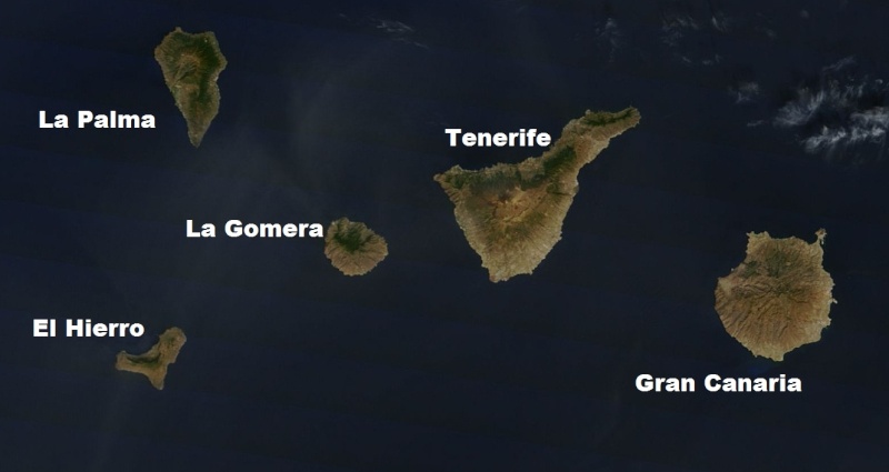
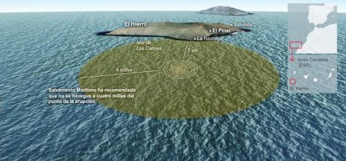
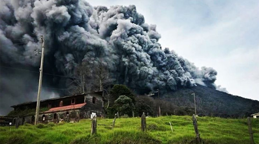
The Mayor of La Frontera (El Hierro), David Cabrera, confirmed in an interview on Radio iron Garoé that ‘underwater eruption’ is taking place about 900 metres beneath the sea surface five kilometres south of La Restinga. The eruption has been ongoing for four hours, the Mayor said.
Spanish newspaper laopionion.es quoted the Minister of emergencies of the Cabildo of El Hierro, Maria of Carmen Morales, as saying the eruption is taking place because ‘the seismic movement of 4.3 occurred on Saturday afternoon caused a fissure, from where the energy is been released’. Scientists remain unclear if the emissions are gas or lava.
http://www.jungleapocalypse.com/featured/subsea-volcanic-eruption-underway-near-el-hierro/
Slide show with illustrations of off-coast eruption: http://www.elmundo.es/elmundo/2011/graficos/oct/s1/hierro.htmlImages same as above link:
http://thetruthbehindthescenes.wordpress.com/2011/10/12/red-alert-and-evacuation-el-hierro-volcano-canary-islands-oct-11-2011/ 


 mader_lapalma.pdf