tMoA

Would you like to react to this message? Create an account in a few clicks or log in to continue.
tMoA

~ The only Home on the Web You'll ever need ~

+21
Aquaries1111
giovonni
arvan33
Floyd
lawlessline
JesterTerrestrial
THEeXchanger
newel
Brook
greybeard
Mercuriel
Sanicle
devakas
hobbit
mudra
burgundia
lindabaker
LeeEllisMusic
MargueriteBee
Carol
HigherLove
25 posters

    The Earthquake/Seismic Activity Log

    Carol
    Carol
    Admin
    Admin


    Posts : 31798
    Join date : 2010-04-07
    Location : Hawaii

    The Earthquake/Seismic Activity Log - Page 30 Empty Re: The Earthquake/Seismic Activity Log

    Post  Carol Wed Mar 14, 2012 10:10 am

    The Earthquake/Seismic Activity Log - Page 30 111-j

    The Earthquake/Seismic Activity Log - Page 30 767994-japan-quake
    http://www.heraldsun.com.au/news/breaking-news/magnitude-68-earthquake-strikes-japanese-coast-tsunami-warning-issued/story-e6frf7jx-1226299726369
    6.8 magnitude earthquake strikes off the coast of Japan- regional tsunami alert issued
    * 20cm tsunami wave hits Japan's northeastern coastline
    * 6.8 magnitude quake struck around 210km off the coast
    *Agency confirmed an earlier 10cm wave had hit land
    March 14, 2012 – JAPAN - A 6.8-magnitude earthquake hit the northeast Japan coast today prompting a regional tsunami warning to be issued, the US Geological Survey (USGS) said. A small tsunami wave has hit Japan's northeastern coastline, officials say, after a strong earthquake rocked the region a year on from the country's worst post-war natural disaster. The earthquake hit 146 miles (235km) from Kushiro on the northeastern island of Hokkaido at a relatively shallow depth of 16 miles (26km). The tsunami was predicted to be around about 20 inches (50cm). No Pacific-wide tsunami threat was issued. It comes just over a year after 9.0-magnitude tremor struck the country’s northeastern coast, leading to a massive tsunami which killed at least 19,000 people. –Herald Sun


    March 14, 2012 – INDIA - An earthquake measuring 3.5 on the Richter scale was felt in western Uttar Pradesh and parts of Delhi and the NCR on Tuesday. The earthquake took place at around 3.37 am. No serious damage has been reported. An official from the Meteorological Department (IMD) said it was a low intensity earthquake with the epicenter at Baghpat in western Uttar Pradesh. This is fifth tremor experienced in Delhi since the beginning of this year. On March 5, a 4.9 magnitude earthquake had shaken Delhi and its adjoining areas in the NCR. Its epicenter was Bahadurgarh on the Haryana-Delhi border. Tremors were felt on September 18 in 2011 too because of an earthquake with an intensity of 6.8 on the Richter scale and its epicenter near the Sikkim-Nepal border. Also, on September 8 in 2011, an earthquake of 4.2 magnitude on Richter Scale hit Delhi with Haryana’s Sonepat as its epicenter. The National Disaster Management Authority has planned a 10-day crash course on Rapid Visual Screening for over 300 engineers. The Municipal Corporation of Delhi and the Delhi Development Authority will help in completing this course. After their training the engineers will assess whether or not buildings in Delhi can withstand quakes. –Deccan Herald


    March 13, 2012 – AUSTRALIA - People in the New South Wales Snowy Mountains are reporting what they say is an earth tremor. Residents at Jindabyne say the earth was shaking around the Kalkite area, on the shores of Lake Jindabyne early this morning. Jim Crocker from the Jindabyne township says the tremor took him by surprise. But he says earth movements are not uncommon when the lake is full. “About 5.20am (AEST) I was laying in bed contemplating getting out and all of a sudden there was an almighty bang and then it rumbled away up towards Kalkite area.,” Mr Crocker said. “We have had these experiences, these tremors in past years and they normally occur round about when we have full lake levels.” –ABC


    _________________
    What is life?
    It is the flash of a firefly in the night, the breath of a buffalo in the wintertime. It is the little shadow which runs across the grass and loses itself in the sunset.

    With deepest respect ~ Aloha & Mahalo, Carol
    Carol
    Carol
    Admin
    Admin


    Posts : 31798
    Join date : 2010-04-07
    Location : Hawaii

    The Earthquake/Seismic Activity Log - Page 30 Empty Re: The Earthquake/Seismic Activity Log

    Post  Carol Sun Mar 18, 2012 11:41 am

    March 16, 2012 – MANILA, Philippines – Officials say a 5.9 magnitude earthquake in the southern Philippines has caused minor damage and a mall stampede, leaving at least 23 people injured. Philippine Institute of Volcanology and Seismology chief Renato Solidum said Friday’s quake was centered 2 kilometers (1.2 miles) off Dinagat Island near southeastern Surigao del Norte province. No tsunami alert was raised. Surigao del Norte Gov. Sol Matugas says in the provincial capital Surigao City, 20 people were injured in a stampede at a mall packed with shoppers. Glass panels were shattered but it was not immediately clear if they were damaged by the quake or broken by panicked shoppers. Matugas says three were hurt in a gymnasium where a cable broke. –NY Daily News


    DATE LAT LON MAG DEPTH km REGION
    18-MAR-2012 07:56:18 54.62 -160.08 4.0 43.0 ALASKA PENINSULA
    18-MAR-2012 06:00:19 0.28 -16.32 4.9 10.0 NORTH OF ASCENSION ISLAND
    18-MAR-2012 04:33:32 -12.03 165.78 4.5 35.0 SANTA CRUZ ISLANDS
    18-MAR-2012 02:56:13 23.66 90.29 4.5 48.4 BANGLADESH
    18-MAR-2012 02:38:17 36.66 49.27 4.4 10.0 WESTERN IRAN
    18-MAR-2012 02:01:54 2.20 96.34 4.6 35.0 NORTHERN SUMATERA, INDONESIA
    18-MAR-2012 01:59:56 -35.10 -111.06 4.7 10.0 SOUTHERN EAST PACIFIC RISE
    18-MAR-2012 00:36:30 39.15 142.16 4.9 53.0 NEAR EAST COAST OF HONSHU, JAPAN
    17-MAR-2012 23:11:30 32.70 140.66 4.5 72.5 SOUTH OF HONSHU, JAPAN
    17-MAR-2012 21:43:17 36.65 144.12 4.7 35.0 OFF EAST COAST OF HONSHU, JAPAN
    17-MAR-2012 19:50:22 -34.65 -107.42 5.1 12.0 SOUTHERN EAST PACIFIC RISE
    17-MAR-2012 19:10:24 -3.29 130.48 4.6 45.8 SERAM, INDONESIA
    17-MAR-2012 17:00:57 3.86 63.39 5.5 10.8 CARLSBERG RIDGE
    17-MAR-2012 15:49:16 3.74 63.45 5.0 10.0 CARLSBERG RIDGE
    17-MAR-2012 15:16:24 3.86 63.39 5.2 10.0 CARLSBERG RIDGE
    17-MAR-2012 15:11:27 3.81 63.46 4.8 10.0 CARLSBERG RIDGE
    17-MAR-2012 13:47:38 38.17 141.53 4.7 56.4 NEAR EAST COAST OF HONSHU, JAPAN
    17-MAR-2012 13:12:57 40.88 144.98 4.5 24.2 OFF EAST COAST OF HONSHU, JAPAN
    17-MAR-2012 13:05:17 -40.05 174.68 4.3 131.2 COOK STRAIT, NEW ZEALAND
    17-MAR-2012 11:55:23 -43.63 172.91 4.3 10.0 SOUTH ISLAND, NEW ZEALAND
    17-MAR-2012 11:24:44 36.85 140.45 4.5 36.2 NEAR EAST COAST OF HONSHU, JAPAN
    17-MAR-2012 11:09:31 19.59 -64.49 4.6 86.0 VIRGIN ISLANDS
    17-MAR-2012 10:25:05 18.46 121.08 4.4 36.8 LUZON, PHILIPPINE ISLANDS
    17-MAR-2012 10:16:25 40.85 145.08 4.8 10.0 OFF EAST COAST OF HONSHU, JAPAN
    17-MAR-2012 09:09:59 49.56 155.61 4.6 40.8 KURIL ISLANDS
    17-MAR-2012 06:21:02 -23.19 179.85 4.9 551.1 SOUTH OF FIJI ISLANDS
    17-MAR-2012 04:08:18 6.94 123.76 4.5 45.4 MINDANAO, PHILIPPINE ISLANDS
    17-MAR-2012 02:55:33 7.30 -35.53 4.5 10.0 CENTRAL MID-ATLANTIC RIDGE
    17-MAR-2012 01:49:28 -7.04 123.41 4.8 631.9 BANDA SEA
    17-MAR-2012 01:38:06 -7.02 123.45 4.3 628.2 BANDA SEA
    17-MAR-2012 01:30:35 19.42 -64.69 4.4 5.0 VIRGIN ISLANDS
    17-MAR-2012 01:11:35 40.80 144.64 4.5 15.9 OFF EAST COAST OF HONSHU, JAPAN
    16-MAR-2012 23:31:55 -33.49 -71.94 4.8 21.7 NEAR COAST OF CENTRAL CHILE
    16-MAR-2012 23:18:20 35.80 140.85 4.7 29.7 NEAR EAST COAST OF HONSHU, JAPAN
    16-MAR-2012 18:46:37 -19.56 169.81 4.9 60.4 VANUATU ISLANDS
    16-MAR-2012 18:37:56 37.81 133.60 4.9 441.4 SEA OF JAPAN
    16-MAR-2012 17:18:34 -22.50 171.11 5.0 84.2 LOYALTY ISLANDS REGION
    16-MAR-2012 16:34:07 3.10 -77.96 4.7 41.6 NEAR WEST COAST OF COLOMBIA
    16-MAR-2012 13:41:31 53.31 158.73 4.5 111.8 NEAR EAST COAST OF KAMCHATKA
    16-MAR-2012 13:35:58 -60.93 -20.86 4.8 10.9 EAST OF SOUTH SANDWICH ISLANDS
    16-MAR-2012 11:36:40 -55.23 -128.90 4.9 10.2 PACIFIC-ANTARCTIC RIDGE
    16-MAR-2012 07:58:06 9.99 125.60 5.8 44.3 MINDANAO, PHILIPPINE ISLANDS
    16-MAR-2012 07:07:23 10.55 93.88 4.8 35.0 ANDAMAN ISLANDS, INDIA
    16-MAR-2012 06:26:13 39.41 144.44 4.8 23.3 OFF EAST COAST OF HONSHU, JAPAN
    16-MAR-2012 06:20:10 -36.85 -73.61 4.7 11.2 NEAR COAST OF CENTRAL CHILE
    16-MAR-2012 05:48:15 23.89 141.88 4.9 83.6 VOLCANO ISLANDS REGION
    16-MAR-2012 03:32:11 -17.55 167.47 4.9 11.9 VANUATU ISLANDS
    16-MAR-2012 00:38:08 49.30 156.05 5.3 45.1 KURIL ISLANDS


    _________________
    What is life?
    It is the flash of a firefly in the night, the breath of a buffalo in the wintertime. It is the little shadow which runs across the grass and loses itself in the sunset.

    With deepest respect ~ Aloha & Mahalo, Carol
    Carol
    Carol
    Admin
    Admin


    Posts : 31798
    Join date : 2010-04-07
    Location : Hawaii

    The Earthquake/Seismic Activity Log - Page 30 Empty Re: The Earthquake/Seismic Activity Log

    Post  Carol Mon Mar 19, 2012 1:50 pm

    More tremors rattle the Philippines - March 19, 2012 – PHILIPPINES – Three mild quakes rocked some areas in Northern Luzon on Saturday afternoon and this morning but no damage to properties was reported, the Philippine Institute of Volcanology and Seismology (Phivolcs) satellite office here said. Phivolcs said that a 3.2 magnitude tremor happened at 7:10 a.m. Sunday with epicenter at 69 kilometers northeast of Laoag City in Ilocos Norte with a depth of 85 kilometers. It was reported that no intensity and aftershocks were recorded. Yesterday, Phivolcs recorded two other earthquakes that rocked Northern Luzon areas. The first happened at about 6:25 p.m. yesterday recording a 4.0 magnitude tremor in some areas in Cagayan province with epicenter at 15 kilometers northwest of Claveria town with a depth of 14 kilometers. Intensity 4 was felt in Claveria, Cagayan and intensity 2 in Sanchez Mira, Cagayan but no reported damage and no aftershocks happened. The other quake was a 3.0 magnitude that happened at about 8:09 p.m. with epicenter located at 24 kilometers northwest of Laoag City with a depth of 32 kilometers but no recorded intensity. Phivolcs said that the three quakes were tectonic in origin caused by the sudden movement of the underground’s rock formation. –PIA.gov http://www.pia.gov.ph/news/index.php?article=381332046084


    _________________
    What is life?
    It is the flash of a firefly in the night, the breath of a buffalo in the wintertime. It is the little shadow which runs across the grass and loses itself in the sunset.

    With deepest respect ~ Aloha & Mahalo, Carol
    mudra
    mudra


    Posts : 23229
    Join date : 2010-04-09
    Age : 69
    Location : belgium

    The Earthquake/Seismic Activity Log - Page 30 Empty Re: The Earthquake/Seismic Activity Log

    Post  mudra Mon Mar 19, 2012 4:57 pm

    2/10/2012 -- MUST SEE ! 2011 earthquakes WORLDWIDE plotted and animated

    https://www.youtube.com/watch?v=2a--NC4Nong


    Love Always
    mudra
    Floyd
    Floyd


    Posts : 4104
    Join date : 2010-04-16

    The Earthquake/Seismic Activity Log - Page 30 Empty Re: The Earthquake/Seismic Activity Log

    Post  Floyd Tue Mar 20, 2012 1:29 pm

    Large quake reported on coast of mexico..buildings shake in Mexico City... 7.9

    Various reports
    Carol
    Carol
    Admin
    Admin


    Posts : 31798
    Join date : 2010-04-07
    Location : Hawaii

    The Earthquake/Seismic Activity Log - Page 30 Empty Re: The Earthquake/Seismic Activity Log

    Post  Carol Tue Mar 20, 2012 3:13 pm

    The Earthquake/Seismic Activity Log - Page 30 Acapulco-de-Juarez-Mexico-map_244x183
    7.6 magnitude earthquake strike near Oaxaca Mexico
    March 20, 2012 – Mexico City (CNN) — A 7.6-magnitude earthquake hit Mexico Tuesday, the U.S. Geological Survey said. The earthquake’s epicenter was about 15 miles (25 km) east of Ometepec, Guerrero, the agency said, and its depth was about 11 miles (17 km). The agency earlier reported the magnitude of the quake at 7.9, but later revised that figure. Residents rushed into the streets after feeling the temblor in Mexico City. Tourists and residents also felt the earthquake in the resort city of Acapulco. Mexican President Felipe Calderon said in a Twitter post that there were no immediate reports of serious damage. In Mexico City, Mayor Marcelo Ebrard sent tweets saying that there was no visible damage in the capital and that the sprawling city’s strategic services and water system were functioning. Regardless, he tweeted, numerous buildings were being evacuated. -CNN

    Twin earthquakes rattle the globe on Spring Equinox
    March 20, 2012 – WORLD – Two major earthquakes have struck the world within 6 minutes of each other. The earthquakes were a deep 6.2 magnitude earthquake near Papua, Indonesia and a much more shallow 7.6 magnitude earthquake which struck about 17.5 km (10.9 miles) deep near Oaxaca, Mexico. The Mexico earthquake’s epicenter was about 186 km (115 miles) from the popular resort area of Acapulco.


    _________________
    What is life?
    It is the flash of a firefly in the night, the breath of a buffalo in the wintertime. It is the little shadow which runs across the grass and loses itself in the sunset.

    With deepest respect ~ Aloha & Mahalo, Carol
    mudra
    mudra


    Posts : 23229
    Join date : 2010-04-09
    Age : 69
    Location : belgium

    The Earthquake/Seismic Activity Log - Page 30 Empty Re: The Earthquake/Seismic Activity Log

    Post  mudra Tue Mar 20, 2012 5:02 pm

    3/20/2012 -- Be ALERT -- Global earthquake activity = 7.6M , 7.9M in Mexico PLUS 6.2M in Indonesia

    https://www.youtube.com/watch?v=7sag28srkWk


    Love Always
    mudra
    Carol
    Carol
    Admin
    Admin


    Posts : 31798
    Join date : 2010-04-07
    Location : Hawaii

    The Earthquake/Seismic Activity Log - Page 30 Empty Re: The Earthquake/Seismic Activity Log

    Post  Carol Wed Mar 21, 2012 11:32 am

    Something's rattling small Wisconsin town
    http://www.cnn.com/2012/03/19/us/wisconsin-noises/index.html
    March 21, 2012 – WISCONSIN – Mysterious explosions. Unexplained shaking. Something’s going on in Clintonville, Wisconsin, but nobody seems to know what it is. The sounds — variously described as rattling pipes, clanging metal, thunder or firecrackers — have continued on and off since early Sunday night in just one part of the small town of 4,600, located about 180 miles northeast of Madison. Accompanying the sounds are vibrations that have shaken homes and household objects in the northeast corner of town, city manager Lisa Kuss said. The sounds were loud enough Monday morning that a CNN journalist could hear them during a cell phone conversation with Kuss. The baffling phenomenon does not appear to have caused any significant damage or injuries, according to Kuss. Workers peered into manhole covers and utility crews tested for leaking natural gas and other problems, but no one has yet to find anything amiss, Kuss said. Geologists and the military don’t seem to have any quick answers, either, she said. U.S. Geological Survey records show no seismic activity anywhere in Wisconsin Sunday or Monday. “It’s like we’re imagining things but it ain’t, because we’re all out and talking to find out what’s going on,” Clintonville resident Verda Shultz told CNN affiliate WLUK. Absent any better explanations for the sounds and sensations that have, well, rattled, the town, residents were left to their own devices to come up with explanations. While the Wisconsin sounds have yet to be explained, mysterious booming noises are not all that unusual. Recent media accounts include reports from North Carolina, Idaho, Tennessee and others. U.S. Geological Survey scientist David Hill even published a paper in 2011 called, “What is That Mysterious Booming Sound?” In it, he said such sounds are so commonplace in upstate New York, they earned the nickname Seneca guns. They’re also well enough known to be named by residents of Belgium, the countries around the Bay of Bengal, Italy and Japan, among other places, he wrote. –CNN


    _________________
    What is life?
    It is the flash of a firefly in the night, the breath of a buffalo in the wintertime. It is the little shadow which runs across the grass and loses itself in the sunset.

    With deepest respect ~ Aloha & Mahalo, Carol
    greybeard
    greybeard


    Posts : 319
    Join date : 2010-04-13
    Age : 78
    Location : Inverness Scotland

    The Earthquake/Seismic Activity Log - Page 30 Empty Re: The Earthquake/Seismic Activity Log

    Post  greybeard Wed Mar 21, 2012 2:23 pm

    Thanks Carol for all your work.
    I really do appreciate it.

    Incidentally this Seismic site has been down for several days-- cant help but wonder why/

    http://aslwww.cr.usgs.gov/Seismic_Data/heli2.shtml

    Chris

    Carol
    Carol
    Admin
    Admin


    Posts : 31798
    Join date : 2010-04-07
    Location : Hawaii

    The Earthquake/Seismic Activity Log - Page 30 Empty Re: The Earthquake/Seismic Activity Log

    Post  Carol Wed Mar 21, 2012 2:36 pm

    You're welcome Chris. That seismic monitor link you gave me is the one I use now because the original is now out of service.


    _________________
    What is life?
    It is the flash of a firefly in the night, the breath of a buffalo in the wintertime. It is the little shadow which runs across the grass and loses itself in the sunset.

    With deepest respect ~ Aloha & Mahalo, Carol
    mudra
    mudra


    Posts : 23229
    Join date : 2010-04-09
    Age : 69
    Location : belgium

    The Earthquake/Seismic Activity Log - Page 30 Empty Re: The Earthquake/Seismic Activity Log

    Post  mudra Wed Mar 21, 2012 4:41 pm

    3/20/2012 -- ALERT! VERIFIED TRUE ! Mexico 7.9M Earthquake PRE-PLANNED = MAN MADE

    https://www.youtube.com/watch?v=Xt1UPfyMx9


    Link to infowars article: http://www.infowars.com/mexican-earthquake-coincides-with-drill-based-around-exact-same-scenario/

    Love Always
    mudra
    arvan33
    arvan33


    Posts : 56
    Join date : 2011-03-12
    Age : 45
    Location : thessaloniki

    The Earthquake/Seismic Activity Log - Page 30 Empty Spot Mega Simulacro en Chiapas

    Post  arvan33 Thu Mar 22, 2012 12:11 pm

    Carol
    Carol
    Admin
    Admin


    Posts : 31798
    Join date : 2010-04-07
    Location : Hawaii

    The Earthquake/Seismic Activity Log - Page 30 Empty Re: The Earthquake/Seismic Activity Log

    Post  Carol Fri Mar 23, 2012 2:30 pm

    Far North Australia rattled by largest earthquake in 15 years
    March 23, 2012 – AUSTRALIA - A magnitude 6.1 earthquake (5.6 USGS), the biggest in the country for 15 years, has rattled Far North South Australia. The earthquake’s epicenter was recorded at shallow depth near Ernabella, 415km North West of Coober Pedy and about 320km south west of Alice Springs, just before 8pm. Geoscience Australia reported the quake could have been felt by people up to 500km away and damage experienced within a 40km radius of the epicenter. Geoscience Australia seismologist David Jepsen said the quake was the biggest in Australia in 15 years. “There are a number of Aboriginal communities near the epicenter and they would have felt the earthquake strongly,” he said. “It is possible there could be some minor damage up there. One of these in a major city would be a different story. “People as far north as Alice Springs and as far south as Coober Pedy and Oodnadatta could have felt this.”An SA Police spokesman said there had been no reports of damage or injuries. Dr. Jepsen said a 4.3 magnitude earthquake struck near the same location about a week ago. The earthquake was the most powerful in Australia since a 6.3 magnitude quake off Collier Bay, on Western Australia’s north coast, on August 10, 1997. It is the second largest quake to be recorded in South Australia. The biggest was a 6.5 magnitude jolt near Beachport in the South East in 1897, which caused chaos at the nearby town of Kingston and was felt in Adelaide. A magnitude 3.3 quake rumbled through Adelaide on October 19 last year. –Herald Sun

    http://www.heraldsun.com.au/news/more-news/adelaide-hit-by-a-61-strong-earthquake-considered-the-biggest-in-australia-in-15-years/story-fn7x8me2-1226308719140


    USGS claims ‘booming noises’ are attributable to a missed earthquake
    March 23, 20112 – WISCONSIN - Sharon Binger cracked basement floor was testament that something actually happened. Now authorities say a minor earthquake occurred this week near the eastern Wisconsin city where researchers have been investigating a series of unexplained booming sounds, federal geologists said Thursday. The U.S. Geological Survey said the 1.5 magnitude earthquake struck Tuesday just after midnight in Clintonville, a town of about 4,600 people about 40 miles west of Green Bay. Geophysicist Paul Caruso told The Associated Press that loud booming noises have been known to accompany earthquakes. It’s possible the mysterious sounds that town officials have been investigating are linked to the quake, he said. Earthquakes can generate seismic energy that moves through rock at thousands of miles per hour, producing a sonic boom when the waves come to the earth’s surface, Caruso said. “To be honest, I’m skeptical that there’d be a sound report associated with such a small earthquake, but it’s possible,” he said. Those reservations didn’t stop Clintonville City Administrator Lisa Kuss from declaring ‘the mystery is solved” at a news conference Thursday evening. She said USGS representatives described the event as a swarm of several small earthquakes in a very short time. “In other places in the United States, a 1.5 earthquake would not be felt,” she said. ‘But the type of rock Wisconsin has transmits seismic energy very well.” The U.S. Geological Survey says earthquakes with magnitude of 2.0 or less aren’t commonly felt by people and are generally recorded only on local seismographs. Caruso said the Tuesday earthquake was discovered after people reported feeling something, and geologists pored through their data to determine that an earthquake did indeed strike. Local residents have reported late-night disturbances since Sunday, including a shaking ground and loud booms that sound like thunder or fireworks. -SF http://www.sfgate.com/cgi-bin/article.cgi?f=/n/a/2012/03/22/national/a141225D83.DTL&tsp=1


    Growing seismic unrest in Middle East: Earthquake hits Dead Sea region, felt in Jerusalem
    The Earthquake/Seismic Activity Log - Page 30 F110121MA08-635x357
    http://www.timesofisrael.com/earthquake-hits-dead-sea-region-shakes-jerusalem/
    March 23, 2012 – ISRAEL – An earthquake measuring 3.7 on the Richter scale shook the Dead Sea area and was felt as far away as Jerusalem on Thursday morning. The quake struck at 6:17 a.m. with an epicenter near Masada, according to the Seismological Institute. There were no reports of injuries or damage from the tremor. MK Zeev Bielski (Kadima), the head of a Knesset subcommittee for Home Front preparedness, used the event to lament the country’s lack of readiness for an earthquake, Maariv reported. Not enough of the country’s buildings have been quake-proofed, as is called for under National Master Plan 38, he said. “NMP 38 is not being implemented and there is a sense of complacency in the government over anything concerning an earthquake,” Bielski said. “This is a matter that should be at the top of national priorities. We need to learn from other countries that invested budgetary and other resources to protect the home front, and not wake up one day and discover we are too late.” Two weeks ago another 3.7 quake rattled the Galilee in the north of the country causing alarm but no injuries or damage. The epicenter for that quake was just over the border in southern Lebanon. In February, a 3.1 earthquake struck the Tiberias area, also without injury or damage. –Times of Israel


    The Earthquake/Seismic Activity Log - Page 30 Images?q=tbn:ANd9GcQauKMPt3lTSZ0tMRUp3HpZ3MxgY5-0qcSmM4EEsOnlPBUk7UrzKQ
    http://news.am/eng/news/98248.html
    Expert says minor earthquakes have become frequent in Armenia
    March 23, 2012 – ARMENIA – The number of earthquakes has recently increased in Armenia and the region. The National Seismic Protection Service (NSPS) of Armenia on Wednesday registered a magnitude-3 tremor, whose epicenter was 13 kilometers southeast of Martuni city. Thirteen earthquakes measuring 3 magnitude or higher have occurred in the region. In an interview with Armenian News-NEWS.am Ashkhen Tovmasyan, representative of the National Seismic Protection Service, said According to her, seismic risks are growing with urban development and with population growth. Risk increases in Armenia when new buildings are built and population grows, if there was no urban development there would be no risks. As Ashkhen Tovmasyan mentioned, currently there are no serious anomaly indicating earthquakes, so there is no need to worry about any earthquake. There are often all the indicators of an earthquake but no quake happens. The expert advised to build buildings in safe places and avoid blocking the main entrances. –News.am


    _________________
    What is life?
    It is the flash of a firefly in the night, the breath of a buffalo in the wintertime. It is the little shadow which runs across the grass and loses itself in the sunset.

    With deepest respect ~ Aloha & Mahalo, Carol
    Carol
    Carol
    Admin
    Admin


    Posts : 31798
    Join date : 2010-04-07
    Location : Hawaii

    The Earthquake/Seismic Activity Log - Page 30 Empty Re: The Earthquake/Seismic Activity Log

    Post  Carol Sun Mar 25, 2012 11:09 am

    The Earthquake/Seismic Activity Log - Page 30 State-jpg
    4.9 magnitude earthquake rattles Hawaii’s Big Island
    March 25, 2012 – HONOLULU – Many people from the Big Island to Oahu felt a magnitude 4.9 earthquake Saturday morning. The quake struck a little after 10:45 a.m., centered just west of Honomu in East Hawaii, at a depth of 27 miles. There are no reports of major damage or injuries. Scientists say the earthquake was too small to generate a tsunami and the weight of the Big Island settling is the likely cause. Geologists at the Hawaiian Volcanoes Observatory say there have been no aftershocks so far, and there’s been no change in the ongoing eruption at Kilauea Volcano. -KITV http://www.kitv.com/news/hawaii/Magnitude-4-9-earthquake-jolts-islands/-/8905354/9695582/-/13hxyhb/-/


    The Earthquake/Seismic Activity Log - Page 30 Guc_eve_sen_20120324072831
    5.1 earthquake rumbles along the outskirts of Santiago, Chile
    March 24, 2012 – CHILE - A moderate earthquake of 5.3 magnitude (5.1 USGS) on the Richter scale struck near Santiago on Saturday morning in the central area of the country, according to the Seismological Service of the University of Chile. The epicenter of the quake, which occurred at 4:28 am was located 43 kilometers northeast of the town of Casablanca, on the border regions of Valparaiso and Santiago, at a depth of 68.9 kilometers. It was in the capital and the fifth region where the earthquake was felt more strongly. According to reports received by the National Bureau of Emegencia (Onemi), the quake reached an intensity of V degrees on the Mercalli scale in Santiago, the Andes, Talagante, Tiltil, Valparaiso, Viña del Mar, Quintero, San Antonio, San Felipe, and German Village. V grades also recorded in Los Vilos, in the Coquimbo Region. In the Region of O’Higgins, meanwhile, the earthquake was felt with a force of IV degrees in Rancagua and III degrees on Christmas, Pichilemu, San Fernando and Santa Cruz. In the El Maule reached II degrees in Curicó and Order. It reached in the Fourth Region II degrees in La Serena. The Onemi received no reports of damage or injured as a result of the earthquake. –El Mostrador


    The Earthquake/Seismic Activity Log - Page 30 Images?q=tbn:ANd9GcQYU83pg0IHNMQScJk1gHHirsvMSWLlCADl1wCOVA6q6IufqozS
    Three villiages in Saudi Arabia rattled by tremor
    March 24, 2012 – SAUDI ARABIA – A tremor has hit three villages in Sabya governorate in Jizan region – Mashlaha, Al-Hayja and Al-Wajeeh. The Director General of the National Center for Earthquakes and Volcanoes Hani Zahrani said the earthquake, which measured 3.1 on the Richter scale and was felt in Al-Kudmi took place 80 km from Jizan. He insisted it was ordinary and did not cause any damage or casualties. The area in which the tremor occurred is seismically active and is regularly hit by tremors of different intensities. The Director of Civil Defense in Jizan region Brig. Hassan Bin Ali Al-Qufaili said “there are plans readied by the Directorate of Civil Defense to deal with damage that occurs because of earthquakes. These plans include coordination with authorities affiliated to Civil Defense. The plans will be implemented in case damage occurs, God forbid.” The Acting Spokesman of the Directorate of Civil Defense in Jizan region, First Lt. Musslih Al-Ghamdi revealed that the Command and Control Center in the Civil Defense received a report from the National Center for Earthquakes and Volcanoes on the occurrence of an earthquake northeast of Jizan measuring 3.05 on the Richter scale at 1.19 AM Wednesday. He said: “Some of the residents of Al-Kudmi felt the earthquake. Immediately, Civil Defense teams were dispatched to inspect the location. Thanks to Allah, there was no damage to property or any casualties.’ A resident of Al-Kudmi Muhammad Al-Najmi told Okaz/Saudi Gazette that he and his family were asleep when they heard a terrifying explosion at 1:00 A.M. followed by an earthquake. Expatriate Abdul Qader said: “When the earthquake hit the area, some of the furniture toppled. Fortunately, no cracks occurred in the building. Some citizens came rushing out of their homes for fear that they might collapse especially since these homes are not strongly built.” –Saudi Gazette


    _________________
    What is life?
    It is the flash of a firefly in the night, the breath of a buffalo in the wintertime. It is the little shadow which runs across the grass and loses itself in the sunset.

    With deepest respect ~ Aloha & Mahalo, Carol
    Carol
    Carol
    Admin
    Admin


    Posts : 31798
    Join date : 2010-04-07
    Location : Hawaii

    The Earthquake/Seismic Activity Log - Page 30 Empty Re: The Earthquake/Seismic Activity Log

    Post  Carol Sun Mar 25, 2012 7:06 pm

    Magnitude 7.1 - MAULE, CHILE
    http://earthquake.usgs.gov/earthquakes/recenteqsww/Quakes/usc0008pwq.html
    Magnitude: 7.1
    Date-Time: Sunday, March 25, 2012 at 06:37:06 PM at epicenter
    Time of Earthquake in other Time Zones
    Location: 35.183°S, 71.792°W
    Depth: 34.8 km (21.6 miles)
    Region: MAULE, CHILE

    Distances
    27 km (16 miles) NNW of Talca, Maule, Chile
    55 km (34 miles) WSW of Curico, Maule, Chile
    99 km (61 miles) NNE of Cauquenes, Maule, Chile
    219 km (136 miles) SSW of SANTIAGO, Region Metropolitana, Chile


    _________________
    What is life?
    It is the flash of a firefly in the night, the breath of a buffalo in the wintertime. It is the little shadow which runs across the grass and loses itself in the sunset.

    With deepest respect ~ Aloha & Mahalo, Carol
    mudra
    mudra


    Posts : 23229
    Join date : 2010-04-09
    Age : 69
    Location : belgium

    The Earthquake/Seismic Activity Log - Page 30 Empty Re: The Earthquake/Seismic Activity Log

    Post  mudra Mon Mar 26, 2012 3:40 am

    3/25/2012 -- 7.2 magnitude earthquake -- Chile / Andes Mountains

    https://www.youtube.com/watch?v=jrDcHCb08Ls


    Love Always
    mudra
    Carol
    Carol
    Admin
    Admin


    Posts : 31798
    Join date : 2010-04-07
    Location : Hawaii

    The Earthquake/Seismic Activity Log - Page 30 Empty Re: The Earthquake/Seismic Activity Log

    Post  Carol Tue Mar 27, 2012 12:17 pm

    The Earthquake/Seismic Activity Log - Page 30 Japan
    March 27, 2012 – JAPAN - An earthquake with a preliminary magnitude of 6.0 struck northern Japan on Tuesday, according to the U.S. Geological Survey. There was no risk of a tsunami. No injuries or damage were immediately reported. The epicenter was off the coast of Iwate, which was a region that was heavily damaged by last year’s massive quake and tsunami. –ABC7

    The Earthquake/Seismic Activity Log - Page 30 T4
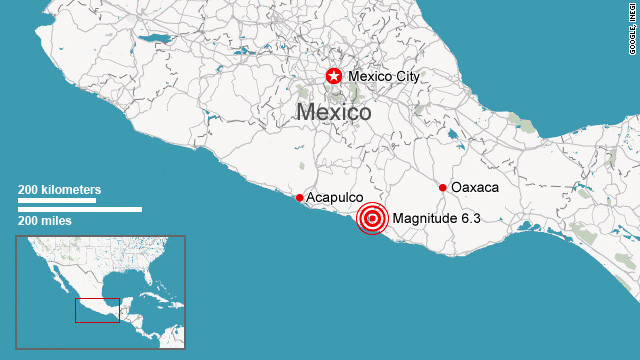
    March 26, 2012 – MEXICO - A 6.0 magnitude earthquake erupted along a boundary of the Pacific and Cosco tectonic plates at a depth of 9.9 km (6.1 miles) known as the Northeast Pacific Rise. The earthquake erupted after the region was shaken by double 5.0+ foreshocks. The epicenter of the 6.0 earthquake was 862 km (535 miles) SSW of Acapulco, Guerrero, Mexico. The region is still reeling from the effects of the 7.4 earthquake which struck Oaxaca Mexico on March 20. The red squares on the tectonic plate map (above) reflect the earthquakes that have struck tectonic plate boundaries over the last 24 hours. It is a clear indication that seismic stresses continue to mount along some of these high-risk regions. –The Extinction Protocol


    DATE LAT LON MAG DEPTH km REGION
    27-MAR-2012 11:00:43 39.87 142.12 6.0 10.0 NEAR EAST COAST OF HONSHU, JAPAN
    27-MAR-2012 09:01:41 -5.66 146.74 5.0 50.0 EASTERN NEW GUINEA REG., P.N.G.
    27-MAR-2012 07:17:49 -22.25 170.33 4.9 10.0 LOYALTY ISLANDS REGION
    27-MAR-2012 02:46:12 -37.00 -73.28 4.4 22.5 NEAR COAST OF CENTRAL CHILE
    26-MAR-2012 22:21:06 4.06 126.42 4.9 64.4 TALAUD ISLANDS, INDONESIA
    26-MAR-2012 21:02:24 -4.06 130.29 5.3 55.7 BANDA SEA
    26-MAR-2012 18:12:54 10.20 -104.03 6.0 9.9 NORTHERN EAST PACIFIC RISE
    26-MAR-2012 18:09:29 12.60 144.87 4.9 55.0 SOUTH OF MARIANA ISLANDS
    26-MAR-2012 17:58:27 10.19 -104.28 5.0 10.3 NORTHERN EAST PACIFIC RISE
    26-MAR-2012 17:48:44 10.15 -104.01 5.1 10.1 NORTHERN EAST PACIFIC RISE
    26-MAR-2012 16:58:09 -30.05 60.68 5.7 3.1 SOUTHWEST INDIAN RIDGE
    26-MAR-2012 16:11:42 15.43 -97.92 5.0 21.1 NEAR COAST OF OAXACA, MEXICO
    26-MAR-2012 14:04:13 -44.50 -78.62 4.9 42.4 OFF COAST OF SOUTHERN CHILE
    26-MAR-2012 11:22:00 -9.36 107.82 4.5 41.1 SOUTH OF JAWA, INDONESIA
    26-MAR-2012 10:46:28 16.17 -98.13 5.0 10.2 NEAR COAST OF GUERRERO, MEXICO
    26-MAR-2012 10:35:36 39.14 42.32 5.2 23.1 TURKEY
    26-MAR-2012 09:30:19 66.34 -174.63 5.5 12.9 NEAR N. COAST OF EASTERN SIBERIA
    26-MAR-2012 05:29:11 -29.27 -69.31 4.8 97.4 CHILE-ARGENTINA BORDER REGION
    26-MAR-2012 03:00:17 41.79 19.40 4.8 16.3 ALBANIA
    26-MAR-2012 02:33:50 40.38 142.37 4.8 34.8 NEAR EAST COAST OF HONSHU, JAPAN
    26-MAR-2012 02:01:16 14.07 -90.22 4.7 18.9 GUATEMALA
    26-MAR-2012 00:06:19 27.75 58.83 5.0 67.2 SOUTHERN IRAN
    25-MAR-2012 23:03:36 -35.10 -72.68 4.7 43.6 NEAR COAST OF CENTRAL CHILE
    25-MAR-2012 23:01:06 -12.61 -77.38 4.6 44.7 NEAR COAST OF PERU
    25-MAR-2012 22:37:06 -35.20 -71.78 7.1 30.0 CENTRAL CHILE
    25-MAR-2012 20:45:41 -19.07 168.72 4.9 10.2 VANUATU ISLANDS
    25-MAR-2012 18:33:56 10.64 -85.87 4.7 39.3 COSTA RICA
    25-MAR-2012 17:07:22 1.52 126.50 4.6 45.4 NORTHERN MOLUCCA SEA
    25-MAR-2012 15:13:09 -17.67 -178.66 4.2 609.0 FIJI ISLANDS REGION
    25-MAR-2012 14:50:46 40.67 145.20 4.7 10.0 OFF EAST COAST OF HONSHU, JAPAN
    25-MAR-2012 14:50:35 40.13 43.29 4.3 4.7 GEORGIA-ARMENIA-TURKEY BORD REG.
    25-MAR-2012 14:18:44 -21.60 -178.85 4.6 566.8 FIJI ISLANDS REGION
    25-MAR-2012 13:59:22 -18.63 -178.78 5.1 507.5 FIJI ISLANDS REGION
    25-MAR-2012 13:41:01 47.73 153.63 4.9 84.7 KURIL ISLANDS
    25-MAR-2012 13:22:41 37.68 141.61 5.2 60.5 NEAR EAST COAST OF HONSHU, JAPAN
    25-MAR-2012 12:38:56 36.29 70.89 4.6 95.7 HINDU KUSH REGION, AFGHANISTAN
    25-MAR-2012 12:28:53 32.47 46.98 4.6 30.6 IRAN-IRAQ BORDER REGION
    25-MAR-2012 12:22:58 38.55 141.58 4.6 51.6 NEAR EAST COAST OF HONSHU, JAPAN
    25-MAR-2012 11:30:17 6.68 -72.87 4.3 160.0 NORTHERN COLOMBIA
    25-MAR-2012 11:27:16 -16.46 177.87 4.7 35.0 FIJI ISLANDS
    25-MAR-2012 10:26:53 -60.81 -23.86 5.2 33.1 SOUTH SANDWICH ISLANDS REGION
    25-MAR-2012 10:23:16 18.19 122.30 4.6 26.2 LUZON, PHILIPPINE ISLANDS
    25-MAR-2012 10:06:20 33.73 89.33 4.5 25.0 XIZANG
    25-MAR-2012 06:43:48 -20.06 -176.31 5.7 247.5 FIJI ISLANDS REGION
    25-MAR-2012 06:30:26 10.95 -86.30 4.6 44.8 OFF COAST OF COSTA RICA
    25-MAR-2012 06:22:01 15.96 -98.14 4.7 19.9 OFF COAST OF GUERRERO, MEXICO
    25-MAR-2012 04:46:54 39.51 20.49 4.8 10.0 GREECE-ALBANIA BORDER REGION
    25-MAR-2012 03:59:09 -4.12 -104.27 4.8 10.0 CENTRAL EAST PACIFIC RISE
    25-MAR-2012 03:13:10 15.53 -97.58 4.2 20.0 NEAR COAST OF OAXACA, MEXICO
    25-MAR-2012 02:24:47 16.68 -99.25 4.3 20.0 NEAR COAST OF GUERRERO, MEXICO
    25-MAR-2012 01:55:30 16.38 -97.77 4.7 20.0 OAXACA, MEXICO
    25-MAR-2012 01:46:26 16.39 -97.81 4.6 20.0 OAXACA, MEXICO
    25-MAR-2012 01:05:34 -54.57 -135.90 5.2 10.0 PACIFIC-ANTARCTIC RIDGE


    _________________
    What is life?
    It is the flash of a firefly in the night, the breath of a buffalo in the wintertime. It is the little shadow which runs across the grass and loses itself in the sunset.

    With deepest respect ~ Aloha & Mahalo, Carol
    Carol
    Carol
    Admin
    Admin


    Posts : 31798
    Join date : 2010-04-07
    Location : Hawaii

    The Earthquake/Seismic Activity Log - Page 30 Empty Re: The Earthquake/Seismic Activity Log

    Post  Carol Fri Mar 30, 2012 12:21 pm

    March 30, 2012 – SAN DIEGO, CA – The USGS confirmed a small earthquake struck San Diego County Thursday night. The quake struck with a magnitude of 3.3 and at a depth of 7 miles at 11:09 p.m. The epicenter of the earthquake was four miles south-southeast of the Palomar Observatory, 17 miles northeast of Escondido and 39 miles north-northeast of San Diego, according to a computer-generated USGS report. News stations in the area said they received over a dozen calls from concerned viewers who described the earthquake as very loud and said it was accompanied by three eerie booms. There were also reports of violent shaking. No injuries or damage was reported the tremor.


    _________________
    What is life?
    It is the flash of a firefly in the night, the breath of a buffalo in the wintertime. It is the little shadow which runs across the grass and loses itself in the sunset.

    With deepest respect ~ Aloha & Mahalo, Carol
    Carol
    Carol
    Admin
    Admin


    Posts : 31798
    Join date : 2010-04-07
    Location : Hawaii

    The Earthquake/Seismic Activity Log - Page 30 Empty Re: The Earthquake/Seismic Activity Log

    Post  Carol Sat Mar 31, 2012 4:20 pm

    DATE LAT LON MAG DEPTH km REGION
    31-MAR-2012 09:47:24 10.44 -63.17 4.9 9.8 NEAR COAST OF VENEZUELA
    31-MAR-2012 09:18:38 49.24 -176.30 5.1 9.9 SOUTH OF ALEUTIAN ISLANDS
    31-MAR-2012 09:04:40 -23.55 179.37 6.2 543.5 SOUTH OF FIJI ISLANDS
    31-MAR-2012 04:16:54 36.50 71.28 4.9 222.3 AFGHANISTAN-TAJIKISTAN BORD REG.
    31-MAR-2012 03:58:18 1.04 101.53 4.5 11.0 NORTHERN SUMATERA, INDONESIA
    31-MAR-2012 00:05:08 -23.21 -66.77 4.6 196.7 JUJUY PROVINCE, ARGENTINA
    30-MAR-2012 23:05:16 -5.87 147.73 4.8 41.8 EASTERN NEW GUINEA REG., P.N.G.
    30-MAR-2012 22:02:11 4.58 95.09 5.1 59.7 NORTHERN SUMATERA, INDONESIA
    30-MAR-2012 20:04:40 24.47 126.45 4.8 31.6 RYUKYU ISLANDS
    30-MAR-2012 19:51:04 -6.61 154.58 5.2 45.7 SOLOMON ISLANDS
    30-MAR-2012 18:47:38 -41.09 175.49 4.8 29.5 NORTH ISLAND, NEW ZEALAND
    30-MAR-2012 18:16:13 14.52 -93.01 5.4 40.4 NEAR COAST OF CHIAPAS, MEXICO
    30-MAR-2012 17:39:55 -7.07 125.13 4.6 519.4 BANDA SEA
    30-MAR-2012 17:21:05 -21.14 -174.59 5.0 11.2 TONGA ISLANDS
    30-MAR-2012 14:38:53 17.55 -94.26 4.6 136.7 CHIAPAS, MEXICO
    30-MAR-2012 12:54:53 40.86 144.80 4.5 10.3 OFF EAST COAST OF HONSHU, JAPAN
    30-MAR-2012 11:19:19 79.94 0.99 4.9 9.9 GREENLAND SEA
    30-MAR-2012 10:55:24 40.84 144.78 5.1 9.9 OFF EAST COAST OF HONSHU, JAPAN
    30-MAR-2012 09:40:56 39.76 142.36 4.6 35.3 NEAR EAST COAST OF HONSHU, JAPAN
    30-MAR-2012 09:38:59 -21.03 -178.85 5.3 595.9 FIJI ISLANDS REGION
    30-MAR-2012 08:55:51 -14.77 167.47 4.9 134.5 VANUATU ISLANDS
    30-MAR-2012 08:24:17 39.21 144.53 4.7 75.7 OFF EAST COAST OF HONSHU, JAPAN
    30-MAR-2012 07:12:52 -35.20 -72.19 4.5 38.3 NEAR COAST OF CENTRAL CHILE
    30-MAR-2012 06:19:33 -35.87 -101.47 5.0 10.0 SOUTHEAST OF EASTER ISLAND
    30-MAR-2012 04:38:33 37.55 141.23 5.1 53.8 NEAR EAST COAST OF HONSHU, JAPAN
    30-MAR-2012 00:52:10 42.65 141.95 4.4 135.3 HOKKAIDO, JAPAN REGION
    29-MAR-2012 23:57:19 -2.04 -78.53 4.7 63.5 ECUADOR
    29-MAR-2012 22:31:30 57.38 -154.31 4.5 19.2 KODIAK ISLAND REGION
    29-MAR-2012 14:23:49 -25.68 -68.90 4.3 91.4 CHILE-ARGENTINA BORDER REGION
    29-MAR-2012 14:16:04 -4.20 133.70 4.7 18.0 IRIAN JAYA REGION, INDONESIA
    29-MAR-2012 10:13:34 38.45 30.07 4.0 15.5 TURKEY
    29-MAR-2012 06:51:29 -15.73 168.02 4.7 204.6 VANUATU ISLANDS
    29-MAR-2012 06:05:44 4.67 127.72 4.6 264.4 TALAUD ISLANDS, INDONESIA
    29-MAR-2012 05:54:40 -5.25 145.52 4.4 109.1 EASTERN NEW GUINEA REG., P.N.G.
    29-MAR-2012 02:52:37 -5.67 130.16 4.9 23.2 BANDA SEA
    29-MAR-2012 00:36:40 -40.94 44.64 5.3 10.0 SOUTHWEST INDIAN RIDGE
    29-MAR-2012 00:23:21 21.60 94.75 4.5 120.8 MYANMAR
    29-MAR-2012 00:19:11 5.12 94.83 4.4 69.6 NORTHERN SUMATERA, INDONESIA


    _________________
    What is life?
    It is the flash of a firefly in the night, the breath of a buffalo in the wintertime. It is the little shadow which runs across the grass and loses itself in the sunset.

    With deepest respect ~ Aloha & Mahalo, Carol
    Carol
    Carol
    Admin
    Admin


    Posts : 31798
    Join date : 2010-04-07
    Location : Hawaii

    The Earthquake/Seismic Activity Log - Page 30 Empty Re: The Earthquake/Seismic Activity Log

    Post  Carol Tue Apr 03, 2012 3:52 am

    The Earthquake/Seismic Activity Log - Page 30 120402064756-mexico-earthquake-april-2-story-top
    6.0 magnitude earthquake strikes Oaxaca region of Mexico
    April 2, 2012 – MEXICO – A powerful earthquake with a preliminary magnitude of 6.3 (6.0 downgraedd USGS) struck southern Mexico on Monday, the U.S. Geological Survey said. The quake’s epicenter was about 17 miles (27 kilometers) from Ometepec, Guerrero. It was about 7.6 miles (12 kilometers) deep, the USGS said. There were no immediate reports of damage or injuries. Officials described the quake as an aftershock of the 7.4-magnitude temblor which struck in the same area on March 20, damaging hundreds of homes. There have been 280 aftershocks since that quake, Mexico’s National Seismological Survey reported. Residents felt Monday’s quake in Mexico City, hundreds of miles from the epicenter. There were no initial reports of major damage in the capital, Mayor Marcelo Ebrard said on Twitter. The USGS describes Mexico as one of the most seismically active areas of the world. The country sees an average of seven earthquakes daily with a magnitude greater than 3.0, according to Mexico’s National Seismological Service. -CNN


    _________________
    What is life?
    It is the flash of a firefly in the night, the breath of a buffalo in the wintertime. It is the little shadow which runs across the grass and loses itself in the sunset.

    With deepest respect ~ Aloha & Mahalo, Carol
    Carol
    Carol
    Admin
    Admin


    Posts : 31798
    Join date : 2010-04-07
    Location : Hawaii

    The Earthquake/Seismic Activity Log - Page 30 Empty Re: The Earthquake/Seismic Activity Log

    Post  Carol Fri Apr 06, 2012 11:40 am

    DATE LAT LON MAG DEPTH km REGION
    06-APR-2012 16:15:55 -4.53 153.50 6.2 85.4 NEW IRELAND REGION, P.N.G.
    06-APR-2012 08:50:57 -21.22 -174.46 5.0 35.0 TONGA ISLANDS
    06-APR-2012 06:42:56 51.46 16.19 4.4 5.0 POLAND
    06-APR-2012 06:28:40 1.99 97.85 4.9 56.9 NORTHERN SUMATERA, INDONESIA
    06-APR-2012 06:03:28 -6.53 129.13 4.7 214.5 BANDA SEA
    06-APR-2012 04:48:07 45.73 141.95 4.2 297.4 HOKKAIDO, JAPAN REGION
    06-APR-2012 02:41:12 28.98 132.08 4.5 10.0 WEST OF BONIN ISLANDS
    06-APR-2012 02:04:47 -4.73 154.09 4.1 55.0 SOLOMON ISLANDS
    06-APR-2012 01:31:40 16.34 -97.87 4.4 20.0 OAXACA, MEXICO
    05-APR-2012 22:55:43 57.37 -147.12 4.0 38.8 GULF OF ALASKA
    05-APR-2012 14:19:31 1.46 97.12 4.5 46.1 NORTHERN SUMATERA, INDONESIA
    05-APR-2012 11:04:09 56.17 -156.61 4.2 60.8 ALASKA PENINSULA
    05-APR-2012 05:45:35 36.65 71.40 4.3 150.1 AFGHANISTAN-TAJIKISTAN BORD REG.
    05-APR-2012 05:14:20 53.13 160.28 5.0 62.3 NEAR EAST COAST OF KAMCHATKA
    05-APR-2012 04:56:22 36.19 4.56 4.6 10.1 NORTHERN ALGERIA
    05-APR-2012 04:40:21 6.24 -82.55 4.5 11.5 SOUTH OF PANAMA
    05-APR-2012 03:58:42 14.54 -92.80 4.4 53.1 NEAR COAST OF CHIAPAS, MEXICO
    05-APR-2012 01:44:39 -10.32 123.77 4.7 15.7 TIMOR REGION, INDONESIA
    04-APR-2012 22:41:20 -16.31 177.81 4.8 10.0 FIJI ISLANDS
    04-APR-2012 20:27:29 -4.03 152.09 5.5 16.7 NEW BRITAIN REGION, P.N.G.
    04-APR-2012 16:20:54 -3.13 139.78 4.8 124.8 IRIAN JAYA, INDONESIA
    04-APR-2012 14:18:40 39.23 41.07 4.3 35.0 TURKEY
    04-APR-2012 12:10:47 7.41 -34.54 4.9 10.0 CENTRAL MID-ATLANTIC RIDGE
    04-APR-2012 11:05:16 36.94 36.94 4.2 8.7 JORDAN - SYRIA REGION
    04-APR-2012 09:41:40 38.88 43.57 4.6 2.6 TURKEY
    04-APR-2012 06:11:07 19.52 -92.99 4.5 15.2 BAY OF CAMPECHE
    04-APR-2012 05:41:37 6.23 -82.70 4.3 10.0 SOUTH OF PANAMA
    04-APR-2012 05:21:35 55.82 162.47 4.6 39.1 NEAR EAST COAST OF KAMCHATKA
    04-APR-2012 04:28:59 19.01 -103.41 5.0 83.1 JALISCO, MEXICO
    04-APR-2012 02:28:08 20.47 -93.02 4.3 15.2 BAY OF CAMPECHE
    04-APR-2012 00:33:00 37.90 29.43 4.3 8.8 TURKEY
    04-APR-2012 00:12:58 36.87 142.00 4.6 25.3 OFF EAST COAST OF HONSHU, JAPAN


    _________________
    What is life?
    It is the flash of a firefly in the night, the breath of a buffalo in the wintertime. It is the little shadow which runs across the grass and loses itself in the sunset.

    With deepest respect ~ Aloha & Mahalo, Carol
    Carol
    Carol
    Admin
    Admin


    Posts : 31798
    Join date : 2010-04-07
    Location : Hawaii

    The Earthquake/Seismic Activity Log - Page 30 Empty Re: The Earthquake/Seismic Activity Log

    Post  Carol Sat Apr 07, 2012 10:40 am

    The Earthquake/Seismic Activity Log - Page 30 Images?q=tbn:ANd9GcQobCMhdaOf0Ps7Q0mL-lYbAEKQAtjHSWes072edAZc3ea26q6UNw
    Santa Clara County rattled by 13 earthquakes in seven days
    April 7, 2012 – CALIFORNIA – Thirteen earthquakes, averaging a magnitude of 1.9 on the Richter scale, struck Santa Clara County this week. The largest quake, with a magnitude of 2.9, occurred just nine miles north of Morgan Hill at 2:42 a.m. Thursday, according to the U.S. Geological Survey website. Three tremors rocked the county on Friday alone, with a 1.8 magnitude quake striking three miles south of Los Altos and 20 minutes from Campbell at 5:11 p.m. A slightly smaller quake, registering at 1.5, hit three miles from Los Altos the day before at 11:59 a.m. Multiple tremors shook the South County area, especially in Gilroy and Morgan Hill. In Gilroy, a 1.8 magnitude quake hit four miles south of the Garlic Capital at 4:08 p.m. Thursday, and three more hit Gilroy Wednesday. The first struck a few miles from Gilroy at 2:29 a.m. with a magnitude of 2.0. The second, a 1.2, hit three miles away at 4:28 p.m. and another 2.0 quake hit the Garlic City about 10 minutes later in the same area. On Tuesday, a 1.2 magnitude quake hit five miles from San Martin at 7:19 p.m., along with additional smaller quakes striking near the same area. To view the quakes that sent trembles through the county in the earlier portion of the week, view the UGSG earthquake list. –Gilroy Patch


    The Earthquake/Seismic Activity Log - Page 30 Images?q=tbn:ANd9GcScApu6w5lGOtIfE1nuPX7xElxE6FCJSNLV6QZhBok_6ylH0sO9bw
    6.2 magnitude earthquake strikes off the coast of Papua New Guinea
    April 6, 2012 – PAPUA, NG – A 6.2-magnitude earthquake struck off Papua New Guinea early Saturday, the US Geological Survey said, but there were no immediate reports of damage and no tsunami warning was issued. The quake hit at 02:15 am (16:15 GMT) 150 kilometers (93 miles) east of Rabaul, in Papua New Guinea’s East New Britain province and 885 kilometers northeast of the capital Port Moresby at a depth of 85 kilometers. Quakes of such magnitude are common in impoverished Papua New Guinea, which sits on the so-called “Pacific Ring of Fire“, a hotspot for seismic activity due to friction between tectonic plates. Last month, the country was hit by a 6.7-magnitude earthquake but while the tremor was widely felt it was too deep, at 105 kilometers, to cause much damage. Earlier in March, a 6.4-magnitude earthquake struck the New Britain region of the country, with no damage or injuries reported. A giant tsunami in 1998, caused by an undersea earthquake, killed more than 2,000 people near Aitape, on the country’s northwest coast. –Times of India


    07-APR-2012 11:58:07 -6.78 149.55 5.8 39.6 NEW BRITAIN REGION, P.N.G.
    07-APR-2012 08:44:48 -20.84 -178.18 4.8 548.7 FIJI ISLANDS REGION
    07-APR-2012 03:50:18 9.55 -79.10 4.4 20.4 PANAMA
    07-APR-2012 03:26:46 67.89 -166.28 4.3 10.0 BERING STRAIT
    07-APR-2012 00:57:21 -4.54 153.55 4.9 113.2 NEW IRELAND REGION, P.N.G.
    06-APR-2012 19:24:12 -3.38 100.45 5.5 5.5 SOUTHERN SUMATERA, INDONESIA


    _________________
    What is life?
    It is the flash of a firefly in the night, the breath of a buffalo in the wintertime. It is the little shadow which runs across the grass and loses itself in the sunset.

    With deepest respect ~ Aloha & Mahalo, Carol
    Carol
    Carol
    Admin
    Admin


    Posts : 31798
    Join date : 2010-04-07
    Location : Hawaii

    The Earthquake/Seismic Activity Log - Page 30 Empty Re: The Earthquake/Seismic Activity Log

    Post  Carol Mon Apr 09, 2012 3:08 pm

    Swarm of small earthquakes strike near Lake Tahoe region
    The Earthquake/Seismic Activity Log - Page 30 Images?q=tbn:ANd9GcQ6xVl02fa3SFcJvxuvDf8_bXPJEoKvfn34tfN3Mzm4xzBIGMSv
    April 9, 2012 – NEVADO - A series of small earthquakes over the weekend in the area between Mt. Rose and Incline Village is nothing out of the norm, a seismologist for the University of Nevada, Reno said Monday. More than a dozen small tremors registering between 1.0 and 1.9 on the Richter scale were recorded on Sunday, most taking place about 6 miles north of Incline Village. The quakes were so small, and at a depth that they likely weren’t felt. “I wouldn’t consider this unusual,” said Diane Depolo, a seismologist with the UNR Seismological Lab. “These are pretty small, and depth-wise, they’re what we’d consider normal depth for that area.” The quakes were about 8 to 12 kilometers deep. Depolo said it would normally take a quake of 2.5 to 3 to be felt at that depth. Depolo said this cluster of quakes is different from those that affected the Verdi-Mogul area in past years because the Verdi-Mogul quakes were much shallower. A 1.1 quake was registered in the Mt. Rose area on Monday morning. –RGJ


    DATE LAT LON MAG DEPTH km REGION
    09-APR-2012 06:54:39 51.34 -179.70 4.8 89.7 ANDREANOF ISLANDS, ALEUTIAN IS.
    09-APR-2012 06:43:05 48.55 152.79 4.3 173.1 KURIL ISLANDS
    09-APR-2012 06:01:09 -15.54 167.43 4.7 125.6 VANUATU ISLANDS
    09-APR-2012 02:30:24 -5.49 147.34 4.8 210.7 EASTERN NEW GUINEA REG., P.N.G.
    08-APR-2012 21:43:32 24.09 122.30 5.4 25.5 TAIWAN REGION
    08-APR-2012 19:18:00 16.21 -97.68 4.2 14.1 OAXACA, MEXICO
    08-APR-2012 17:42:47 36.36 143.01 4.6 25.7 OFF EAST COAST OF HONSHU, JAPAN
    08-APR-2012 16:00:08 20.81 120.80 4.7 10.0 PHILIPPINE ISLANDS REGION
    08-APR-2012 15:11:48 5.06 94.17 4.5 47.6 NORTHERN SUMATERA, INDONESIA
    08-APR-2012 15:03:31 4.84 94.14 4.3 73.0 OFF W COAST OF NORTHERN SUMATERA
    08-APR-2012 13:11:22 53.73 -163.50 4.5 34.7 UNIMAK ISLAND REGION
    08-APR-2012 08:50:02 -6.94 125.31 5.1 559.3 BANDA SEA
    08-APR-2012 06:24:40 2.16 -101.25 4.8 10.1 GALAPAGOS TRIPLE JUNCTION REGION
    08-APR-2012 05:44:53 37.36 141.88 4.4 35.0 NEAR EAST COAST OF HONSHU, JAPAN
    08-APR-2012 05:44:11 4.18 126.43 4.6 92.5 TALAUD ISLANDS, INDONESIA
    08-APR-2012 02:31:21 1.97 -101.12 4.4 10.0 GALAPAGOS TRIPLE JUNCTION REGION


    _________________
    What is life?
    It is the flash of a firefly in the night, the breath of a buffalo in the wintertime. It is the little shadow which runs across the grass and loses itself in the sunset.

    With deepest respect ~ Aloha & Mahalo, Carol
    Floyd
    Floyd


    Posts : 4104
    Join date : 2010-04-16

    The Earthquake/Seismic Activity Log - Page 30 Empty Re: The Earthquake/Seismic Activity Log

    Post  Floyd Wed Apr 11, 2012 4:56 am

    Tsunami warning 8.9 Indonesia

    http://www.bbc.co.uk/news/world-asia-17675399

    Geological Survey say Tsunami unlikely
    arvan33
    arvan33


    Posts : 56
    Join date : 2011-03-12
    Age : 45
    Location : thessaloniki

    The Earthquake/Seismic Activity Log - Page 30 Empty CNN LIVE NEWS 8,7 earthquake in Sumatra Indonesia, Tsunami alert in 27 counties

    Post  arvan33 Wed Apr 11, 2012 5:03 am


      Current date/time is Sun May 19, 2024 3:52 am