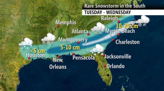
Polar Vortex Collapse, Arctic Freeze Imminent
http://theweathercentre.blogspot.de/2012/12/polar-vortex-collapse-arctic-freeze.html?showComment=1356230240926
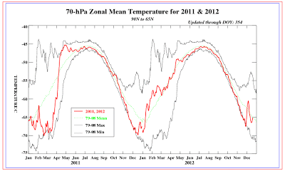
A polar vortex collapse and subsequent Arctic Freeze is imminent across the nation in January. The stratospheric temperatures at the 70mb level, commonly known as one of the lowest levels in the stratosphere. Looking at the 2012 section, that recent stratospheric temperatures have taken an uptick to normal temperatures, expressed by the dashed green line. This uptick indicates that the stratosphere is now at average temperatures, and the polar vortex is now at average strength. http://theweathercentre.blogspot.de/2012/12/polar-vortex-collapse-arctic-freeze.html?showComment=1356230240926
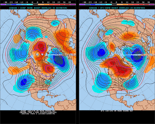
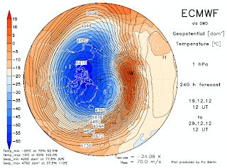
This is the 8-10 day height anomalies at the 500mb level. The 500mb level is the best area to identify areas of low pressure (blues) and high pressure (reds). Stormy patterns and quiet patterns correspond to these colors, respectively. The image is of two model forecasts- the one on the left is the ECMWF model, and the one on the right is the GFS model. For those unfamiliar with the polar vortex, it is a permanent low pressure system stationed over the Arctic. When enhanced low pressure is over the Arctic, the polar vortex (PV) is stronger than normal, and high pressure weakens the polar vortex.
read more at link above...