


Significant winter storm set to impact the West,
bringing heavy snow, U.S. - Monday, February 26, 2024
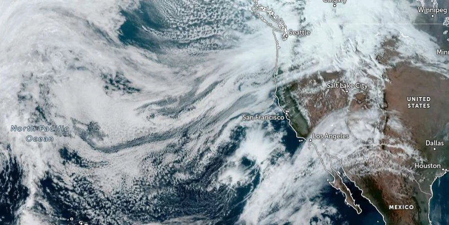
An impending winter storm, driven by an upper-level trough and strong cold front from the northeastern Pacific and western Canada, is forecasted to deliver significant snowfall and strong gusty winds to much of the West in the coming days. Heavy snow is expected in the Central Rockies and Cascades through Monday, extending to the Sierra and the Northern Rockies/Great Basin by Tuesday, with over a foot of snow possible in many areas.
The strong cold front will move into the Northwest Sunday evening, progress southeastward on Monday into the Northern Rockies, and then into the Central Rockies by Tuesday.
Snowfall rates of 25 – 50 mm (1 – 2 inches) per hour are expected over the Cascades and Northern Rockies through Monday, before spreading into the Great Basin and Central Rockies Tuesday. These snow rates combined with winds gusting to 80 – 105 km/h (50 – 65 mph) will produce near-blizzard conditions with significantly reduced visibility and snow-covered roads leading to dangerous travel.
More than 60 cm (2 feet) of snow is expected (>80% chance) in the Cascades through Tuesday, with locally as much as 120 cm (4 feet) possible in the highest terrain. Elsewhere across the Intermountain West, there is a high chance (>70%) of more than 30 cm (1 foot) of snow in the higher elevations. Lowering snow levels will also produce some accumulations on the valley floors.
Snow squalls are expected to develop along the path of the cold front Monday and Tuesday. Where snow squalls occur, intense snow rates will produce rapid drops in visibility and a flash freeze, resulting in dangerous travel.
Temperatures will fall into the teens and single digits (°F) by Tuesday morning along and east of the Rockies.
A strong cold front moving southward from the northeastern Pacific and western Canada is forecast to trigger a major winter storm across the West, affecting areas from the Central Rockies to the Great Basin in the next couple of days.
This system will draw increased moisture from the Pacific, resulting in heavy snowfall across higher elevations and mountainous regions.
The Central Rockies and Cascades are expected to see significant snow accumulations through Monday, with the Sierra and Northern Rockies/Great Basin experiencing similar conditions by Tuesday. Most locations within these areas are predicted to receive at least 30 cm (1 foot) of snow through Tuesday evening, February 27.
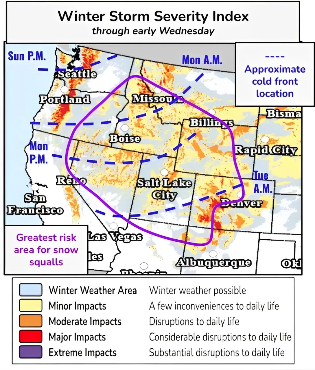
US affected area map: https://watchers.news/wp-content/uploads/2024/02/winter-storm-severity-index-through-wed-feb-28-2024.webp
In addition to the snow, the region is forecasted to experience widespread, strong, and gusty winds, with numerous high wind-related watches and warnings already in effect across the Intermountain West and adjacent High Plains.
Wind gusts may reach up to 120 km/h (75 mph), which, combined with heavy snowfall rates of 2.5 – 5 cm (1 – 2 inches) per hour, could lead to significant blowing and drifting snow, dramatically reducing visibility.
The forecast also highlights the likelihood of snow squalls across the northern Great Basin and Rockies on Monday, potentially leading to sudden drops in visibility and flash freezes on roads, which would create dangerous travel conditions.
“As this storm system over the West continues eastward into the Plains/Midwest Tuesday, moist southerly flow ahead of the cold front will bring increasing shower and thunderstorm chances to the Midwest/Great Lakes,” NWS forecaster Putnam said.
Strong low-level and upper-level dynamics will lead to the risk of some more potent thunderstorms with the potential for some locally heavy rainfall as well as severe weather.
The Storm Prediction Center has outlined a Slight Risk of severe weather (level 2/5) for the risk of large hail, damaging winds, and a few tornadoes. This threat will ramp up late Tuesday afternoon and continue into the overnight hours.
Some moderate snow showers are also possible for portions of the Upper Midwest/Great Lakes in the colder air behind the front.
==[/color]
